US20030231132A1 - Method and apparatus for selecting optimal satellites in global positioning system - Google Patents
Method and apparatus for selecting optimal satellites in global positioning system Download PDFInfo
- Publication number
- US20030231132A1 US20030231132A1 US10/341,145 US34114503A US2003231132A1 US 20030231132 A1 US20030231132 A1 US 20030231132A1 US 34114503 A US34114503 A US 34114503A US 2003231132 A1 US2003231132 A1 US 2003231132A1
- Authority
- US
- United States
- Prior art keywords
- satellite
- satellites
- redundancy
- gps receiver
- list
- Prior art date
- Legal status (The legal status is an assumption and is not a legal conclusion. Google has not performed a legal analysis and makes no representation as to the accuracy of the status listed.)
- Granted
Links
Images


Classifications
-
- G—PHYSICS
- G01—MEASURING; TESTING
- G01S—RADIO DIRECTION-FINDING; RADIO NAVIGATION; DETERMINING DISTANCE OR VELOCITY BY USE OF RADIO WAVES; LOCATING OR PRESENCE-DETECTING BY USE OF THE REFLECTION OR RERADIATION OF RADIO WAVES; ANALOGOUS ARRANGEMENTS USING OTHER WAVES
- G01S19/00—Satellite radio beacon positioning systems; Determining position, velocity or attitude using signals transmitted by such systems
- G01S19/01—Satellite radio beacon positioning systems transmitting time-stamped messages, e.g. GPS [Global Positioning System], GLONASS [Global Orbiting Navigation Satellite System] or GALILEO
- G01S19/13—Receivers
- G01S19/24—Acquisition or tracking or demodulation of signals transmitted by the system
- G01S19/28—Satellite selection
-
- G—PHYSICS
- G01—MEASURING; TESTING
- G01S—RADIO DIRECTION-FINDING; RADIO NAVIGATION; DETERMINING DISTANCE OR VELOCITY BY USE OF RADIO WAVES; LOCATING OR PRESENCE-DETECTING BY USE OF THE REFLECTION OR RERADIATION OF RADIO WAVES; ANALOGOUS ARRANGEMENTS USING OTHER WAVES
- G01S19/00—Satellite radio beacon positioning systems; Determining position, velocity or attitude using signals transmitted by such systems
- G01S19/38—Determining a navigation solution using signals transmitted by a satellite radio beacon positioning system
- G01S19/39—Determining a navigation solution using signals transmitted by a satellite radio beacon positioning system the satellite radio beacon positioning system transmitting time-stamped messages, e.g. GPS [Global Positioning System], GLONASS [Global Orbiting Navigation Satellite System] or GALILEO
- G01S19/42—Determining position
-
- G—PHYSICS
- G01—MEASURING; TESTING
- G01S—RADIO DIRECTION-FINDING; RADIO NAVIGATION; DETERMINING DISTANCE OR VELOCITY BY USE OF RADIO WAVES; LOCATING OR PRESENCE-DETECTING BY USE OF THE REFLECTION OR RERADIATION OF RADIO WAVES; ANALOGOUS ARRANGEMENTS USING OTHER WAVES
- G01S19/00—Satellite radio beacon positioning systems; Determining position, velocity or attitude using signals transmitted by such systems
- G01S19/01—Satellite radio beacon positioning systems transmitting time-stamped messages, e.g. GPS [Global Positioning System], GLONASS [Global Orbiting Navigation Satellite System] or GALILEO
- G01S19/13—Receivers
- G01S19/24—Acquisition or tracking or demodulation of signals transmitted by the system
- G01S19/25—Acquisition or tracking or demodulation of signals transmitted by the system involving aiding data received from a cooperating element, e.g. assisted GPS
- G01S19/256—Acquisition or tracking or demodulation of signals transmitted by the system involving aiding data received from a cooperating element, e.g. assisted GPS relating to timing, e.g. time of week, code phase, timing offset
-
- G—PHYSICS
- G01—MEASURING; TESTING
- G01S—RADIO DIRECTION-FINDING; RADIO NAVIGATION; DETERMINING DISTANCE OR VELOCITY BY USE OF RADIO WAVES; LOCATING OR PRESENCE-DETECTING BY USE OF THE REFLECTION OR RERADIATION OF RADIO WAVES; ANALOGOUS ARRANGEMENTS USING OTHER WAVES
- G01S19/00—Satellite radio beacon positioning systems; Determining position, velocity or attitude using signals transmitted by such systems
- G01S19/01—Satellite radio beacon positioning systems transmitting time-stamped messages, e.g. GPS [Global Positioning System], GLONASS [Global Orbiting Navigation Satellite System] or GALILEO
- G01S19/13—Receivers
- G01S19/24—Acquisition or tracking or demodulation of signals transmitted by the system
- G01S19/25—Acquisition or tracking or demodulation of signals transmitted by the system involving aiding data received from a cooperating element, e.g. assisted GPS
- G01S19/258—Acquisition or tracking or demodulation of signals transmitted by the system involving aiding data received from a cooperating element, e.g. assisted GPS relating to the satellite constellation, e.g. almanac, ephemeris data, lists of satellites in view
Definitions
- the present invention relates generally to GPS (Global Positioning System), and in particular, to an apparatus and method for selecting optimal GPS satellites to locate an object.
- GPS Global Positioning System
- GPS receivers broadcast their ephemeredes and system time, circling the earth in predetermined orbits, so that GPS receivers can determine their positions.
- the orbits of GPS satellites are carefully chosen so that at least four of them can be observed around the earth to allow the locations, velocities, and clock errors of the GPS receivers to be calculated.
- the GPS receivers can trace their positions with an error of 20 or less meters in urban areas.
- Navigation data broadcasted from each satellite contains the PRN (Pseudo-Random Noise) code of the satellite corresponding to its satellite ID. Since the GPS navigation message is transmitted in CDMA (Code Division Multiple Access) format, a GPS receiver can receive the navigation data from each satellite accurately. The GPS receiver calculates its position using the navigation data. With the use of its internal algorithm, the GPS receiver tracks GPS satellite signals. Once it tracks one satellite signal, the GPS receiver can achieve information about the relative positions of other satellites using the received satellite orbit infomation. Thus the GPS receiver can track signals from all available satellites within a short period of time. Recently, the A-GPS (Assisted-GPS) is widely used which enables a GPS receiver to receive the ephemeris and timing information from a base station. Therefore, information of all available satellites is immediately available to the GPS receiver.
- A-GPS Assisted-GPS
- a GPS receiver on the ground can observe 6 to 12 satellites simultaneously.
- a typical GPS receiver is required to search a wide range of frequency and code for each satellite signal. This search process is a major time-consuming factor that determines time to first fix (TTFF).
- TTFF time to first fix
- the GPS receiver can acquire at least 4 satellite signals more rapidly by assigning a plurality of independent channels to track the satellite signals.
- a system such as a small-sized portable terminal having a limited size uses a relatively small number of hardware channels and, in some cases, assigns multiple hardware channels to one satellite to reduce the TTFF.
- the GPS receiver selectively tracks a subset of visible satellites.
- the accuracy of a navigational solution, when a fixed number of satellites is to be selected, depends mainly on the quality of the subset (GDOP) that is being selected. Accordingly, a number of methods of selecting satellites that minimizes the positioning error of the GPS receiver (hereinafter, referred to as optimal satellites) have been proposed.
- GDOP Geometric Dilution Of Precision
- H represents line of sight matrix for N visible satellites.
- the selected line of sight (LOS) matrices are represented by h.
- LOS line of sight
- ⁇ overscore ( ⁇ ) ⁇ is an (n ⁇ 1) vector containing measurements received from satellites
- ⁇ overscore (x) ⁇ is a three-dimensional vector with which an intended navigational solution is updated
- ⁇ is the noise standard deviation
- I is an identity matrix
- ⁇ overscore (x) ⁇ ( h j T h j ) ⁇ 1 h j T ⁇ overscore ( ⁇ ) ⁇ ( h j T h j ) ⁇ 1 h j T ⁇ overscore ( ⁇ ) ⁇
- GDOP ⁇ square root ⁇ square root over (TRACE [( h j T h j ) ⁇ 1 ]) ⁇ (6)
- TRACE is an operator that indicates the sum of the diagonal elements of the matrix, which is equal to the sum of all Eigen-values. It is noted from Eq. (6) that the measurement error of the GPS receiver is influenced by the geometrical positions h j of satellites. If GDOP is less than 1, the effective noise standard deviation is less than the measurement noise standard deviation. If GDOP is larger than 1, the former is higher than the latter by a multiple of GDOP. Therefore, it is desired to select the combination h that minimizes GDOP in order to achieve an optimal navigational solution.
- FIG. 1 is a flowchart illustrating a conventional satellite selection method for optimal satellite selection.
- GDOP is calculated for all possible subsets of the available satellites and the subset that minimizes the GDOP is selected by comparing the GDOPs of all possible subsets. It is assumed in this process that a GPS receiver has already received information about the relative positions of all the other satellites from an initially observed satellite.
- the GPS receiver sets a variable k to 1 in step S 30 .
- the variable k is used to identify a LOS combination.
- the GPS receiver calculates the GDOP for a kth combination, GDOP(k) by TRACE(h k T h k ) ⁇ 1 in step S 40 and stores it in step S 50 .
- the GPS receiver After calculating the GDOPs for all T number of combinations, increasing the variable by 1 at each time in step S 60 until the variable k is T in step S 70 , the GPS receiver compares the GDOPs and chooses the LOS combination that has the minimum GDOP in step S 80 . Then the GPS receiver assigns channels to the PRN codes of the satellites included in the chosen LOS combination.
- FIG. 2 is a listing of numbers of matrix combinations required for the optimal satellite selection.
- the number of matrix combinations grows by geometric progression as the number N of visible satellites and the number n of satellites to be chosen increase. Therefore, despite its effectiveness in selecting optimal satellites, the optimal satellite selection has the shortcomings of the long operation time, impossible real time operation, requirement for a large number of operation circuits, large-capacity memory requirement, great power consumption, limited integration, and the resulting limitations in application for small portable systems.
- the Galileo system similar to GPS, already under development under ESA (European Space Agency) were to be deployed, more satellites could be observed. In such case, the number of subsets of satellites and the required operation volume would further increase.
- Another conventional satellite selecting method is a highest elevation satellite selection method.
- this method selects the subset of satellites with the highest elevations with respect to a user.
- the algorithm requires very little computation.
- satellites in only one direction may be selected, minimization of GDOP cannot be guaranteed.
- a GDOP achieved in this scheme is larger than a GDOP achieved in the optimal satellite selection by about 2 to 10 times, which implies that the error of a navigational solution is 2 to 10 times higher.
- the receiver may fail to acquire signals if it attempts to track satellites in one direction only.
- a satellite list including the coordinates of satellites is made, the redundancies of the satellites are calculated, at least one satellite having a maximum redundancy is eliminated from the satellite list, and channels of a GPS receiver are assigned to an intended number of satellites if the intended number of satellites remain in the satellite list.
- a satellite list including the coordinates of effective satellites is made, the redundancies of the satellites are calculated, the satellite list is updated by eliminating at least one satellite having a maximum redundancy from the satellite list, the redundancy calculation and the satellite list updating are repeated for the updated satellite list until an intended number of satellites remain in the updated satellite list, and channels of a GPS receiver are assigned to the intended number of satellites if the intended number of satellites remain in the satellite list.
- an RF unit receives RF signals on channels assigned to GPS satellites, a digital unit processes the received RF signals, a processor unit selects satellites to which the channels are assigned and calculates a navigational solution using the processed signals, and a memory stores an operating program executed in the processor unit.
- the processor unit makes a satellite list including the coordinates of satellites, calculates the redundancies of the satellites, eliminates at least one satellite having a maximum redundancy from the satellite list, and assigns the channels to an intended number of satellites if the intended number of satellites remain in the satellite list.
- an RF unit receives RF signals on channels assigned to GPS satellites, a digital unit processes the received RF signals, a processor unit selects satellites to which the channels are assigned and calculates a navigational solution using the processed signals, and a memory stores an operating program executed in the processor unit.
- the processor unit makes a satellite list including the coordinates of effective satellites, calculates the redundancies of the satellites included in the satellite list, updates the satellites list by eliminating at least one satellite having a maximum redundancy from the satellite list, calculates the redundancies of the satellites included in the updated satellite list, eliminates one satellite having a maximum redundancy from the updated satellite list, and assigns channels of a GPS receiver to an intended number of satellites if the intended number of satellites remain in the satellite list.
- FIG. 1 is a flowchart illustrating a conventional satellite selecting method, optimal satellite selection
- FIG. 2 is a listing of numbers of matrix combinations required for the optimal satellite selection in a conventional satellite selecting method
- FIG. 3 is a block diagram of an example of a GPS receiver to which the present invention is applied;
- FIG. 4 is a detailed block diagram of an example of an RF unit in the GPS receiver
- FIG. 5 is a detailed block diagram of an example of a digital unit in the GPS receiver
- FIG. 6 is a flowchart illustrating a control operation of a processor unit in the GPS receiver
- FIG. 7 is a flowchart illustrating a procedure for selecting optimal satellites according to one embodiment of the present invention.
- FIG. 8 is a detailed flowchart illustrating a procedure for selecting optimal satellites according to one embodiment of the present invention.
- FIGS. 9 to 11 C illustrate examples of satellite selections using simplified LOS vectors
- FIG. 12 illustrates a comparison in computation volume between satellite selection according to the present invention and the optimal satellite selection
- FIG. 13 illustrates variations in GDOP with respect to the number of channels used in a GPS receiver, that is, the number of satellites.
- FIGS. 14A and 14B are graphs showing GDOP distributions in the satellite selection according to the present invention and the highest elevation satellite selection, respectively.
- the present invention in one embodiment pertains to selection of GPS satellites using minimum operations to locate an object. Satellites of which the relative positions have the least geometrical redundancy with respect to the other satellites are selected among visible satellites.
- the term “redundancy” here is not used strictly in its original sense. That is, “redundancy” indicates the closeness of a satellite to another satellite, not perfect coincidence in position between them.
- FIG. 3 is a block diagram of an example of a GPS receiver to which the present invention is applied.
- a GPS receiver 100 is self-contained and is connected to a power bus and communication buses of a portable terminal that may be located through one or more connectors (not shown).
- the GPS receiver 100 includes an RF (Radio Frequency) unit 110 , a digital unit 120 , a processor unit 130 , and a memory unit 140 .
- RF Radio Frequency
- the processor unit 130 exchanges commands, control commands, and data with the portable terminal via a typical interface, and provides control to and processes data for the GPS receiver 100 .
- Related algorithms are stored in a ROM (Read Only Memory) (not shown) in the memory unit 140 .
- Data generated during executing the algorithms is stored in a RAM (Random Access Memory) (not shown) in the memory unit 140 .
- the processor unit 130 performs a variety of operations including management of the RF unit 110 and the digital unit 120 , calculation of navigational solutions, updating a constellation almanac, and selection of optimal satellites.
- FIG. 4 is a detailed block diagram of the RF unit 110 .
- the RF unit 110 includes a correlator 112 , and antenna front ends 114 and 116 .
- the antenna front ends 114 and 116 are connected to antennas 152 and 154 , respectively. While only one correlator 112 is shown, a plurality of correlators connected to two or more antenna front ends may be used to reduce TTFF.
- the correlator 112 supports a plurality of hardware channels and mapping between the hardware channels, and the antenna front ends 114 and 116 are user-defined.
- the correlator 112 Upon reception of an overall GPS spectrum via the antenna front ends 114 and 116 , the correlator 112 acquires a specific GPS signal by correlating an internally generated PN code with the received signal. The resulting digitized GPS signal is fed to the digital unit 120 .
- FIG. 5 is a detailed block diagram of the digital unit 120 .
- the digital unit 120 comprises a microprocessor 122 and a memory 124 .
- the memory 124 stores micro-codes needed for the microprocessor 122 to control the correlator 112 according to a command from the processor unit 130 .
- the microprocessor 122 performs a satellite tracking algorithm using the micro-codes.
- FIG. 6 is a flowchart illustrating a control operation of the processor unit 130 .
- the processor unit 130 collects information about a satellite constellation almanac, an approximate user position, and clock information (GPS time) from an external server (e.g., an mobile switching center) or an internal memory in step S 100 .
- the satellite constellation almanac provides information about the orbits of GPS satellites.
- the processor unit 130 estimates the current positions of the satellites using the constellation almanac and clock information and forms a list of visible satellites according to the estimated positions and approximate user position in step S 200 .
- Visible satellites are satellites from which the GPS receiver can receive signals.
- step S 300 When the number of satellites to be tracked is determined in consideration of the number of hardware channels and the condition of the GPS receiver, as many optimal satellites as the determined number are chosen from the listed visible satellites in step S 300 . Then, the frequencies and codes of the chosen satellites, a search location, and a search range are calculated in step S 400 and satellite signals are searched with channels are assigned to the chosen satellites in step S 500 .
- FIG. 7 is a detailed flowchart illustrating the selection of the optimal satellites (S 300 FIG. 6) according to the preferred embodiment of the present invention.
- An intended number of satellites are chosen by eliminating satellites with the highest redundancy levels from the satellite list. It is assumed here that the GPS receiver has already received information about the relative positions of the other satellites from an initially observed satellite.
- the satellite list containing the coordinates of the visible satellites is formed in step S 310 and the redundancy levels of the satellites are calculated in step S 320 .
- the redundancy is here defined as the degree of geometrical overlap between a satellite and the other satellites, which will be described later in more detail.
- the redundancy levels are compared and the satellite having the highest redundancy level is eliminated from the satellite list, updating the satellite list in step S 330 .
- step S 340 it is determined whether an intended number of satellites remain in the satellite list in step S 340 . If satellites are further to be eliminated, steps S 320 and S 330 are repeated until the intended number of satellites remain. Then channels are assigned to the satellites of the final updated satellite list in step S 350 .
- the LOS vectors representing the three-dimensional coordinates of two GPS satellites i and j with respect to the GPS receiver be los i and los j , respectively. If the angle between the two vectors los i and los j is ⁇ ij , the redundancy J ij between the two vectors is defined as
- the redundancy J ij is least when the angle ⁇ ij is 90° and largest when the angle ⁇ ij is 0 or 180°.
- the X-axis or Y-axis coordinate of the GPS receiver is difficult to calculate.
- the two satellites are at 90°, the all-directional coordinates of the GPS receiver are easily calculated.
- Eq. (7) as the angle between the two satellites approaches 90°, their redundancy approaches ⁇ 1. If the angle approaches 0 or 180°, the redundancy approaches +1.
- FIG. 8 is a flowchart illustrating selection of optimal satellites in more detail according to one embodiment of the present invention.
- the GPS receiver calculates N unit vectors los 1 , los 2 , . . . , los N representing the three-dimensional coordinates of N visible satellites with respect to the GPS receiver using their relative positions, and forms an N ⁇ 3 matrix H with unit vectors in step S 605 .
- the redundancy matrix D is symmetrical, it can be generated by calculating only the upper or lower triangular half.
- a variable m is set to 1 to identify a satellite to be eliminated in step S 615 and a variable i is set to 1 to identify a satellite contained in the redundancy matrix D in step S 620 .
- Redundancies are calculated completely for the redundancy matrix D by columns or rows by repeating steps S 625 , increasing the variable i by 1 each in step S 630 time until the variable i is equal to (N ⁇ m+1) in step S 635 .
- the maximum redundancy J k1 is obtained in step S 640 .
- J k1 max i ⁇ J 1 , J 2 , . . . , J N ⁇ (12)
- the redundancy matrix D is updated to an (N ⁇ m) ⁇ (N ⁇ m) redundancy matrix D′ by eliminating a column and a row containing an element kl having the maximum redundancy J k1 because exclusion of a specific satellite influences the redundancies of other satellites. For example, when two satellites are close to each other, their redundancy levels are very high. Unless a redundancy matrix is not updated after either of them is eliminated, both satellites are eliminated.
- J i ′ is the redundancy of an ith satellite in the updated redundancy matrix D′ and J k2 ′ is the maximum redundancy of the updated redundancy matrix D′. Then a column and a row containing an element k 2 are eliminated.
- the final (n ⁇ n) redundancy matrix is a final satellite list.
- the satellites of the (n ⁇ n) redundancy matrix are selected as optimal satellites in step S 660 and the GPS receiver assigns channels to the optimal satellites in step S 665 .
- the optimal satellites can be selected by Eq. (15) instead of updating a redundancy matrix each time one satellite is eliminated.
- ⁇ i is the direction angle of a LOS vector to an ith satellite.
- ⁇ 1 and ⁇ 3 are chosen by calculating GDOP for each of 4 C 2 subsets in the conventional optimal satellite selection.
- the redundancies of the LOS vectors are calculated to be 0.089, 0.008, ⁇ 0.085, and ⁇ 0.083, respectively as illustrated in FIG. 10A and FIG. 11A.
- ⁇ 1 and ⁇ 2 are eliminated as illustrated in FIG. 10B.
- GDOP or PDOP Position Dilution Of Precision representing a navigational solution error is calculated to be 17.1 using ⁇ 3 and ⁇ 4 , which is very high as compared in the optimal satellite selection.
- ⁇ 1 having a maximum redundancy 0.089 is first eliminated.
- the redundancies of the remaining LOS vectors ⁇ 2 , ⁇ 3 and ⁇ 4 are recalculated to be ⁇ 0.0858, 0.0900 and 0.7812, respectively as illustrated in FIG. 11B.
- a PDOP for the remaining vectors, that is, ⁇ 2 and ⁇ 4 is 2.0153 as illustrated in FIG. 11C, which is very close to the PDOP value achieved from the conventional optimal satellite selection method. Therefore, the effects of the optimal satellite selection are achieved with fewer operations.
- FIG. 12 illustrates a comparison in computation volume requirement between satellite selection (quasi-optimal) according to the present invention and the optimal satellite selection in a simulation. 6 satellites are selected among 7 to 15 visible satellites. Referring to FIG. 12, the quasi-optimal satellite selection requires floating point operations less than the optimal satellite selection by 10 to 1000 times. If the total number of visible satellites is 10 to 12 and 6 satellites are selected, the required computation volume can be reduced to a one hundredth.
- FIG. 13 illustrates changes in GDOP with respect to the number of channels used in a GPS receiver, that is, the number of satellites used.
- 13 visible satellites exist and 4 to 13 satellites can be selected.
- PDOP increases very rapidly, which implies that a relatively large number of channels are needed within an allowed error range.
- the use of many hardware channels affects the size of a GPS receiver.
- PDOP does not increase much.
- the difference in PDOP between use of 6 satellites and use of 9 satellites is only 0.35,
- a desired error range can be satisfied using fewer hardware channels, thereby further obviating the need for matrix computation and vector computation required to achieve a navigation solution.
- memory capacity requirement and the size of the GPS receiver are reduced.
- the use of fewer hardware channels reduces computation volume in calculating the navigational solution at a processor unit.
- [0087] indicates the degree of discrepancy between a GDOP achieved in the present invention (quasi-optimal satellite selection) and the GDOP achieved in the conventional optimal satellite selection. As ⁇ approaches 1, the satellite selection becomes optimal.
- the GDOP in the highest elevation satellite selection is higher than the GDOP of the optimal satellite selection by one to three times on the whole, by 3500% at the worst.
- the GDOP in the quasi-optimal elevation satellite selection is equal to the GDOP in the optimal satellite selection on the whole, merely 23% higher at the worst.
- an intended number of geometrically optimal or quasi-optimal satellites are chosen to locate an object with a minimum number of operations and minimized use of a processor. Therefore, required hardware (e.g., operation circuits and a memory) can be reduced and a GPS receiver can be made small enough to be built in a portable terminal.
- required hardware e.g., operation circuits and a memory
Abstract
An apparatus and method for selecting optimal GPS satellites to locate an object. A satellite list including the coordinates of satellites is made, the redundancies of the satellites are calculated, at least one satellite having a maximum redundancy is eliminated from the satellite list, and channels of a GPS receiver are assigned to an intended number of satellites if the intended number of satellites remain in the satellite list.
Description
- This application claims priority to an application entitled “Apparatus and Method for Selecting Optimal Satellites in Global Positioning System” filed in the Korean Industrial Property Office on Jun. 12, 2002 and assigned Serial No. 2002-32955, the contents of which are hereby incorporated by reference.
- 1. Field of the Invention
- The present invention relates generally to GPS (Global Positioning System), and in particular, to an apparatus and method for selecting optimal GPS satellites to locate an object.
- 2. Description of the Related Art
- Along with today's dramatic development in personal, portable communication devices, a variety of additional services are supported. In particular, some countries have mandated the use of positioning devices such as GPS in mobile terminals to provide location-based services to users.
- Many GPS satellites broadcast their ephemeredes and system time, circling the earth in predetermined orbits, so that GPS receivers can determine their positions. The orbits of GPS satellites are carefully chosen so that at least four of them can be observed around the earth to allow the locations, velocities, and clock errors of the GPS receivers to be calculated. The GPS receivers can trace their positions with an error of 20 or less meters in urban areas.
- Navigation data broadcasted from each satellite contains the PRN (Pseudo-Random Noise) code of the satellite corresponding to its satellite ID. Since the GPS navigation message is transmitted in CDMA (Code Division Multiple Access) format, a GPS receiver can receive the navigation data from each satellite accurately. The GPS receiver calculates its position using the navigation data. With the use of its internal algorithm, the GPS receiver tracks GPS satellite signals. Once it tracks one satellite signal, the GPS receiver can achieve information about the relative positions of other satellites using the received satellite orbit infomation. Thus the GPS receiver can track signals from all available satellites within a short period of time. Recently, the A-GPS (Assisted-GPS) is widely used which enables a GPS receiver to receive the ephemeris and timing information from a base station. Therefore, information of all available satellites is immediately available to the GPS receiver.
- In general, a GPS receiver on the ground can observe 6 to 12 satellites simultaneously. To initially acquire CDMA signals from the satellites, a typical GPS receiver is required to search a wide range of frequency and code for each satellite signal. This search process is a major time-consuming factor that determines time to first fix (TTFF).
- The GPS receiver can acquire at least 4 satellite signals more rapidly by assigning a plurality of independent channels to track the satellite signals. However, a system such as a small-sized portable terminal having a limited size uses a relatively small number of hardware channels and, in some cases, assigns multiple hardware channels to one satellite to reduce the TTFF.
- In this case, it is difficult to track all the satellites that are visible to the GPS receiver because of the limited number of hardware channels. Thus, the GPS receiver selectively tracks a subset of visible satellites. The accuracy of a navigational solution, when a fixed number of satellites is to be selected, depends mainly on the quality of the subset (GDOP) that is being selected. Accordingly, a number of methods of selecting satellites that minimizes the positioning error of the GPS receiver (hereinafter, referred to as optimal satellites) have been proposed.
- The primary requirements for optimal satellites are that they must minimize GDOP (Geometric Dilution Of Precision) and that their signals can actually be acquired through tracking. If GDOP is not minimized, position error could increase by a factor of five or more in some cases.
- A unit vector pointing from a GPS receiver to a satellite i is defined as an LOS (Line-Of-Sight) vector los i. If there are N visible satellites in the three-dimensional space, their coordinates can be expressed as an N×3 (x, y, z coordinates)-LOS matrix of

- where H represents line of sight matrix for N visible satellites.
- When n satellites are to be selected from N number of the total visible satellites, NCn number of satellite combinations can be produced where NCn represents the number of combinations of the n selected satellites among the N visible satellites. Then, T (T=NCn) number of n×3 LOS matrices h1, h2, . . . , hT are formed. The selected line of sight (LOS) matrices are represented by h. Using the jth combination hj, the position of the GPS receiver is calculated by using the following linearized equation
- δ{overscore (Φ)}=h j δ{overscore (x)}+{overscore (ν)} (2)
- where δ{overscore (Φ)} is an (n×1) vector containing measurements received from satellites, δ{overscore (x)} is a three-dimensional vector with which an intended navigational solution is updated, and {overscore (ν)} is an (n×1) vector indicating the measurement noise of the satellite signals (Ev=0 and Evv T=σ2I. Here, σ is the noise standard deviation and I is an identity matrix).
- The estimation procedure of the δ{overscore (x)} is
- δ{overscore (x)}=(h j T h j)−1 h j Tδ{overscore (Φ)}−(h j T h j)−1 h j T{overscore (ν)}
- δ{overscore (x)}=(h j T h j)−1 h j Tδ{overscore (Φ)} (3)
- The influence of the measurement error {overscore (ν)} on the navigational solution is calculated by
- νe=(h j T h j)−1 h j T{overscore (ν)} (4)
- The statistics of the effective noise ν e is
- Eν e =E[(h j T h j)−1 h j T{overscore (ν)}]=0
- Eν eνe T =E[(h j T h j)−1 h j T{overscore (ν)}νT h j(h j T h j)−1]=(h j T h j)−1σ2 (5)
- From Eq. (5) GDOP is defined as
- GDOP ={square root}{square root over (TRACE [(h j T h j)−1])} (6)
- Where TRACE is an operator that indicates the sum of the diagonal elements of the matrix, which is equal to the sum of all Eigen-values. It is noted from Eq. (6) that the measurement error of the GPS receiver is influenced by the geometrical positions h j of satellites. If GDOP is less than 1, the effective noise standard deviation is less than the measurement noise standard deviation. If GDOP is larger than 1, the former is higher than the latter by a multiple of GDOP. Therefore, it is desired to select the combination h that minimizes GDOP in order to achieve an optimal navigational solution.
- FIG. 1 is a flowchart illustrating a conventional satellite selection method for optimal satellite selection. In the optimal satellite selection, GDOP is calculated for all possible subsets of the available satellites and the subset that minimizes the GDOP is selected by comparing the GDOPs of all possible subsets. It is assumed in this process that a GPS receiver has already received information about the relative positions of all the other satellites from an initially observed satellite.
- Referring to FIG. 1, the GPS receiver calculates N unit vectors (LOS vectors) representing the three-dimensional coordinates of N available/visible satellites with respect to the GPS receiver, using the relative positions of the satellites in step S 10 and generates T (=NCn) LOS combinations h1, h2, . . . , hT from the N LOS vectors in step S20. The GPS receiver sets a variable k to 1 in step S30. The variable k is used to identify a LOS combination. The GPS receiver calculates the GDOP for a kth combination, GDOP(k) by TRACE(hk Thk)−1 in step S40 and stores it in step S50. After calculating the GDOPs for all T number of combinations, increasing the variable by 1 at each time in step S60 until the variable k is T in step S70, the GPS receiver compares the GDOPs and chooses the LOS combination that has the minimum GDOP in step S80. Then the GPS receiver assigns channels to the PRN codes of the satellites included in the chosen LOS combination.
- The GDOP calculation and storage for all the LOS combinations requires a very large number of operations including matrix inversions. FIG. 2 is a listing of numbers of matrix combinations required for the optimal satellite selection. Referring to FIG. 2, the number of matrix combinations grows by geometric progression as the number N of visible satellites and the number n of satellites to be chosen increase. Therefore, despite its effectiveness in selecting optimal satellites, the optimal satellite selection has the shortcomings of the long operation time, impossible real time operation, requirement for a large number of operation circuits, large-capacity memory requirement, great power consumption, limited integration, and the resulting limitations in application for small portable systems. Moreover, if the Galileo system, similar to GPS, already under development under ESA (European Space Agency) were to be deployed, more satellites could be observed. In such case, the number of subsets of satellites and the required operation volume would further increase.
- Another conventional satellite selecting method is a highest elevation satellite selection method. In principle, this method selects the subset of satellites with the highest elevations with respect to a user. The algorithm requires very little computation. However, since satellites in only one direction may be selected, minimization of GDOP cannot be guaranteed. In real application, a GDOP achieved in this scheme is larger than a GDOP achieved in the optimal satellite selection by about 2 to 10 times, which implies that the error of a navigational solution is 2 to 10 times higher. When a GPS receiver is indoors or in an area crowded with buildings, the receiver may fail to acquire signals if it attempts to track satellites in one direction only.
- It is, therefore, an object of the present invention to provide an apparatus and method for selecting GPS satellites to locate an object.
- It is another object of the present invention to provide an apparatus and method for selecting GPS satellites without directional redundancy.
- It is a further object of the present invention to provide an apparatus and method for selecting optimal satellites using minimum operation.
- It is still another object of the present invention to provide an apparatus and method for selecting optimal satellites, suitable for small portable systems.
- To achieve the above and other objects, there is provided an apparatus and method for selecting optimal GPS satellites to locate an object.
- According to an aspect of the present invention, to select optimal satellites, a satellite list including the coordinates of satellites is made, the redundancies of the satellites are calculated, at least one satellite having a maximum redundancy is eliminated from the satellite list, and channels of a GPS receiver are assigned to an intended number of satellites if the intended number of satellites remain in the satellite list.
- According to another aspect of the present invention, to select optimal satellites, a satellite list including the coordinates of effective satellites is made, the redundancies of the satellites are calculated, the satellite list is updated by eliminating at least one satellite having a maximum redundancy from the satellite list, the redundancy calculation and the satellite list updating are repeated for the updated satellite list until an intended number of satellites remain in the updated satellite list, and channels of a GPS receiver are assigned to the intended number of satellites if the intended number of satellites remain in the satellite list.
- According to a further aspect of the present invention, in a satellite electing apparatus, an RF unit receives RF signals on channels assigned to GPS satellites, a digital unit processes the received RF signals, a processor unit selects satellites to which the channels are assigned and calculates a navigational solution using the processed signals, and a memory stores an operating program executed in the processor unit. Specifically, the processor unit makes a satellite list including the coordinates of satellites, calculates the redundancies of the satellites, eliminates at least one satellite having a maximum redundancy from the satellite list, and assigns the channels to an intended number of satellites if the intended number of satellites remain in the satellite list.
- According to still another aspect of the present invention, in a satellite selecting apparatus, an RF unit receives RF signals on channels assigned to GPS satellites, a digital unit processes the received RF signals, a processor unit selects satellites to which the channels are assigned and calculates a navigational solution using the processed signals, and a memory stores an operating program executed in the processor unit. Specifically, the processor unit makes a satellite list including the coordinates of effective satellites, calculates the redundancies of the satellites included in the satellite list, updates the satellites list by eliminating at least one satellite having a maximum redundancy from the satellite list, calculates the redundancies of the satellites included in the updated satellite list, eliminates one satellite having a maximum redundancy from the updated satellite list, and assigns channels of a GPS receiver to an intended number of satellites if the intended number of satellites remain in the satellite list.
- The above and other objects, features and advantages of the present invention will become more apparent from the following detailed description when taken in conjunction with the accompanying drawings in which:
- FIG. 1 is a flowchart illustrating a conventional satellite selecting method, optimal satellite selection;
- FIG. 2 is a listing of numbers of matrix combinations required for the optimal satellite selection in a conventional satellite selecting method;
- FIG. 3 is a block diagram of an example of a GPS receiver to which the present invention is applied;
- FIG. 4 is a detailed block diagram of an example of an RF unit in the GPS receiver;
- FIG. 5 is a detailed block diagram of an example of a digital unit in the GPS receiver;
- FIG. 6 is a flowchart illustrating a control operation of a processor unit in the GPS receiver;
- FIG. 7 is a flowchart illustrating a procedure for selecting optimal satellites according to one embodiment of the present invention;
- FIG. 8 is a detailed flowchart illustrating a procedure for selecting optimal satellites according to one embodiment of the present invention;
- FIGS. 9 to 11C illustrate examples of satellite selections using simplified LOS vectors;
- FIG. 12 illustrates a comparison in computation volume between satellite selection according to the present invention and the optimal satellite selection;
- FIG. 13 illustrates variations in GDOP with respect to the number of channels used in a GPS receiver, that is, the number of satellites; and
- FIGS. 14A and 14B are graphs showing GDOP distributions in the satellite selection according to the present invention and the highest elevation satellite selection, respectively.
- A preferred embodiment of the present invention will be described herein below with reference to the accompanying drawings. In the following description, well-known functions or constructions are not described in detail since they would obscure the invention in unnecessary detail.
- The present invention in one embodiment pertains to selection of GPS satellites using minimum operations to locate an object. Satellites of which the relative positions have the least geometrical redundancy with respect to the other satellites are selected among visible satellites. The term “redundancy” here is not used strictly in its original sense. That is, “redundancy” indicates the closeness of a satellite to another satellite, not perfect coincidence in position between them.
- FIG. 3 is a block diagram of an example of a GPS receiver to which the present invention is applied. Referring to FIG. 3, a
GPS receiver 100 is self-contained and is connected to a power bus and communication buses of a portable terminal that may be located through one or more connectors (not shown). TheGPS receiver 100 includes an RF (Radio Frequency)unit 110, adigital unit 120, aprocessor unit 130, and amemory unit 140. - The
processor unit 130 exchanges commands, control commands, and data with the portable terminal via a typical interface, and provides control to and processes data for theGPS receiver 100. Related algorithms are stored in a ROM (Read Only Memory) (not shown) in thememory unit 140. Data generated during executing the algorithms is stored in a RAM (Random Access Memory) (not shown) in thememory unit 140. Theprocessor unit 130 performs a variety of operations including management of theRF unit 110 and thedigital unit 120, calculation of navigational solutions, updating a constellation almanac, and selection of optimal satellites. - FIG. 4 is a detailed block diagram of the
RF unit 110. Referring to FIG. 4, theRF unit 110 includes acorrelator 112, and antenna front ends 114 and 116. The antenna front ends 114 and 116 are connected toantennas correlator 112 is shown, a plurality of correlators connected to two or more antenna front ends may be used to reduce TTFF. Thecorrelator 112 supports a plurality of hardware channels and mapping between the hardware channels, and the antenna front ends 114 and 116 are user-defined. - Upon reception of an overall GPS spectrum via the antenna front ends 114 and 116, the
correlator 112 acquires a specific GPS signal by correlating an internally generated PN code with the received signal. The resulting digitized GPS signal is fed to thedigital unit 120. - FIG. 5 is a detailed block diagram of the
digital unit 120. Referring to FIG. 5, thedigital unit 120 comprises amicroprocessor 122 and amemory 124. Thememory 124 stores micro-codes needed for themicroprocessor 122 to control thecorrelator 112 according to a command from theprocessor unit 130. Themicroprocessor 122 performs a satellite tracking algorithm using the micro-codes. - FIG. 6 is a flowchart illustrating a control operation of the
processor unit 130. Referring to FIG. 6, when theGPS receiver 100 starts to operate, theprocessor unit 130 collects information about a satellite constellation almanac, an approximate user position, and clock information (GPS time) from an external server (e.g., an mobile switching center) or an internal memory in step S100. The satellite constellation almanac provides information about the orbits of GPS satellites. Thus theprocessor unit 130 estimates the current positions of the satellites using the constellation almanac and clock information and forms a list of visible satellites according to the estimated positions and approximate user position in step S200. Visible satellites are satellites from which the GPS receiver can receive signals. - When the number of satellites to be tracked is determined in consideration of the number of hardware channels and the condition of the GPS receiver, as many optimal satellites as the determined number are chosen from the listed visible satellites in step S 300. Then, the frequencies and codes of the chosen satellites, a search location, and a search range are calculated in step S400 and satellite signals are searched with channels are assigned to the chosen satellites in step S500.
- FIG. 7 is a detailed flowchart illustrating the selection of the optimal satellites (S 300 FIG. 6) according to the preferred embodiment of the present invention. An intended number of satellites are chosen by eliminating satellites with the highest redundancy levels from the satellite list. It is assumed here that the GPS receiver has already received information about the relative positions of the other satellites from an initially observed satellite.
- Referring to FIG. 7, the satellite list containing the coordinates of the visible satellites is formed in step S 310 and the redundancy levels of the satellites are calculated in step S320. The redundancy is here defined as the degree of geometrical overlap between a satellite and the other satellites, which will be described later in more detail.
- The redundancy levels are compared and the satellite having the highest redundancy level is eliminated from the satellite list, updating the satellite list in step S 330.
- Then it is determined whether an intended number of satellites remain in the satellite list in step S 340. If satellites are further to be eliminated, steps S320 and S330 are repeated until the intended number of satellites remain. Then channels are assigned to the satellites of the final updated satellite list in step S350.
- Hereinbelow, a detailed description will be made of the principle of satellite selection according to the present invention.
- Let the LOS vectors representing the three-dimensional coordinates of two GPS satellites i and j with respect to the GPS receiver be los i and losj, respectively. If the angle between the two vectors losi and losj is θij, the redundancy Jij between the two vectors is defined as
- J ij=cos 2θij (7)
- The redundancy J ij is least when the angle θij is 90° and largest when the angle θij is 0 or 180°. For example, if two satellites exist at 0 or 180° with respect to a GPS receiver on a two-dimensional plane, the X-axis or Y-axis coordinate of the GPS receiver is difficult to calculate. On the contrary, if the two satellites are at 90°, the all-directional coordinates of the GPS receiver are easily calculated. According to Eq. (7), as the angle between the two satellites approaches 90°, their redundancy approaches −1. If the angle approaches 0 or 180°, the redundancy approaches +1.
- If the number of available satellites is N, the redundancy J i (i=1, 2, . . . , N) of an ith satellite is defined as

- When a satellite redundant with other satellites in relative position is chosen, the error of a navigational solution is increased. Therefore, elimination of the satellite that is geometrically most redundant with other satellites from the visible satellite list minimizes the error of the navigational solution.
- FIG. 8 is a flowchart illustrating selection of optimal satellites in more detail according to one embodiment of the present invention. Referring to FIG. 8, the GPS receiver calculates N unit vectors los 1, los2, . . . , losN representing the three-dimensional coordinates of N visible satellites with respect to the GPS receiver using their relative positions, and forms an N×3 matrix H with unit vectors in step S605. The matrix H can be understood to be a visible satellite list in the GPS receiver, expressed as

- From the matrix H, an N×N redundancy matrix D representing the relationship of each visible satellite with respect to the other visible satellites is generated in step 610 as

- Since the redundancy matrix D is symmetrical, it can be generated by calculating only the upper or lower triangular half.
- If n satellites are chosen from the redundancy matrix D including the N visible satellites, k(=N−n) satellites must be eliminated from the redundancy matrix D. A variable m is set to 1 to identify a satellite to be eliminated in step S 615 and a variable i is set to 1 to identify a satellite contained in the redundancy matrix D in step S620. Then, the redundancy of an ith satellite in the redundancy matrix D is calculated in step S625 by

- That is, since an element d ij in the redundancy matrix D is the cosine value of the angle between the LOS vectors losi and losj, the redundancy of a column or row can be achieved by squaring each element in the column or row and summing the squares. This is because (2×, −1) in (2 cos 2 θij−1) of Eq. (11) is negligible in redundancy comparison and thus can be omitted.
- Redundancies are calculated completely for the redundancy matrix D by columns or rows by repeating steps S 625, increasing the variable i by 1 each in step S630 time until the variable i is equal to (N−m+1) in step S635.
- By comparing the redundancies, the maximum redundancy J k1 is obtained in step S640.
- J k1=maxi {J 1 , J 2 , . . . , J N} (12)
- In step S 645, the redundancy matrix D is updated to an (N−m)×(N−m) redundancy matrix D′ by eliminating a column and a row containing an element kl having the maximum redundancy Jk1 because exclusion of a specific satellite influences the redundancies of other satellites. For example, when two satellites are close to each other, their redundancy levels are very high. Unless a redundancy matrix is not updated after either of them is eliminated, both satellites are eliminated.
- k columns and k rows are eliminated by repeating steps S 620 to S645 increasing the variable by 1 each time in step S650 until the variable m is k in step S655. The resulting redundancy matrix has n columns and n rows. These steps are expressed as
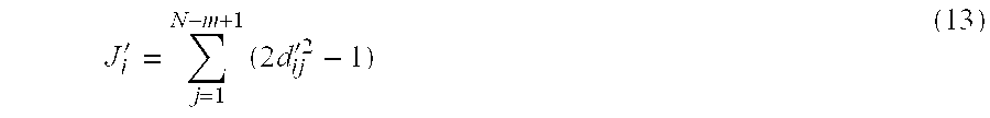
- where J i′ is the redundancy of an ith satellite in the updated redundancy matrix D′ and Jk2′ is the maximum redundancy of the updated redundancy matrix D′. Then a column and a row containing an element k2 are eliminated.
- The final (n×n) redundancy matrix is a final satellite list. The satellites of the (n×n) redundancy matrix are selected as optimal satellites in step S 660 and the GPS receiver assigns channels to the optimal satellites in step S665.
- It can be further contemplated as another embodiment that the optimal satellites can be selected by Eq. (15) instead of updating a redundancy matrix each time one satellite is eliminated.
- J i ′=J i −J iK (15)
- As described above, one satellite having a maximum redundancy J iK is eliminated from a redundancy matrix from which the redundancy Ji of an ith satellite is calculated. Eq. (15) is repeated until an intended number of satellites remain.
- Because redundancy is calculated with respect to satellites in pairs, elimination of one satellite having a maximum redundancy is repeated. Simultaneous elimination of a plurality of satellites from a satellite list will be compared with elimination of the satellites one by one from the satellite list.
- FIG. 9 illustrates simply four LOS vectors θ 1 (=−5.1°), θ2 (=5.0°), θ3 (=80°), and θ4 (=100°) on a two-dimensional plane. θi is the direction angle of a LOS vector to an ith satellite. When two optimal LOS vectors are chosen, θ1 and θ3 are chosen by calculating GDOP for each of 4C2 subsets in the conventional optimal satellite selection.
- The redundancies of the LOS vectors are calculated to be 0.089, 0.008, −0.085, and −0.083, respectively as illustrated in FIG. 10A and FIG. 11A. When two vectors having maximum redundancies are chosen simultaneously, θ 1 and θ2 are eliminated as illustrated in FIG. 10B. Then GDOP or PDOP (Position Dilution Of Precision) representing a navigational solution error is calculated to be 17.1 using θ3 and θ4, which is very high as compared in the optimal satellite selection.
- However, when the vectors are sequentially selected one by one according to an embodiment of the present invention, θ 1 having a maximum redundancy 0.089 is first eliminated. The redundancies of the remaining LOS vectors θ2, θ3 and θ4 are recalculated to be −0.0858, 0.0900 and 0.7812, respectively as illustrated in FIG. 11B. After θ3 having a maxim redundancy 0.900 is then eliminated, a PDOP for the remaining vectors, that is, θ2 and θ4 is 2.0153 as illustrated in FIG. 11C, which is very close to the PDOP value achieved from the conventional optimal satellite selection method. Therefore, the effects of the optimal satellite selection are achieved with fewer operations.
- FIG. 12 illustrates a comparison in computation volume requirement between satellite selection (quasi-optimal) according to the present invention and the optimal satellite selection in a simulation. 6 satellites are selected among 7 to 15 visible satellites. Referring to FIG. 12, the quasi-optimal satellite selection requires floating point operations less than the optimal satellite selection by 10 to 1000 times. If the total number of visible satellites is 10 to 12 and 6 satellites are selected, the required computation volume can be reduced to a one hundredth.
- For example, if 6 satellites are selected among 10 visible satellites, GDOP is calculated for each of 10C6 (=210) subsets in the optimal satellite selection. This implies that 210 matrix multiplications, 210 matrix inversions and 210 scalar additions are performed. On the contrary, the quasi-optimal satellite selection allows optimal satellites to be selected using one matrix multiplication and a few scalar additions/subtractions.
- FIG. 13 illustrates changes in GDOP with respect to the number of channels used in a GPS receiver, that is, the number of satellites used. Here, 13 visible satellites exist and 4 to 13 satellites can be selected. At worst, as the number of channels decreases, PDOP increases very rapidly, which implies that a relatively large number of channels are needed within an allowed error range. However, the use of many hardware channels affects the size of a GPS receiver.
- According to the present invention, even though the number of channels decreases, PDOP does not increase much. The difference in PDOP between use of 6 satellites and use of 9 satellites is only 0.35, Thus a desired error range can be satisfied using fewer hardware channels, thereby further obviating the need for matrix computation and vector computation required to achieve a navigation solution. As a result, memory capacity requirement and the size of the GPS receiver are reduced. Moreover, the use of fewer hardware channels reduces computation volume in calculating the navigational solution at a processor unit.
- FIGS. 14A and 14B are graphs illustrating simulated GDOP distributions in the quasi-optimal satellite selection according to the present invention and the highest elevation satellite selection, respectively. 10 visible satellites are randomly distributed three-dimensionally with respect to a user and 6 of them are to be selected. A parameter

- indicates the degree of discrepancy between a GDOP achieved in the present invention (quasi-optimal satellite selection) and the GDOP achieved in the conventional optimal satellite selection. As ζ approaches 1, the satellite selection becomes optimal.
- As noted from FIG. 14B, the GDOP in the highest elevation satellite selection is higher than the GDOP of the optimal satellite selection by one to three times on the whole, by 3500% at the worst. On the other hand, the GDOP in the quasi-optimal elevation satellite selection is equal to the GDOP in the optimal satellite selection on the whole, merely 23% higher at the worst.
- In accordance with the present invention as described above, an intended number of geometrically optimal or quasi-optimal satellites are chosen to locate an object with a minimum number of operations and minimized use of a processor. Therefore, required hardware (e.g., operation circuits and a memory) can be reduced and a GPS receiver can be made small enough to be built in a portable terminal.
- While the invention has been shown and described with reference to a certain preferred embodiment thereof, it will be understood by those skilled in the art that various changes in form and details may be made therein without departing from the spirit and scope of the invention as defined by the appended claims.
Claims (11)
1. A method of selecting GPS (Global Positioning System) satellites to locate an object using a GPS receiver, comprising:
making a satellite list including the coordinates of satellites visible in the GPS receiver;
calculating redundancies indicating respectively the degree that the satellites are overlapped with other satellites included in the satellite list using the coordinates of satellites and eliminating one satellite having a maximum redundancy from the satellite list; and
assigning channels of the GPS receiver to an intended number of satellites if the intended number of satellites remain in the satellite list and, if not, repeating the calculating step.
2. The method of claim 1 , wherein the calculating and eliminating step comprises: updating the satellite list by eliminating one satellite having a maximum redundancy from the satellite list; and
repeating the satellite list updating step until the intended number of satellites remain in the satellite list.
3. The method of claim 1 , wherein the redundancies are calculated by

wherein Ji is a redundancy of an ith satellite, N is a number of the satellites in the satellite list, and θij is an angle between a LOS (Line-Of-Sight) vector from the GPS receiver to the ith satellite and a LOS vector from the GPS receiver to a jth satellite.
4. The method of claim 2 , wherein the redundancies are calculated by

wherein Ji is a redundancy of an ith satellite, N is a number of the satellites in the satellite list, and θij is an angle between a LOS (Line-Of-Sight) vector from the GPS receiver to the ith satellite and a LOS vector from the GPS receiver to a jth satellite.
5. The method of claim 1 , wherein the calculating step comprises:
generating a redundancy matrix having cosine values of angles between each of the satellites in the satellite list;
calculating the redundancies of the satellites by squaring each of elements in each column or row of the redundancy matrix and summing the squares;
comparing the calculated redundancies;
updating the redundancy matrix by eliminating a column and a row corresponding to a maximum redundancy from the redundancy matrix;
repeating the redundancy calculating step, the redundancy comparing step, and the redundancy matrix updating step until an intended number of satellites remain in the redundancy matrix; and
updating the satellite list to have an intended number of satellites if the intended number of satellites remain.
6. A method of selecting GPS (Global Positioning System) satellites to locate an object using a GPS receiver, comprising:
making a satellite list including the coordinates of satellites visible in the GPS receiver;
calculating redundancies indicating respectively the degree that the satellite are overlapped with other satellites included in the satellite list using the coordinates of satellites;
updating the satellite list by eliminating from the satellite list one satellite having a maximum redundancy;
repeating the redundancy calculating step and the satellite list updating step for the satellite list until an intended number of satellites remain in the satellite list; and
assigning channels of the GPS receiver to the intended number of satellites.
7. The method of claim 6 , wherein the redundancies are calculated by

wherein Ji is a redundancy of an ith satellite, N is a number of the satellites in the satellite list, and θij is an angle between a LOS (Line-Of-Sight) vector from the GPS receiver to the ith satellite and a LOS vector from the GPS receiver to a jth satellite.
8. An apparatus for selecting GPS (Global Positioning System) satellites to locate an object using a GPS receiver, comprising:
an RF (Radio Frequency) unit for receiving RF signals on channels assigned to GPS satellites;
a digital unit for processing the received RF signals;
a processor unit for selecting satellites to which the channels are assigned and calculating a navigational solution using the processed signals; and
a memory for storing an operating program executed in the processor unit,
wherein the processor unit makes a satellite list including the coordinates of satellites visible in the GPS receiver, calculates redundancies indicating respectively the degree that the satellites are overlapped with other satellites included in the satellite list using the coordinate of satellite and, eliminates one satellite having a maximum redundancy from the satellite list, and assigns the channels of the GPS receiver to an intended number of satellites if the intended number of satellites remain in the satellite list.
9. The apparatus of claim 8 , wherein the processor unit calculates the redundancies of the satellites in the satellite list, updates the satellite list by eliminating one satellite having a maximum redundancy from the satellite list, repeats redundancy calculation and satellite list updating for the satellite list until the intended number of satellites remain in the satellite list.
10. The apparatus of claim 8 , wherein the redundancies are calculated by

wherein Ji is a redundancy of an ith satellite, N is a number of the satellites in the satellite list, and θij is an angle between a LOS (Line-Of-Sight) vector from the GPS receiver to the ith satellite and a LOS vector from the GPS receiver to a jth satellite.
11. The apparatus of claim 9 , wherein the redundancies are calculated by

wherein Ji is a redundancy of an ith satellite, N is a number of the satellites in the satellite list, and θij is an angle between a LOS (Line-Of-Sight) vector from the GPS receiver to the ith satellite and a LOS vector from the GPS receiver to a jth satellite.
Applications Claiming Priority (2)
| Application Number | Priority Date | Filing Date | Title |
|---|---|---|---|
| KR10-2002-0032955A KR100450954B1 (en) | 2002-06-12 | 2002-06-12 | Method and apparatus for selecting optimum satellites in global positioning system |
| KRP2002-32955 | 2002-06-12 |
Publications (2)
| Publication Number | Publication Date |
|---|---|
| US20030231132A1 true US20030231132A1 (en) | 2003-12-18 |
| US6727850B2 US6727850B2 (en) | 2004-04-27 |
Family
ID=29728643
Family Applications (1)
| Application Number | Title | Priority Date | Filing Date |
|---|---|---|---|
| US10/341,145 Expired - Lifetime US6727850B2 (en) | 2002-06-12 | 2003-01-13 | Method and apparatus for selecting optimal satelittes in global positioning system |
Country Status (2)
| Country | Link |
|---|---|
| US (1) | US6727850B2 (en) |
| KR (1) | KR100450954B1 (en) |
Cited By (27)
| Publication number | Priority date | Publication date | Assignee | Title |
|---|---|---|---|---|
| US20050195107A1 (en) * | 2004-03-05 | 2005-09-08 | Kotaro Wakamatsu | Satellite positioning apparatus and method |
| US20060077096A1 (en) * | 2004-10-08 | 2006-04-13 | King Thomas M | Navigation satellite acquisition in satellite positioning system receiver |
| US20060103574A1 (en) * | 2004-11-12 | 2006-05-18 | Geier George J | Satellite positioning system receiver time determination in minimum satellite coverage |
| US20060152409A1 (en) * | 2002-10-01 | 2006-07-13 | Sundar Raman | Fast search gps receiver |
| US20060250304A1 (en) * | 2005-05-06 | 2006-11-09 | Jun Mo | System and method for fast initialization of navigational satellite signal receivers |
| EP1804071A1 (en) * | 2005-12-29 | 2007-07-04 | Alcatel Lucent | Method for optimising positioning data processing where there are several satellite positioning constellations |
| US20070241958A1 (en) * | 2006-04-18 | 2007-10-18 | Peter Nicholson | Method and apparatus for geolocation determination |
| US20080191935A1 (en) * | 2007-02-14 | 2008-08-14 | Navico Inc. | Method, Computer Program Product and Apparatus for Selecting a Satellite Navigation System Module |
| US20090207076A1 (en) * | 2008-02-19 | 2009-08-20 | Honeywell International Inc. | System and method for gnss position aided signal acquisition |
| US20090273511A1 (en) * | 2008-04-21 | 2009-11-05 | Deutsches Zentrum Fuer Luft-Und Raumfahrt E.V. | Method of operating a satellite navigation receiver |
| US20110187816A1 (en) * | 2008-11-05 | 2011-08-04 | Fujitsu Limited | Camera angle computing device and camera angle computing method |
| CN102183771A (en) * | 2011-03-21 | 2011-09-14 | 华南理工大学 | Realizing method of multi-mode GNSS (Global Navigation Satellite System) software receiver based on multi-core processor |
| JP4897824B2 (en) * | 2005-11-29 | 2012-03-14 | ノルドナブ テクノロジーズ エー ビー | Satellite navigation method and spread spectrum software receiver |
| CN102955162A (en) * | 2011-08-16 | 2013-03-06 | 神基科技股份有限公司 | Satellite positioning method |
| EP2565676A1 (en) * | 2011-09-05 | 2013-03-06 | Samsung Electronics Co., Ltd. | Apparatus and method for correcting position information of portable terminal in multi-path zone |
| US20140292572A1 (en) * | 2009-03-11 | 2014-10-02 | CSR Technology Holdings Inc. | Utilizing sbas signals to improve gnss receiver performance |
| US20160274242A1 (en) * | 2015-03-16 | 2016-09-22 | Honeywell International Inc. | Satellite subset selection for use in monitoring the integrity of computed navigation solutions |
| EP2864809B1 (en) * | 2012-06-20 | 2017-03-01 | Topcon Positioning Systems, Inc. | Selection of a subset of global navigation satellite system measurements based on prediction of accuracy of target parameters |
| US9958551B1 (en) * | 2017-07-07 | 2018-05-01 | Beihang University | Method and device for determining availability of ARAIM system |
| CN110221322A (en) * | 2019-06-13 | 2019-09-10 | 上海交通大学 | It is a kind of based on tri- constellation quick satellite selection method of class equilibrium configuration and the GPS/BDS/GLONASS of positive triangle method |
| US10416315B2 (en) | 2017-03-07 | 2019-09-17 | Honeywell International Inc. | False alarm distribution in advanced receiver autonomous integrity monitoring |
| US10495761B2 (en) | 2015-11-13 | 2019-12-03 | Honeywell International Inc. | Smart satellite distribution into ARAIM clusters for use in monitoring integrity of computed navigation solutions |
| US10613233B2 (en) | 2016-09-21 | 2020-04-07 | Honeywell International Inc. | ARAIM clustering distribution improvement |
| CN111736189A (en) * | 2020-04-08 | 2020-10-02 | 腾讯科技(深圳)有限公司 | Satellite selection method and device, computer readable storage medium and electronic device |
| US10845487B2 (en) * | 2017-06-13 | 2020-11-24 | Microsoft Technology Licensing, Llc | Acquisition in global navigation satellite systems based on previously acquired satellites |
| US10908295B2 (en) | 2014-05-22 | 2021-02-02 | Samsung Electronics Co., Ltd. | Electronic device for judging whether said electronic device is disposed indoors or outdoors, and method for controlling same |
| EP4220233A1 (en) * | 2012-12-14 | 2023-08-02 | Huawei Technologies Co., Ltd. | Method of estimating the position of a device |
Families Citing this family (16)
| Publication number | Priority date | Publication date | Assignee | Title |
|---|---|---|---|---|
| JP2005292082A (en) * | 2004-04-05 | 2005-10-20 | Denso Corp | Controller for satellite navigation |
| RU2314232C2 (en) | 2004-10-27 | 2008-01-10 | Закрытое акционерное общество "НПО Космического Приборостроения" | Method of forming navigational satellite system |
| US20070132636A1 (en) * | 2005-12-14 | 2007-06-14 | Motorola, Inc. | Multi-receiver satellite positioning system method and system for improved performance |
| WO2007078223A1 (en) | 2006-01-05 | 2007-07-12 | Nordnav Technologies Ab | Spread spectrum software receiver |
| US7715852B2 (en) * | 2006-01-06 | 2010-05-11 | Mediatek Inc. | Location estimation method |
| US9250330B2 (en) * | 2007-12-07 | 2016-02-02 | Telecommunication Systems, Inc. | Method and system for selecting optimal satellites for A-GPS location of handsets in wireless networks |
| KR100937876B1 (en) | 2008-09-23 | 2010-01-21 | 한국전자통신연구원 | Method and apparatus of satellite tracking and data transmission in the uplink station |
| US8412093B2 (en) * | 2008-10-22 | 2013-04-02 | Mediatek Inc. | Receiver applying channel selection filter for receiving satellite signal and receiving method thereof |
| US8044852B2 (en) * | 2009-01-14 | 2011-10-25 | Trimble Navigation Limited | Position determination based on hybrid pseudorange solution data |
| GB201100114D0 (en) | 2011-01-05 | 2011-02-16 | Cambridge Silicon Radio Ltd | Determing positiion |
| GB2487256B8 (en) | 2011-01-05 | 2015-04-01 | Cambridge Silicon Radio Ltd | Location fix from unknown position |
| GB2491549A (en) * | 2011-01-05 | 2012-12-12 | Cambridge Silicon Radio Ltd | Satellite subset selection |
| GB2487348B (en) * | 2011-01-05 | 2018-10-03 | Qualcomm Technologies Int Ltd | Calculation of location in a satellite navigation system with extended convergence zone |
| US9285479B2 (en) * | 2012-06-20 | 2016-03-15 | Topcon Positioning Systems, Inc. | Selection of a subset of global navigation satellite system measurements based on relation between shifts in target parameters and sum of residuals |
| WO2015178632A1 (en) * | 2014-05-22 | 2015-11-26 | 삼성전자 주식회사 | Electronic device for judging whether said electronic device is disposed indoors or outdoors, and method for controlling same |
| CN111045038B (en) * | 2019-12-27 | 2021-12-07 | 中国科学院国家空间科学中心 | Optimization method for number of reflection channels of GNSS-R receiver |
Citations (7)
| Publication number | Priority date | Publication date | Assignee | Title |
|---|---|---|---|---|
| US4928107A (en) * | 1988-06-22 | 1990-05-22 | Hitachi, Ltd. | Signal receiving method for a user's device in a global positioning system |
| US6278404B1 (en) * | 1998-07-08 | 2001-08-21 | The United States Of America As Represented By The United States National Aeronautics And Space Administration | Global positioning system satellite selection method |
| US6392593B1 (en) * | 2000-05-08 | 2002-05-21 | Garmin Corporation | Time division satellite acquisition |
| US20030008666A1 (en) * | 2001-07-09 | 2003-01-09 | Yuji Ohmura | Positioning system |
| US6583759B2 (en) * | 2000-09-01 | 2003-06-24 | Nokia Mobile Phones Ltd | Method for determining a position, a positioning system, and an electronic device |
| US6642886B2 (en) * | 2001-02-22 | 2003-11-04 | Motorola, Inc. | Prioritizing satellite search order based on doppler uncertainty |
| US6650288B1 (en) * | 2002-05-23 | 2003-11-18 | Telecommunication Systems | Culled satellite ephemeris information for quick assisted GPS location determination |
Family Cites Families (5)
| Publication number | Priority date | Publication date | Assignee | Title |
|---|---|---|---|---|
| JPH04127077A (en) * | 1990-09-18 | 1992-04-28 | Japan Radio Co Ltd | Gps position measuring apparatus |
| JPH0933631A (en) * | 1995-07-18 | 1997-02-07 | Matsushita Electric Ind Co Ltd | Method for setting search satellite in gps receiver |
| JP3601241B2 (en) * | 1997-04-03 | 2004-12-15 | 株式会社デンソー | GPS receiver |
| US6459405B1 (en) * | 1999-09-07 | 2002-10-01 | Lucent Technologies Inc. | Satellite-based location system employing knowledge-based sequential signal search strategy |
| JP2001228232A (en) * | 2000-02-21 | 2001-08-24 | Matsushita Electric Ind Co Ltd | Gps receiver |
-
2002
- 2002-06-12 KR KR10-2002-0032955A patent/KR100450954B1/en not_active IP Right Cessation
-
2003
- 2003-01-13 US US10/341,145 patent/US6727850B2/en not_active Expired - Lifetime
Patent Citations (7)
| Publication number | Priority date | Publication date | Assignee | Title |
|---|---|---|---|---|
| US4928107A (en) * | 1988-06-22 | 1990-05-22 | Hitachi, Ltd. | Signal receiving method for a user's device in a global positioning system |
| US6278404B1 (en) * | 1998-07-08 | 2001-08-21 | The United States Of America As Represented By The United States National Aeronautics And Space Administration | Global positioning system satellite selection method |
| US6392593B1 (en) * | 2000-05-08 | 2002-05-21 | Garmin Corporation | Time division satellite acquisition |
| US6583759B2 (en) * | 2000-09-01 | 2003-06-24 | Nokia Mobile Phones Ltd | Method for determining a position, a positioning system, and an electronic device |
| US6642886B2 (en) * | 2001-02-22 | 2003-11-04 | Motorola, Inc. | Prioritizing satellite search order based on doppler uncertainty |
| US20030008666A1 (en) * | 2001-07-09 | 2003-01-09 | Yuji Ohmura | Positioning system |
| US6650288B1 (en) * | 2002-05-23 | 2003-11-18 | Telecommunication Systems | Culled satellite ephemeris information for quick assisted GPS location determination |
Cited By (39)
| Publication number | Priority date | Publication date | Assignee | Title |
|---|---|---|---|---|
| US20060152409A1 (en) * | 2002-10-01 | 2006-07-13 | Sundar Raman | Fast search gps receiver |
| US7623067B2 (en) * | 2002-10-01 | 2009-11-24 | Sirf Technology Holdings, Inc. | Fast search GPS receiver |
| US7295155B2 (en) * | 2004-03-05 | 2007-11-13 | Alpine Electronics, Inc. | Satellite positioning apparatus and method |
| US20050195107A1 (en) * | 2004-03-05 | 2005-09-08 | Kotaro Wakamatsu | Satellite positioning apparatus and method |
| US20060077096A1 (en) * | 2004-10-08 | 2006-04-13 | King Thomas M | Navigation satellite acquisition in satellite positioning system receiver |
| US7250904B2 (en) * | 2004-10-08 | 2007-07-31 | Motorola, Inc. | Navigation satellite acquisition in satellite positioning system receiver |
| US20060103574A1 (en) * | 2004-11-12 | 2006-05-18 | Geier George J | Satellite positioning system receiver time determination in minimum satellite coverage |
| US7623066B2 (en) * | 2004-11-12 | 2009-11-24 | Motorola, Inc. | Satellite positioning system receiver time determination in minimum satellite coverage |
| US7324045B2 (en) * | 2005-05-06 | 2008-01-29 | Sirf Technology, Inc. | System and method for fast initialization of navigational satellite signal receivers |
| US20060250304A1 (en) * | 2005-05-06 | 2006-11-09 | Jun Mo | System and method for fast initialization of navigational satellite signal receivers |
| JP4897824B2 (en) * | 2005-11-29 | 2012-03-14 | ノルドナブ テクノロジーズ エー ビー | Satellite navigation method and spread spectrum software receiver |
| EP1804071A1 (en) * | 2005-12-29 | 2007-07-04 | Alcatel Lucent | Method for optimising positioning data processing where there are several satellite positioning constellations |
| US20070236387A1 (en) * | 2005-12-29 | 2007-10-11 | Alcatel Lucent | Method of optimization of processing of location data in the presence of a plurality of satellite positioning constellations |
| US7646338B2 (en) | 2005-12-29 | 2010-01-12 | Alcatel Lucent | Method of optimization of processing of location data in the presence of a plurality of satellite positioning constellations |
| US20070241958A1 (en) * | 2006-04-18 | 2007-10-18 | Peter Nicholson | Method and apparatus for geolocation determination |
| US20080191935A1 (en) * | 2007-02-14 | 2008-08-14 | Navico Inc. | Method, Computer Program Product and Apparatus for Selecting a Satellite Navigation System Module |
| US20090207076A1 (en) * | 2008-02-19 | 2009-08-20 | Honeywell International Inc. | System and method for gnss position aided signal acquisition |
| US8106822B2 (en) * | 2008-02-19 | 2012-01-31 | Honeywell International Inc. | System and method for GNSS position aided signal acquisition |
| US20090273511A1 (en) * | 2008-04-21 | 2009-11-05 | Deutsches Zentrum Fuer Luft-Und Raumfahrt E.V. | Method of operating a satellite navigation receiver |
| US8106823B2 (en) * | 2008-04-21 | 2012-01-31 | Deutsches Zentrum Fuer Luft-und | Method of operating a satellite navigation receiver |
| US20110187816A1 (en) * | 2008-11-05 | 2011-08-04 | Fujitsu Limited | Camera angle computing device and camera angle computing method |
| US8537199B2 (en) * | 2008-11-05 | 2013-09-17 | Fujitsu Limited | Camera calibration device and method by computing coordinates of jigs in a vehicle system |
| US20140292572A1 (en) * | 2009-03-11 | 2014-10-02 | CSR Technology Holdings Inc. | Utilizing sbas signals to improve gnss receiver performance |
| CN102183771A (en) * | 2011-03-21 | 2011-09-14 | 华南理工大学 | Realizing method of multi-mode GNSS (Global Navigation Satellite System) software receiver based on multi-core processor |
| EP2560024A3 (en) * | 2011-08-16 | 2013-08-14 | Getac Technology Corporation | Satellite-based positioning method |
| CN102955162A (en) * | 2011-08-16 | 2013-03-06 | 神基科技股份有限公司 | Satellite positioning method |
| EP2565676A1 (en) * | 2011-09-05 | 2013-03-06 | Samsung Electronics Co., Ltd. | Apparatus and method for correcting position information of portable terminal in multi-path zone |
| EP2864809B1 (en) * | 2012-06-20 | 2017-03-01 | Topcon Positioning Systems, Inc. | Selection of a subset of global navigation satellite system measurements based on prediction of accuracy of target parameters |
| EP4220233A1 (en) * | 2012-12-14 | 2023-08-02 | Huawei Technologies Co., Ltd. | Method of estimating the position of a device |
| US10908295B2 (en) | 2014-05-22 | 2021-02-02 | Samsung Electronics Co., Ltd. | Electronic device for judging whether said electronic device is disposed indoors or outdoors, and method for controlling same |
| US20160274242A1 (en) * | 2015-03-16 | 2016-09-22 | Honeywell International Inc. | Satellite subset selection for use in monitoring the integrity of computed navigation solutions |
| US9885788B2 (en) * | 2015-03-16 | 2018-02-06 | Honeywell International Inc. | Satellite subset selection for use in monitoring the integrity of computed navigation solutions |
| US10495761B2 (en) | 2015-11-13 | 2019-12-03 | Honeywell International Inc. | Smart satellite distribution into ARAIM clusters for use in monitoring integrity of computed navigation solutions |
| US10613233B2 (en) | 2016-09-21 | 2020-04-07 | Honeywell International Inc. | ARAIM clustering distribution improvement |
| US10416315B2 (en) | 2017-03-07 | 2019-09-17 | Honeywell International Inc. | False alarm distribution in advanced receiver autonomous integrity monitoring |
| US10845487B2 (en) * | 2017-06-13 | 2020-11-24 | Microsoft Technology Licensing, Llc | Acquisition in global navigation satellite systems based on previously acquired satellites |
| US9958551B1 (en) * | 2017-07-07 | 2018-05-01 | Beihang University | Method and device for determining availability of ARAIM system |
| CN110221322A (en) * | 2019-06-13 | 2019-09-10 | 上海交通大学 | It is a kind of based on tri- constellation quick satellite selection method of class equilibrium configuration and the GPS/BDS/GLONASS of positive triangle method |
| CN111736189A (en) * | 2020-04-08 | 2020-10-02 | 腾讯科技(深圳)有限公司 | Satellite selection method and device, computer readable storage medium and electronic device |
Also Published As
| Publication number | Publication date |
|---|---|
| US6727850B2 (en) | 2004-04-27 |
| KR100450954B1 (en) | 2004-10-02 |
| KR20030095656A (en) | 2003-12-24 |
Similar Documents
| Publication | Publication Date | Title |
|---|---|---|
| US6727850B2 (en) | Method and apparatus for selecting optimal satelittes in global positioning system | |
| EP2051556B1 (en) | Procedure to increase position availability | |
| US5418538A (en) | Rapid satellite signal acquisition in a satellite positioning system | |
| CA2404109C (en) | Methods and apparatuses for using assistance data relating to satellite position systems | |
| EP2864809B9 (en) | Selection of a subset of global navigation satellite system measurements based on prediction of accuracy of target parameters | |
| US8629802B2 (en) | Method for the location of mobile terminals | |
| US6865478B2 (en) | Determining the position of a receiver and/or the system time of a positioning system | |
| US20080036654A1 (en) | Method for fusing multiple gps measurement types into a weighted least squares solution | |
| CN112394379A (en) | Double-antenna combined satellite navigation positioning method and device | |
| Wübbena et al. | State space approach for precise real time positioning in GPS reference networks | |
| US6191729B1 (en) | Satellite signal receiver with integrity control and exclusion of defective axes | |
| US6882306B2 (en) | Method for determining a position of an electronic device using a satellite positioning system | |
| US20050080557A1 (en) | Method and a system in positioning, and a device | |
| Miaoyan et al. | Satellite selection for multi-constellation | |
| JPH0651047A (en) | Gps receiver | |
| US7916077B2 (en) | Method for obtaining correct phase inversion points in signal of GPS | |
| Pietilä et al. | Improved method for satellite acquisition |
Legal Events
| Date | Code | Title | Description |
|---|---|---|---|
| AS | Assignment |
Owner name: SAMSUNG ELECTRONICS CO., LTD., KOREA, REPUBLIC OF Free format text: ASSIGNMENT OF ASSIGNORS INTEREST;ASSIGNORS:PARK, CHAN-WOO;HOW, JONATHAN P.;REEL/FRAME:014071/0815 Effective date: 20030428 |
|
| STCF | Information on status: patent grant |
Free format text: PATENTED CASE |
|
| FPAY | Fee payment |
Year of fee payment: 4 |
|
| FEPP | Fee payment procedure |
Free format text: PAYOR NUMBER ASSIGNED (ORIGINAL EVENT CODE: ASPN); ENTITY STATUS OF PATENT OWNER: LARGE ENTITY |
|
| FPAY | Fee payment |
Year of fee payment: 8 |
|
| FPAY | Fee payment |
Year of fee payment: 12 |