WO2010059934A2 - Wireless position determination using adjusted round trip time measurements - Google Patents
Wireless position determination using adjusted round trip time measurements Download PDFInfo
- Publication number
- WO2010059934A2 WO2010059934A2 PCT/US2009/065319 US2009065319W WO2010059934A2 WO 2010059934 A2 WO2010059934 A2 WO 2010059934A2 US 2009065319 W US2009065319 W US 2009065319W WO 2010059934 A2 WO2010059934 A2 WO 2010059934A2
- Authority
- WO
- WIPO (PCT)
- Prior art keywords
- wireless access
- access point
- mobile station
- distance
- wireless
- Prior art date
Links
Classifications
-
- G—PHYSICS
- G01—MEASURING; TESTING
- G01S—RADIO DIRECTION-FINDING; RADIO NAVIGATION; DETERMINING DISTANCE OR VELOCITY BY USE OF RADIO WAVES; LOCATING OR PRESENCE-DETECTING BY USE OF THE REFLECTION OR RERADIATION OF RADIO WAVES; ANALOGOUS ARRANGEMENTS USING OTHER WAVES
- G01S5/00—Position-fixing by co-ordinating two or more direction or position line determinations; Position-fixing by co-ordinating two or more distance determinations
- G01S5/02—Position-fixing by co-ordinating two or more direction or position line determinations; Position-fixing by co-ordinating two or more distance determinations using radio waves
- G01S5/10—Position of receiver fixed by co-ordinating a plurality of position lines defined by path-difference measurements, e.g. omega or decca systems
-
- G—PHYSICS
- G01—MEASURING; TESTING
- G01S—RADIO DIRECTION-FINDING; RADIO NAVIGATION; DETERMINING DISTANCE OR VELOCITY BY USE OF RADIO WAVES; LOCATING OR PRESENCE-DETECTING BY USE OF THE REFLECTION OR RERADIATION OF RADIO WAVES; ANALOGOUS ARRANGEMENTS USING OTHER WAVES
- G01S5/00—Position-fixing by co-ordinating two or more direction or position line determinations; Position-fixing by co-ordinating two or more distance determinations
- G01S5/02—Position-fixing by co-ordinating two or more direction or position line determinations; Position-fixing by co-ordinating two or more distance determinations using radio waves
- G01S5/14—Determining absolute distances from a plurality of spaced points of known location
-
- G—PHYSICS
- G01—MEASURING; TESTING
- G01S—RADIO DIRECTION-FINDING; RADIO NAVIGATION; DETERMINING DISTANCE OR VELOCITY BY USE OF RADIO WAVES; LOCATING OR PRESENCE-DETECTING BY USE OF THE REFLECTION OR RERADIATION OF RADIO WAVES; ANALOGOUS ARRANGEMENTS USING OTHER WAVES
- G01S13/00—Systems using the reflection or reradiation of radio waves, e.g. radar systems; Analogous systems using reflection or reradiation of waves whose nature or wavelength is irrelevant or unspecified
- G01S13/74—Systems using reradiation of radio waves, e.g. secondary radar systems; Analogous systems
- G01S13/76—Systems using reradiation of radio waves, e.g. secondary radar systems; Analogous systems wherein pulse-type signals are transmitted
- G01S13/765—Systems using reradiation of radio waves, e.g. secondary radar systems; Analogous systems wherein pulse-type signals are transmitted with exchange of information between interrogator and responder
-
- H—ELECTRICITY
- H04—ELECTRIC COMMUNICATION TECHNIQUE
- H04W—WIRELESS COMMUNICATION NETWORKS
- H04W24/00—Supervisory, monitoring or testing arrangements
-
- H—ELECTRICITY
- H04—ELECTRIC COMMUNICATION TECHNIQUE
- H04W—WIRELESS COMMUNICATION NETWORKS
- H04W64/00—Locating users or terminals or network equipment for network management purposes, e.g. mobility management
Definitions
- aspects of this disclosure generally relate to wireless communication systems, and more specifically, to improved position determination methods and apparatuses for use with and/or by wireless mobile devices.
- Mobile communications networks are in the process of offering increasingly sophisticated capabilities associated with the motion and/or position location sensing of a mobile device.
- New software applications such as, for example, those related to personal productivity, collaborative communications, social networking, and/or data acquisition, may utilize motion and/or position sensors to provide new features and services to consumers.
- some regulatory requirements of various jurisdictions may require a network operator to report the location of a mobile device when the mobile device places a call to an emergency service, such as a 911 call in the United States.
- position location capability can be provided by various time and/or phase measurement techniques.
- one position determination approach used is Advanced Forward Link Trilateration (AFLT).
- AFLT Advanced Forward Link Trilateration
- a mobile device may compute its position from phase measurements of pilot signals transmitted from a plurality of base stations. Improvements to AFLT have been realized by utilizing hybrid position location techniques, where the mobile station may employ a Satellite Positioning System (SPS) receiver.
- SPS Satellite Positioning System
- the SPS receiver may provide position information independent of the information derived from the signals transmitted by the base stations.
- position accuracy can be improved by combining measurements derived from both SPS and AFLT systems using conventional techniques.
- Utilizing RTT measurement techniques to accurately determine position typically involves knowledge of time delays incurred by the wireless signals as they propagate through various network devices comprising the network. Such delays may be spatially variant due to, for example, multipath and/or signal interference. Moreover, such processing delays may change over time based upon the type of network device and/or the network device's current networking load. In practice, when employing conventional RTT positioning techniques, estimating processing delay times may involve hardware changes in the wireless access points, and/or time-consuming pre- deployment fingerprinting and/or calibration of the operational environment.
- a method may include measuring a round trip time (RTT) to each of a plurality of wireless access points, and estimating a first distance to each wireless access point based upon the round trip time delay and an initial processing time associated with each wireless access point.
- the method may further include estimating a second distance to each wireless access point based upon supplemental information, combining the first and second distance estimates to each wireless access point, and calculating the position of the mobile station based upon the combined distance estimates.
- an apparatus for wireless position determination may include a wireless transceiver, a processor coupled to the wireless transceiver, and a memory coupled to the processor.
- the memory may store executable instructions and data for causing the processor to measure a round trip time (RTT) to each of a plurality of wireless access points, estimate a first distance to each wireless access point based upon the round trip time delay and an initial processing time associated with each wireless access point, estimate a second distance to each wireless access point based upon supplemental information, combine the first and second distance estimates to each wireless access point, and calculate the position of the mobile station based upon the combined distance estimates.
- RTT round trip time
- a method for wirelessly determining a position of a mobile station using signals provided by a plurality of wireless access points may include measuring a distance to each wireless access point based upon a wireless signal model and calculating a position of the mobile station based upon the measured distance. The method may further include determining a computed distance to each wireless access point based upon the calculated position of the mobile station, updating the wireless signal model based upon the measured and computed distances to each wireless access point, and determining whether the wireless signal model has converged.
- an apparatus for wireless position determination of a mobile station using signals provided by a plurality of wireless access points may include a wireless transceiver, a processor coupled to the wireless transceiver, and a memory coupled to the processor.
- the memory may store executable instructions and data for causing the processor to measure a distance to each wireless access point based upon a wireless signal model, calculate a position of the mobile station based upon the measured distance, determine a computed distance to each wireless access point based upon the calculated position of the mobile station, update the wireless signal model based upon the measured and computed distances to each wireless access point, and determine whether the wireless signal model has converged.
- a method for wirelessly determining a position of a mobile station may include measuring a round trip time delay to each of a plurality of wireless access points and estimating an initial processing time for each of the wireless access points. The method may further include calculating the position of the mobile station based upon the measured round trip time delays and estimated processing times, and updating the estimated processing time for each of the wireless access points based upon the calculated position of the mobile station.
- an apparatus for wirelessly determining a position of a mobile station may include a wireless transceiver, a processor coupled to the wireless transceiver, and a memory coupled to the processor.
- the memory may store executable instructions and data for causing the processor to measure a round trip time delay to each of a plurality of wireless access points, estimate an initial processing time for each of the wireless access points, calculate the position of the mobile station based upon the measured round trip time delays and estimated processing times, and update the estimated processing time for each of the wireless access points based upon the calculated position of the mobile station.
- Various embodiments may benefit from having wireless access points which do not require knowledge of their processing times and/or require providing this information to mobile stations using beacons, ranging packets, and/or look-up tables. Such advantages can reduce the burden on wireless access point manufacturers, which may be able to avoid modifications their hardware and/or protocols. Moreover, various embodiments may permit reducing the complexity of maintaining a central database of the processing time values for different manufactures of wireless access points.
- FIG. 1 is a diagram of an exemplary operating environment for a mobile station consistent with embodiments of the disclosure.
- FIG. 2 is a block diagram illustrating various components of an exemplary mobile station.
- FIG. 3 is diagram illustrating an exemplary technique for determining a position of a mobile station using information obtained from a plurality of wireless access points.
- FIG. 4 is a diagram showing exemplary timings within a round trip time (RTT) occurring during a wireless probe request and a response.
- RTT round trip time
- FIG. 5 is a graph illustrating an exemplary relationship of a received signal strength indication (RSSI) and the distance between a mobile station and a wireless access point.
- FIG. 6 is a flowchart showing an exemplary process for combining wireless signal models to improve the position determination of a mobile station.
- FIG. 7 is flowchart of another embodiment of the process illustrated in FIG. 6, where the distances based upon the measured signal strength (RSSI) and RTT may be combined to improve the position of the mobile station.
- FIG. 8 shows a flowchart illustrating an exemplary method for adaptively improving a wireless signal model.
- FIG. 1 shows an exemplary relationship of a received signal strength indication (RSSI) and the distance between a mobile station and a wireless access point.
- FIG. 6 is a flowchart showing an exemplary process for combining wireless signal models to improve the position determination of a mobile station.
- FIG. 7 is flowchart of another embodiment of the process illustrated in FIG. 6, where the distances based upon the measured signal strength (RS
- FIG. 9 is a graph of exemplary ranging models used to determine the distance between a mobile station and a wireless access point based upon RSSI.
- FIG. 10 is a diagram of an exemplary indoor environment which may be modeled to improve distance estimates between wireless access points and a mobile station based upon RSSI.
- FIG. 11 is a flowchart illustrating another exemplary method which uses both
- RSSI and RTT ranging models for position determination wherein the RTT model is adaptive model.
- FIG. 1 is a diagram of an exemplary operating environment 100 for a mobile station 108.
- Embodiments of the invention are directed to a mobile station 108 which may utilize a combination of range models and/or for determining position.
- Other embodiments may adaptively change the ranging models, such as, for example, using round trip time measurements (RTTs) that are adjusted to accommodate for processing delays introduced by wireless access points.
- RTTs round trip time measurements
- the processing delays may vary among different access points and may also change over time.
- supplemental information such as, for example, a received signal strength indicator (RSSI)
- RSSI received signal strength indicator
- the base station may determine position and/or calibrate out the effects of the processing delays introduced by the wireless access points using iterative techniques.
- RSSI received signal strength indicator
- the operating environment 100 may contain one or more different types of wireless communication systems and/or wireless positioning systems.
- a Satellite Positioning System (SPS) 102 may be used as an independent source of position information for the mobile station 108.
- the mobile station 108 may include one or more dedicated SPS receivers specifically designed to receive signals for deriving geo-location information from the SPS satellites.
- the operating environment 100 may also include a plurality of one or more types Wide Area Network Wireless Access Points (WAN-WAPs) 104, which may be used for wireless voice and/or data communication, and as another source of independent position information for mobile station 108.
- the WAN-WAPs 104 may be part of wide area wireless network (WWAN), which may include cellular base stations at known locations, and/or other wide area wireless systems, such as, for example, WiMAX (e.g., 802.16).
- WWAN wide area wireless network
- the WWAN may include other known network components which are not shown in Fig. 1 for simplicity.
- each WAN-WAPs 104a- 104c within the WWAN may operate from fixed positions, and provide network coverage over large metropolitan and/or regional areas.
- the operating environment 100 may further include Local Area Network
- Wireless Access Points may be used for wireless voice and/or data communication, as well as another independent source of position data.
- the LAN-WAPs can be part of a Wireless Local Area Network (WLAN), which may operate in buildings and perform communications over smaller geographic regions than a WWAN.
- WLAN-WAPs 106 may be part of, for example, WiFi networks (802.1 Ix), cellular piconets and/or femtocells, Bluetooth Networks, etc.
- the mobile station 108 may derive position information from any one or a combination of the SPS satellites 102, the WAN-WAPs 104, and/or the LAN-WAPs 106.
- Each of the aforementioned systems can provide an independent estimate of the position for mobile station 108 using different techniques.
- the mobile station may combine the solutions derived from each of the different types of access points to improve the accuracy of the position data.
- the mobile station may utilize a receiver specifically designed for use with the SPS that extracts position, using conventional techniques, from a plurality of signals transmitted by SPS satellites 102.
- the method and apparatus described herein may be used with various satellite positioning systems, which typically include a system of transmitters positioned to enable entities to determine their location on or above the Earth based, at least in part, on signals received from the transmitters.
- Such a transmitter typically transmits a signal marked with a repeating pseudo-random noise (PN) code of a set number of chips and may be located on ground based control stations, user equipment and/or space vehicles.
- PN pseudo-random noise
- such transmitters may be located on Earth orbiting satellite vehicles (SVs).
- SVs Earth orbiting satellite vehicles
- a SV in a constellation of Global Navigation Satellite System such as Global Positioning System (GPS), Galileo, Glonass or Compass may transmit a signal marked with a PN code that is distinguishable from PN codes transmitted by other SVs in the constellation (e.g., using different PN codes for each satellite as in GPS or using the same code on different frequencies as in Glonass).
- GNSS Global Navigation Satellite System
- GPS Global Positioning System
- Glonass Compass
- PN codes e.g., using different PN codes for each satellite as in GPS or using the same code on different frequencies as in Glonass.
- the techniques presented herein are not restricted to global systems (e.g., GNSS) for SPS.
- the techniques provided herein may be applied to or otherwise enabled for use in various regional systems, such as, e.g., Quasi-Zenith Satellite System (QZSS) over Japan, Indian Regional Navigational Satellite System (IRNSS) over India, Beidou over China, etc., and/or various augmentation systems (e.g., an Satellite Based Augmentation System (SBAS)) that may be associated with or otherwise enabled for use with one or more global and/or regional navigation satellite systems.
- QZSS Quasi-Zenith Satellite System
- IRNSS Indian Regional Navigational Satellite System
- SBAS Satellite Based Augmentation System
- an SBAS may include an augmentation system(s) that provides integrity information, differential corrections, etc., such as, e.g., Wide Area Augmentation System (WAAS), European Geostationary Navigation Overlay Service (EGNOS), Multi-functional Satellite Augmentation System (MSAS), GPS Aided Geo Augmented Navigation or GPS and Geo Augmented Navigation system (GAGAN), and/or the like.
- WAAS Wide Area Augmentation System
- GNOS European Geostationary Navigation Overlay Service
- MSAS Multi-functional Satellite Augmentation System
- GPS Aided Geo Augmented Navigation or GPS and Geo Augmented Navigation system (GAGAN), and/or the like GPS Aided Geo Augmented Navigation or GPS and Geo Augmented Navigation system (GAGAN), and/or the like.
- SPS may include any combination of one or more global and/or regional navigation satellite systems and/or augmentation systems
- SPS signals may include SPS, SPS- like, and/or other signals associated with such one or more SPS.
- the disclosed method and apparatus may be used with positioning determination systems that utilize pseudolites or a combination of satellites and pseudolites.
- Pseudolites are ground-based transmitters that broadcast a PN code or other ranging code (similar to a GPS or CDMA cellular signal) modulated on an L-band (or other frequency) carrier signal, which may be synchronized with GPS time. Each such transmitter may be assigned a unique PN code so as to permit identification by a remote receiver.
- Pseudolites are useful in situations where GPS signals from an orbiting satellite might be unavailable, such as in tunnels, mines, buildings, urban canyons or other enclosed areas. Another implementation of pseudolites is known as radio- beacons.
- tellite is intended to include pseudolites, equivalents of pseudolites, and possibly others.
- SPS signals is intended to include SPS-like signals from pseudolites or equivalents of pseudolites.
- each WAN-WAPs 104a- 104c may take the form of base stations within a digital cellular network, and the mobile station 108 may include a cellular transceiver and processor that can exploit the base station signals to derive position.
- digital cellular network may include additional base stations or other resources show in Fig. 1. While WAN-WAPs 104 may actually be moveable or otherwise capable of being relocated, for illustration purposes it will be assumed that they are essentially arranged in a fixed position.
- the mobile station 108 may perform position determination using known time-of-arrival techniques such as, for example, Advanced Forward Link Trilateration (AFLT).
- each WAN-WAP 104a- 104c may take the form of WiMax wireless networking base station.
- the mobile station 108 may determine its position using time-of-arrival (TOA) techniques from signals provided by the WAN-WAPs 104.
- TOA time-of-arrival
- the mobile station 108 may determine positions either in a stand alone mode, or using the assistance of a positioning server 110 and network 112 using TOA techniques, as will be described in more detail below.
- embodiments of the disclosure include having the mobile station 108 determine position information using WAN-WAPs 104 which are different types.
- some WAN-WAPs 104 may be cellular base stations, and other WAN-WAPs may be WiMax base stations.
- the mobile station 108 may be able to exploit the signals from each different type of WAN-WAP, and further combine the derived position solutions to improve accuracy.
- the mobile station 108 may utilize time of arrival techniques with the assistance of the positioning server 110 and the network 112.
- the positioning server 110 may communicate to the mobile station through network 112.
- Network 112 may include a combination of wired and wireless networks which incorporate the LAN-WAPs 106.
- each LAN-WAP 106a-106e may be, for example, a WiFi wireless access point, which is not necessarily set in a fixed position and can change location.
- the position of each LAN-WAP 106a- 106e may be stored in the positioning server 110 in a common coordinate system.
- the position of the mobile station 108 may be determined by having the mobile station 108 receive signals from each LAN-WAP 106a-106e.
- Each signal may be associated with its originating LAN-WAP based upon some form of identifying information that may be included in the received signal (such as, for example, a MAC address).
- the mobile station 108 may then derive the time delays associated with each of the received signals.
- the mobile station 108 may then form a message which can include the time delays and the identifying information of each of the LAN-WAPs, and send the message via network 112 to the positioning server 110.
- the positioning server may then determine a position, using the stored locations of the relevant LAN-WAPs 106, of the mobile station 108.
- the positioning server 110 may generate and provide a Location Configuration Information (LCI) message to the base station that includes a pointer to the mobile station's position in a local coordinate system.
- the LCI message may also include other points of interest in relation to the location of the mobile station 108.
- the positioning server may take into account the different delays which can be introduced by elements within the wireless network.
- the position determination techniques described herein may be used for various wireless communication networks such as a wide area wireless network (WWAN), a wireless local area network (WLAN), a wireless personal area network (WPAN), and so on.
- WWAN wide area wireless network
- WLAN wireless local area network
- WPAN wireless personal area network
- a WWAN may be a Code Division Multiple Access (CDMA) network, a Time Division Multiple Access (TDMA) network, a Frequency Division Multiple Access (FDMA) network, an Orthogonal Frequency Division Multiple Access (OFDMA) network, a Single-Carrier Frequency Division Multiple Access (SC-FDMA) network, a WiMax (IEEE 802.16) and so on.
- CDMA Code Division Multiple Access
- TDMA Time Division Multiple Access
- FDMA Frequency Division Multiple Access
- OFDMA Orthogonal Frequency Division Multiple Access
- SC-FDMA Single-Carrier Frequency Division Multiple Access
- a CDMA network may implement one or more radio access technologies (RATs) such as cdma2000, Wideband-CDMA (W-CDMA), and so on.
- Cdma2000 includes IS-95, IS-2000, and IS-856 standards.
- a TDMA network may implement Global System for Mobile Communications (GSM), Digital Advanced Mobile Phone System (D-AMPS), or some other RAT.
- GSM and W-CDMA are described in documents from a consortium named "3rd Generation Partnership Project" (3GPP).
- Cdma2000 is described in documents from a consortium named "3rd Generation Partnership Project 2" (3GPP2).
- 3GPP and 3GPP2 documents are publicly available.
- a WLAN may be an IEEE 802.1 Ix network
- a WPAN may be a Bluetooth network, an IEEE 802.15x, or some other type of network. The techniques may also be used for any combination of WWAN, WLAN and/or WPAN.
- FIG. 2 is a block diagram illustrating various components of an exemplary mobile station 200.
- the various features and functions illustrated in the box diagram of Fig. 2 are connected together using a common bus which is meant to represent that these various features and functions are operatively coupled together.
- a common bus which is meant to represent that these various features and functions are operatively coupled together.
- Those skilled in the art will recognize that other connections, mechanisms, features, functions, or the like, may be provided and adapted as necessary to operatively couple and configure an actual portable wireless device.
- one or more of the features or functions illustrated in the example of FIG. 2 may be further subdivided or two or more of the features or functions illustrated in FIG. 2 may be combined.
- the mobile station may include one or more wide area network transceiver(s)
- the wide area network transceiver 204 comprises suitable devices, hardware, and/or software for communicating with and/or detecting signals to/from WAN-WAPs 104, and/or directly with other wireless devices within a network.
- the wide area network transceiver 204 may comprise a CDMA communication system suitable for communicating with a CDMA network of wireless base stations; however in other aspects, the wireless communication system may comprise another type of cellular telephony network, such as, for example, TDMA or GSM. Additionally, any other type of wireless networking technologies may be used, for example, WiMax (802.16), etc.
- the mobile station may also include one or more local area network transceivers 206 that may be connected to one or more antennas 202.
- the local area network transceiver 206 comprises suitable devices, hardware, and/or software for communicating with and/or detecting signals to/from LAN-WAPs 106, and/or directly with other wireless devices within a network.
- the local area network transceiver 206 may comprise a WiFi (802.1 Ix) communication system suitable for communicating with one or more wireless access points; however in other aspects, the local area network transceiver 206 comprise another type of local area network, personal area network, (e.g., Bluetooth). Additionally, any other type of wireless networking technologies may be used, for example, Ultra Wide Band, ZigBee, wireless USB etc.
- wireless access point may be used to refer to LAN-WAPs 106 and/or WAN-WAPs 104.
- WAP wireless access point
- embodiments may include a mobile station 200 that can exploit signals from a plurality of LAN-WAPs 106, a plurality of WAN-WAPs 104, or any combination of the two.
- the specific type of WAP being utilized by the mobile station 200 may depend upon the environment of operation.
- the mobile station 200 may dynamically select between the various types of WAPs in order to arrive at an accurate position solution.
- An SPS receiver 208 may also be included in mobile station 200.
- the SPS receiver 208 may be connected to the one or more antennas 202 for receiving satellite signals.
- the SPS receiver 208 may comprise any suitable hardware and/or software for receiving and processing SPS signals.
- the SPS receiver 208 requests information and operations as appropriate from the other systems, and performs the calculations necessary to determine the mobile station's 200 position using measurements obtained by any suitable SPS algorithm.
- a motion sensor 212 may be coupled to processor 210 to provide relative movement and/or orientation information which is independent of motion data derived from signals received by the wide area network transceiver 204, the local area network transceiver 206 and the SPS receiver 208.
- motion sensor 212 may utilize an accelerometer (e.g., a MEMS device), a gyroscope, a geomagnetic sensor (e.g., a compass), an altimeter (e.g., a barometric pressure altimeter), and/or any other type of movement detection sensor.
- motion sensor 212 may include a plurality of different types of devices and combine their outputs in order to provide motion information.
- a processor 210 may be connected to the wide area network transceiver 204, local area network transceiver 206, the SPS receiver 208 and the motion sensor 212.
- the processor may include one or more microprocessors, microcontrollers, and/or digital signal processors that provide processing functions, as well as other calculation and control functionality.
- the processor 210 may also include memory 214 for storing data and software instructions for executing programmed functionality within the mobile station.
- the memory 214 may be on-board the processor 210 (e.g., within the same IC package), and/or the memory may be external memory to the processor and functionally coupled over a data bus.
- a number of software modules and data tables may reside in memory 214 and be utilized by the processor 210 in order to manage both communications and positioning determination functionality.
- memory 214 may include and/or otherwise receive a positioning module 216, an application module 218, a received signal strength indicator (RSSI) module 220, and a round trip time (RTT) module 222.
- RSSI received signal strength indicator
- RTT round trip time
- the application module 218 may be a process running on the processor 210 of the mobile device 200, which requests position information from the positioning module 216.
- Applications typically run within an upper layer of the software architectures, and may include Indoor Navigation, Buddy Locator, Shopping and Coupons, Asset Tracking, and location Aware Service Discovery.
- the positioning module 216 may derive the position of the mobile device 200 using information derived from the RTTs measured from signals exchanged with a plurality of WAPs. In order to accurately determine position using RTT techniques, reasonable estimates of processing time delays introduced by each WAP may be used to calibrate/adjust the measured RTTs.
- the measured RTTs may be determined by the RTT module 222, which can measure the timings of signals exchanged between the mobile station 200 and the WAPs to derive round trip time (RTT) information.
- RTT round trip time
- the RTT values may be passed to the positioning module 216 to assist in determining the position of the mobile device 200.
- the positioning module 216 may use supplemental information to estimate the processing times of the WAPs.
- the amplitude values of the signals transmitted by the WAPs may be used to provide this information. These amplitude values may be determined in the form of RSSI measurements determined by RSSI module 220.
- the RSSI module 220 may provide amplitude and statistical information regarding the signals to the position module 216.
- the position module may then estimate the processing times to calibrate the RTT measurements and accurately determine position.
- the position may then be output to the application module 218 in response to its aforementioned request.
- the positioning module 216 may utilize a parameter database 224 for exchanging operational parameters. Such parameters may include the determined processing times for each WAP, the WAPs positions in a common coordinate frame, various parameters associated with the network, initial processing time estimates, processing time estimates determined previously, etc. Details of these parameters will be provided in subsequent sections below.
- the supplemental information may optionally include auxiliary position and/or motion data which may be determined from other sources.
- the auxiliary position data may be incomplete or noisy, but may be useful as another source of independent information for estimating the processing times of the WAPs.
- mobile device 200 may optionally store auxiliary position/motion data 226 in memory which may be derived from information received other sources as described below.
- supplemental information may include, but not be limited to, information that can be derived or based upon Bluetooth signals, beacons, RFID tags, and/or information derived from map (e.g., receiving coordinates from a digital representation of a geographical map by, for example, a user interacting with a digital map).
- auxiliary position/motion data 226 may be derived from information supplied by motion sensor 212 and/or SPS receiver 208. In other embodiments, auxiliary position/motion data 226 may be determined through additional networks using non-RTT techniques (e.g., AFLT within a CDMA network). In certain implementations, all or part of auxiliary position/motion data 226 may also be provided by way of motion sensor 212 and/or SPS receiver 208 without further processing by processor 210. In some embodiments, the auxiliary position/motion data 226 may be directly provided by the motion sensor 212 and/or SPS receiver 208 to the processing unit 210. Position/motion data 226 may also include acceleration data and/or velocity data which may provide direction and speed.
- position/motion data 226 may further include directionality data which may only provide direction of movement.
- modules shown in Fig. 2 are illustrated in the example as being contained in memory 214, it is recognized that in certain implementations such procedures may be provided for or otherwise operatively arranged using other or additional mechanisms.
- all or part of positioning module 216 and/or application module 218 may be provided in firmware.
- positioning module 216 and application module 218 are illustrated as being separate features, it is recognized, for example, that such procedures may be combined together as one procedure or perhaps with other procedures, or otherwise further divided into a plurality of sub-procedures.
- Processor 210 may include any form of logic suitable for performing at least the techniques provided herein.
- processor 210 may be operatively configurable based on instructions in memory 214 to selectively initiate one or more routines that exploit motion data for use in other portions of the mobile device.
- the mobile station 200 may include a user interface 250 which provides any suitable interface systems, such as a microphone/speaker 252, keypad 254, and display 256 that allows user interaction with the mobile station 200.
- the microphone/speaker 252 provides for voice communication services using the wide area network transceiver 204 and/or the local area network transceiver 206.
- the keypad 254 comprises any suitable buttons for user input.
- the display 256 comprises any suitable display, such as, for example, a backlit LCD display, and may further include a touch screen display for additional user input modes.
- mobile station 108 may be any portable or movable device or machine that is configurable to acquire wireless signals transmitted from, and transmit wireless signals to, one or more wireless communication devices or networks. As shown in Figs. 1 and 2, the mobile device is representative of such a portable wireless device. Thus, by way of example but not limitation, mobile device 108 may include a radio device, a cellular telephone device, a computing device, a personal communication system (PCS) device, or other like movable wireless communication equipped device, appliance, or machine.
- PCS personal communication system
- mobile station is also intended to include devices which communicate with a personal navigation device (PND), such as by short-range wireless, infrared, wire line connection, or other connection - regardless of whether satellite signal reception, assistance data reception, and/or position-related processing occurs at the device or at the PND.
- PND personal navigation device
- mobile station is intended to include all devices, including wireless communication devices, computers, laptops, etc. which are capable of communication with a server, such as via the Internet, WiFi, or other network, and regardless of whether satellite signal reception, assistance data reception, and/or position-related processing occurs at the device, at a server, or at another device associated with the network. Any operable combination of the above are also considered a “mobile station.”
- wireless device may refer to any type of wireless communication device which may transfer information over a network and also have position determination and/or navigation functionality.
- the wireless device may be any cellular mobile terminal, personal communication system (PCS) device, personal navigation device, laptop, personal digital assistant, or any other suitable mobile device capable of receiving and processing network and/or SPS signals.
- PCS personal communication system
- FIG. 3 A simplified environment is shown in FIG. 3 for illustrating an exemplary technique for determining a position of mobile station 108.
- the mobile station 108 may communicate wirelessly with a plurality of WAPs 311 using RF signals (e.g., 2.4 GHz) and standardized protocols for the modulation of the RF signals and the exchanging of information packets (e.g., IEEE 802.11).
- RF signals e.g., 2.4 GHz
- standardized protocols for the modulation of the RF signals and the exchanging of information packets e.g., IEEE 802.11.
- the mobile station 108 may determine its position in a predefined reference coordinate system. As shown in FIG.
- the mobile station may specify its position (x, y) using a two-dimensional coordinate system; however, embodiments disclosed herein are not so limited, and may also be applicable to determining positions using a three- dimensional coordinate system, if the extra dimension is desired. Additionally, while three WAPS 311a - 311c are shown in FIG. 3, embodiments may utilize additional WAPs and solve for position using techniques applicable to over-determined systems, which can average out various errors introduced by different noise effects, and thus improve the accuracy of the determined position.
- the mobile station 108 may first need to determine the network geometry.
- the network geometry may be provided to the mobile station 108 in any manner, such as, for example, providing this information in beacon signals, providing the information using a dedicated server external on an external network, providing the information using uniform resource identifiers, etc.
- dk a distance
- characteristics may include, as will be discussed below, the round trip propagation time of the signals, and/or the strength of the signals (RSSI).
- the distances (dk) may in part be determined or refined using other sources of information that are not associated with the WAPs.
- other positioning systems such as GPS, may be used to provide a rough estimate of d k .
- GPS signals may be combined with other information to assist in the position determination process.
- Other relative positioning devices may reside in the mobile station 108 which can be used as a basis to provide rough estimates of relative position and/or direction (e.g., on-board accelerometers).
- Sections 1 and 2 below will discuss in more detail the following wireless signal models: 1) exemplary models relating distance and wireless signal round trip time, and 2) exemplary models relating distance and wireless signal strength. As both of the exemplary models relate distance to different signal parameters, they may also be referred to as "ranging" models. One should appreciate that various embodiments of the invention are not limited to these ranging models, and that other wireless signal models may be used.
- Determining the distance between the mobile station 108 and each WAP 311 may involve exploiting time information of the RF signals.
- determining the round trip time (RTT) of signals exchanged between the mobile station 108 and a WAP 311 can be performed and converted to a distance (dk).
- RTT techniques can measure the time between sending a data packet and receiving a response. These methods utilize calibration to remove any processing delays. In some environments, it may be assumed that the processing delays for the mobile station and the wireless access points are the same. However, such an assumption may not be true in practice.
- FIG. 4 is a diagram showing exemplary timings within a round trip time (RTT) occurring during a wireless probe request and a response.
- the response may take the form of an acknowledgement packet (ACK); however, any type of response packet would be consistent with various embodiments of the invention.
- RTS request to send
- CTS clear to send
- the mobile station 108 may send a directed probe request to WAP 311k, and then record the time the probe request packet was sent (trx Packet) as shown on the mobile station (MS) timeline in FIG. 4.
- trx Packet time the probe request packet was sent
- MS mobile station
- the WAP 311k may then process the directed probe request and may send an ACK back to the mobile station 108 after some processing time ⁇ as shown on the WAP timeline in FIG. 4.
- the mobile station 108 may record the time the ACK packet was received (tRx ACK) as shown on the MS time line. The mobile station may then determine the RTT as the time difference t R x ACK - t ⁇ x Packet.
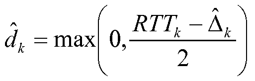
- the mobile station 108 If the mobile station 108 knows the WAP 311k processing time ⁇ , it can then estimate the propagation time to the WAP 31 Ik as (RTT- ⁇ )/2, which will correspond to the distance (d k ) between the mobile station 108 and the WAP 311k. However, since the mobile station 108 typically has no knowledge of the WAP 311k processing time, the mobile station 108 should obtain an accurate estimate of the processing time ⁇ before it can estimate the distance to the WAP 311k. Various techniques presented below will describe embodiments where the mobile station 108 processes the collected RSSI and RTT measurements to three or more WAPs 311 to accurately estimate the WAPs 311 processing times to allow the determination of the mobile station's position in space.
- the wireless device 108 does not need to associate with any of the WAPs 311. Since a directed access probe is considered a unicast packet, the WAP will typically ACK a successful decoding of an access probe packet after a prescribed period of time. The ability to do this ranging without having to associate with the WAPs 311 may greatly reduce the extra overhead involved.
- the round-trip time between the mobile station 108 and WAP k may be analyzed in a ranging model as follows:
- RTT k 2d k + A k + A MS + n k where: d k is the actual distance between the mobile station 108 and WAP 31 Ik (ft).
- a k is the hardware processing time of the k ⁇ WAP (ns).
- a MS is the hardware processing time at the mobile station 108 (ns). Here may be assumed that the processing delay can be calibrated out the by the mobile station 108.
- n k n z k + ⁇ MS k + n AP k ⁇ > which is the error in the RTT measurement (ns). This error is the sum of the errors due to unknown WAP height, mobile station timing errors, and WAP timing errors. [0070]
- the overall noise n k may be the sum of the WAP height, mobile station timing, and WAP timing errors listed above. After combining all these errors, the resulting probability density function may be very close to Gaussian. Thus, the noise may be modeled as Gaussian with the distance-dependent mean and standard deviation.
- the distance between each WAP 311 and the mobile station 108 may also be estimated using information in addition to RTT for obtaining an estimate of the processing times explained above.
- This information is generally referred to herein as supplemental information.
- One form of supplemental information may take the form of the measured signal strength (RSSI) associated with the ACK packets received from each WAP 311.
- RSSI measured signal strength
- FIG. 5 is a graph illustrating an exemplary relationship of RSSI and the distance between a mobile station and a wireless access point.
- the mobile station 108 may utilize an approximate ranging model of distance, and variance of the distance, as a function of the received signal strength (RSSI).
- RSSI received signal strength
- This model may be used when the mobile station 108 is initially trying to learn the WAP processing delays.
- the RSSI model can be extremely simple, without the need for extensive pre-deployment fingerprinting.
- the model may assume that the only RSSI information known to the mobile station is the approximate maximum distance d max , in feet, as a function of RSSI in dBm. Based on initial propagation simulations for an indoor environment with WAPs having a maximum range of 225 feet, this function is provided below in Eq. 2, which is graphed in FIG. 5.
- the mobile station 108 may convert any measured RSSI to a distance estimate that may be modeled as normally distributed with the following relationships in Eqs. 3 and 4: . _ ⁇ m , t RSSI i
- the mobile station could also model the minimum distance as a function of signal strength.
- the minimum distance for 2-D positioning, it is possible that a mobile station is close to a WAP in the X-Y plane (the distance utilized for positioning purposes), but sees arbitrary signal strength because of distance and obstacles in the Z-dimension.
- the simple RSSI model takes the minimum distance vs. signal strength as 0 ft for all RSSI.
- the mobile device 108 may estimate distances to three or more wireless access points using the two or more ranging models. Each wireless access point has positions which are known to the mobile device by providing the network geometry information using techniques mentioned above. Using these distance estimates and the location of the wireless access points 311, the mobile station 108 can determine its position using known positioning techniques.
- the mobile station 108 has the WAP 311 positions in a local or global coordinate system (which may be obtained using methods described above).
- the mobile station 108 is within radio range of at least three non co-linear WAPs 311 for two-dimensional positioning.
- Each WAP 311 may have a different processing time delay.
- the mobile station 108 may be able to make a nanosecond scale measurement of RTT. This may require changes to the current mobile station 108 chipsets in the wireless transceivers 204 and/or 206.
- the mobile station 108 has an approximate model of distance as a function of RSSI.
- a complete set of RSSI and RTT measurements can be completed fast enough such that the mobile station 108 can be considered stationary while the measurements are taken; and 8.
- the mobile station 108 has a method of determining when it has moved to a new location based on significant changes in RSSI, RTT, elapsed time since the last set of measurements, and/or additional sensor data (such as for example, motion sensor 212).
- FIG. 6 is a flowchart showing an exemplary method 600 for combining ranging models to improve the position determination of the mobile station 108.
- the method may be performed at the mobile station 108 on processor 210 using various modules and data stored in memory 214.
- the parameters/models may include:
- An identifier for the network associated with the WAP e.g., an SSID.
- An identifier associated with the WAP hardware e.g., a MACID.
- a model of distance vs. signal strength (RSSI).
- RSSI signal strength
- parameters 1-3 above may be obtained from annotations from a map, as described above.
- parameters 2 and 3 may be learned by the mobile station 108 by listening to beacons that may be provided by the WAPs 311 (e.g., for a WiFi network, mobile station 108 may determine the SSID and the MACID from standard beacon signals).
- Parameter 4 above may be an a priori coarse initial estimate based upon WAP specifications, and/or a more refined value learned previously by the mobile station 108.
- the initial processing time read from the parameter database 224 may have been provided from the server 110, which may have been previously learned by mobile station 108, or by another mobile station.
- WAP 311 A k may be the turnaround time for sending a response to a unicast packet.
- this processing time may correspond to a delay known as the short interframe space (SIFS) and typically lies within 16000 ⁇ 900 ns for a 20 MHz channel.
- SIFS short interframe space
- a k be the actual, unknown processing delay for WAP 311k
- a k be the mobile station best estimate of the processing delay.
- the mobile device can obtain the initial processing delays for a WAP 311k by using its hardware identifier (e.g., a MACID) in a local cache that can be stored in parameter database 224, or an external database to obtain an estimate of the processing time.
- a hardware identifier e.g., a MACID
- some embodiments may use a model of distance vs. RSSI for each WAP 311 that can map each signal strength measurement RSSIk to a distance that may be normally distributed with mean d RSSI k and variance ⁇ 1 , , . If no model is available, the mobile device can use a default model (such as, for example, the model described above in Eq. 2).
- the mobile station 108 may measure round trip time (RTT) to each WAP 311 (B610).
- RTT round trip time
- the mobile station 108 either using the wide area network transceiver 204, the local area network transceiver 206, or a combination of the two, may send a directed probe request using the each WAP 311 based upon the hardware identifier (e.g., MACID for WAP 311k).
- the mobile station can perform RTT ranging measurements without associating with the WAPs 311.
- WAPs for RTT measurements which are locked down using some form of wireless encryption (e.g., WEP, WAP, RADIUS, etc.) and require a pass- code for access.
- some form of wireless encryption e.g., WEP, WAP, RADIUS, etc.
- embodiments are not limited to probe request packets, and other types of packets may be used.
- each RTT measurement for WAP 311k may be given by
- RTT k 2d k + A k + n k
- d k is the actual distance (ft) between the mobile station 108 and the WAP 31 Ik
- a k is the actual processing time (ns) for WAP 311k
- n k is Gaussian noise having a mean and variance depending on distance d k .
- the units for distance and time are feet and nano-seconds, respectively, so the speed of light propagation may be estimated as ⁇ lft/ns. This approximation may be useful as it may obviate multiplication operations when converting between distance and time, thus saving processing time and power consumption.
- the distance between the mobile station and each WAP 31 Ik may be estimated (B615).
- the actual processing time delay A k for each WAP 311k may be previously determined using manufacturer specifications and/or calibration techniques, and subsequently stored in parameter database 224 for used by the mobile station 108.
- a supplemental distance to each WAP may be estimated using another approach(es) which may not rely on the RTT of the signal, but rather some other supplemental information (B620).
- the supplemental distance is the same distance (d k ) as discussed above, but it is estimated using techniques other than RTT.
- the supplemental information may exploit one or more alternative properties of the signals exchanged between the mobile station 108 and the WAPs 311, such as, for example, amplitude and/or phase.
- the supplemental information may a previously determined position. As discussed above, and presented in more detail below in the description of FIG. 7, amplitude (e.g., RSSI) may be used to estimate the supplemental distance.
- amplitude e.g., RSSI
- sensors may provide supplemental information that may be useful.
- accelerometers or other forms of networked position determination may help estimate distances between the WAPs and mobile station 108.
- SPS signals may be weak and/or intermittent in some of the operating environments of method 600, there may be, in some environments, adequate SPS signal strength which may be sufficient for determining supplemental distances between the mobile station 108 and the WAPs 311.
- a mobile station with a set of valid ephemerides may be able to detect when it is indoors vs. outdoors based on its ability to detect satellites. This can help eliminate conditions when a portion of the initial bounded space is outside. If the system has provided WGS 84 coordinates for the WAPs or a WGS 84 landmark on a map, the mobile station 108 may also be able to use its last-known position from SPS to limit its current position.
- the mobile station 108 may have motion sensor-based information (from motion sensor 212) which may relate its current position to a previously established position. If, for example, a mobile station includes an accelerometer, it may know that it has experienced at most 4 meters of movement from a previously established position It can use that data to limit the range of locations at which it may currently be. A triaxial accelerometer and altimeter might also be combined to determine movement along the Z axis.
- the distance estimates may be processed to generate a combined distance estimate to each WAP (B625).
- This processing may include any type of statistical and/or deterministic approaches, including kalman filters, fading memory filters, minimal mean square error (MMSE) techniques, etc.
- the mobile station 108 may determine its position using conventional trilateration methods based upon the combined distances and the network geometry (B630).
- FIG. 7 is flowchart of another embodiment 700 providing an alternative approach to the process blocks 615-625 illustrated in FIG. 6.
- the supplemental distances are based upon the measured signal strength RSSI associated with the ACK responses provided by the WAPs 311.
- the RSSI measurements for each WAP may be mapped to distances using the models described above. These RSSI-based distances may be used in conjunction with RTT-based distances to determine position of the mobile station 108, and to calibrate the processing times of the WAPs 311.
- the distance to each WAP 311k is determined based upon the RSSI (B715).
- the measured RSSIk values (for each WAP) may be the average of the RTT ranging packets measured from each WAP 311k.
- RSSI k i me distance from mobile station 108 to WAP 31 Ik.
- ⁇ lssi ,k is me variance the distance d RSSI k based upon RSSIk.
- f d (RSSl ⁇ ) is a mathematical model relating distance and RSSI.
- / 2 (RSSI k ) is a mathematical model relating variance and RSSI.
- °l ,k ⁇ l ,k (d RSSI ⁇ + 2 ⁇ dRss] ⁇ ) where ⁇ n k is an estimate of the mean of the RTT noise.
- &l k is an estimate of the variance of the RTT noise.
- ⁇ n k (d RSSI k ) is a mathematical model of the mean RTT noise as a function of distance to WAP 3 I lk.
- ⁇ l k (d R ssi k + 2cr d k ) is a mathematical model of the variance of the RTT noise as a function of distance to the WAP 311k, where the mobile device adds 2 ⁇ d ,RSSl > k . to take a more conservative estimate of the RTT noise variance.
- the mobile device 108 may then determine the distance to each WAP 311k based upon the measured RTT (B720), and may also determine the variance of the distance based on the measured RTT using the following equations.
- d RTT k is the RTT-based distance to each WAP 311k.
- RTTk is the averaged RTT time over m k measurements for WAP 311k.
- a k is the estimated processing time for WAP 311k ⁇ ] k is the variance of d RTT k .
- ⁇ ? k is the variance of A k
- &l k is an estimate of the variance of RTT noise.
- m k is the number RTT measurements associated with WAP 311k.
- the mobile station 108 may truncate d RTT k if necessary to fall between 0 and the maximum WAP 311 range.
- the mobile station 108 may determine a combined distance estimate to each WAP 31 Ik (B723).
- the combined distance estimate may be performed using a weighted combination of the RTT-based distance d RTT k and the RSSI-based distance d RSSI k for each WAP 31 Ik to determine a distance estimate d est k .
- This distance estimate may be determined by using a Minimum Mean Square Error (MMSE) estimator based on the following equation:
- the above equations may assume that the RSSI and RTT noise can be modeled as uncorrelated and Gaussian.
- the above distance estimator may rely on RSSI when ⁇ d 2 k is large, either from uncertainty in the processing time or very noisy RTT measurements. However, once the processing time is known (e.g., low ⁇ ? ) the above MMSE estimator may put more weight on the RTT measurements.
- the method may then proceed to Block 725, where the position of the mobile device 108 may be determined using known trilateration techniques. In other embodiments, triangulation or other positioning algorithms may be used. The distances with lower variance ⁇ d 2 k may be given more weight in the algorithm.
- the trilateration algorithm may also utilize past localization data to perform trajectory smoothing using, for example, Kalman filtering.
- various embodiments of the invention provide for updating the ranging models to improve their accuracy in an adaptive manner.
- the processing times A k associated with each WAP 31 Ik used in the RTT ranging model may be updated using an iterative approach.
- these processing times A k can be refined through a "learning" process to arrive at better values.
- the RSSI ranging models may be adjusted using an adaptive process to improve their fidelity. Different aspects of the models may be continuously monitored and updated if it is determined that the model should be improved.
- FIG. 8 shows a flowchart illustrating an exemplary method 800 for adaptively improving a wireless signal model.
- the mobile station 108 may measure the distance to each WAP 311k using a wireless signal model (B815). While only one model is discussed here for ease of explanation, other embodiments may use a plurality of wireless signal models.
- a position of the mobile station 108 may then be calculated using conventional localization (e.g., trilateration) techniques (B820). Once the mobile station 108 position has been estimated, mobile station 108 may compute the distance between the estimated position and each WAP 311k. Using the computed distances determined in B825 and the measured distances determined in B815, mobile station 108 may update the wireless signal model to improve its fidelity.
- the RTT ranging model may be improved by updated the processing time A k associated with each WAP 311k.
- coefficients associated with the RSSI ranging model may be updated, as will also be described in more detail below.
- a test may be performed to determine if the model has converged (B835). This test may be a simple threshold of a parameter of interest in the model, or may be a more sophisticated metric based on statistical measurements. Once the model has converged, any further iterations may only bring marginal improvements to the model and are thus may not be worth performing. If no further convergence is observed in B835, then subsequent position determinations may be performed using the updated wireless model (B840).
- the mobile station 108 may update the estimated processing times A k for each WAP 311k based upon the position.
- the mobile station 108 After performing the position determination in B820 (e.g., trilateration), the mobile station 108 has the option of updating a local (e.g., parameter database 224) or remote database with information about the processing times A k , observed WAPs 311k (e.g., based upon MACID).
- a local e.g., parameter database 224
- remote database e.g., a local database 224 or remote database with information about the processing times A k , observed WAPs 311k (e.g., based upon MACID).
- Embodiments allow the localization system to learn and adapt over time by varying each A k , without requiring a substantial up-front deployment cost.
- the mobile station 108 may calculate the distance ⁇ sW between the estimated position and WAP 31 Ik .
- the average round-trip time RTT k and the post-trilateration distance d tr i ,k may be related via the following matrix equation:
- a k is the exact processing time delay for WAP 311£
- dt is the exact distance to WAP 3 ⁇ ⁇ k
- n k is the average noise in the RTT measurements
- ⁇ k is the post-trilateration error.
- ⁇ ] k A reasonable heuristic may be to take the average variance of the pre -trilateration distances, modeled using the following equation, as trilateration may have an averaging effect on the positioning error:
- the mobile station 108 can model all variables on the right side of the above matrix equation as being uncorrelated and normally distributed as described below.
- the mobile station 108 can then form an updated estimate of the processing time delays using minimum mean square error (MMSE) techniques as shown using the equations below:
- MMSE minimum mean square error
- the new processing time A k new may be a weighted sum of the current
- processing time A k and a measured processing time A k measured that may be derived from the RTT measurements, the RSSI distances, and the post-trilateration distances.
- the weights may depend on the estimated variance of the processing time. During the early stages of learning, typically ⁇ ? k new « ⁇
- the wireless signal model may be based upon an RSSI ranging model.
- FIG. 9 is a graph of exemplary ranging models used to determine the distance between a mobile station and a wireless access point based upon RSSI.
- the mobile station 108 may "listen" for signals transmitted by each WAP 311k, where the signals may be in the form of beacons. The signal strength of each transmission may be converted to a distance using a model that may be based on the deployment environment, such as, for example, an office building or shopping mall.
- the exemplary plot of RSSI vs. distance is representative of an indoor environment, with upper and lower bounds being shown. These bounds may be based upon the variance of the RSSI.
- the model may be based on propagation models based upon a map of the WAP deployment.
- the models may be used to convert signal strength to a distance for each WAP
- An initial distance estimate may be determined by the midpoint of the min/max range from the RSSI, although more sophisticated approaches may be used. Trilateration may be performed using the initial distance estimates to roughly approximate the position of the mobile station 108.
- the variance of the RSSI measurements may be used to weight distance estimates based upon confidence prior to trilateration (e.g., low variance distance estimates may be weighted higher than high variance estimates).
- multiple measurements may be performed to each WAP 311 in a short time interval to reduce noise via averaging, filtering, and/or other processing.
- various model(s) may provide an average distance, and a variance in this distance, as a function of RSSI.
- Advantages of using such a model may include: avoiding time-consuming fingerprinting of the environment of interest; generating no additional wireless traffic to determine the estimates; and utilizing standard wireless protocols (e.g., 802.11 a/b/g/n, etc.) without having to alter them.
- standard wireless protocols e.g., 802.11 a/b/g/n, etc.
- FIG. 10 illustrates a diagram of an exemplary indoor environment 1000 which may be modeled to improve distance estimates between wireless access points and a mobile station based upon RSSI.
- the mobile station 108 may be able to exchange wireless signals with a plurality of Local Area Network Wireless Access Points (LAN-WAPs) 1006.
- LAN-WAPs Local Area Network Wireless Access Points
- Some LAN-WAPs, for example, 1006a, 1006c, and 1006e may be within direct line of sight with the mobile station 108.
- One may expect, in the absence of other forms of electronic interference, that the signals received from LAN-WAPs 1006a 1006c, and 1006e would be relatively strong.
- LAN-WAPs for example 1006b and 1006d, may reside in different rooms, and may have the signals attenuated by building obstructions such as walls.
- the attenuation of signals exchanged with LAN-WAPs 1006b and 1006e may vary depending upon the material used in the construction of the walls.
- RSSI models relating distance and signal strength may be generated based upon the indoor environment 1000. Such models may include the geometry of each LAN-WAP in relation to the mobile device 108, and/or geometry of each LAN-WAP in relation to the obstructions within the environment. Furthermore, such models may also include other factors affecting the signal, such as, for example, the material of the obstructions to module their attenuation effects (e.g. metal walls versus drywall), the radiation patterns of the LAN-WAP antennas, interfering signals from undesired sources (e.g., other WAPs external to the LAN), the make and model of each individual LAN-WAP 1006, etc.
- the mobile station may already be receiving the LAN-
- WAP network geometry through a particular channel.
- Such as channel may be used to provide information about the local conditions which may be presumed to exist.
- the channel may be used to provide a ray-tracing based model of the local conditions which would improve on the fidelity of the base RSSI model.
- This model might be provided in the forms as detailed as the ray-tracing of the venue or as simple as a reference to a known set of general models (e.g. "auditorium", "cube farm", “high-rise office”).
- a full map of the environment may be provided, and the mobile station 108 may also produce its own ray-tracing model, and/or perform pattern- matching to pick a more appropriate RSSI model.
- the RSSI model may be dynamic in nature, and thus can be refined in an iterative manner over time as the mobile station 108 moves throughout the environment 1000.
- the mobile station 108 may initially start with a simple model of how the RSSI behaves with distance (for example, as described above in FIG. 5 and FIG. 9), using a ray-tracing model generated from a map of the environment, and/or from a generic model such as office, warehouse, mall, etc.
- the mobile station 108 may then move around the environment, localizing itself using the positioning algorithm described in above. Deviations from the model may be compared, and the model updated, based upon the computed position of the mobile station 108.
- FIG. 11 is a flowchart showing another exemplary process 1100 for which uses both RTT and RSSI ranging modules for determining the position of a mobile station and adaptively improving the RTT model.
- the mobile station may determine an initial estimation of the
- the mobile station 108 may calculate its position using a trilateration algorithm, where typically at least three WAPs 311 are visible in two-dimensional space.
- the mobile station may perform updates to prior estimates of the WAP 311 processing times by comparing its most recent calculated position with prior position solutions. Using the updated position calculations and additional RTT measurements, the mobile station 108 may continue refining the processing time estimate as more measurements are taken. The details of this process are presented below.
- Process 1100 may start out by having the mobile device 108 initialize various parameters associated with each WAP 311k (Bl 105). This process may be similar to the initialization described in B605. The mobile station 108 may then perform RTT measurements to each WAP 311k (Bl I lO). As before, the model for RTT may be provided as:
- RTT k 2d k + A k + n k , where d k is the actual distance (ft) between the mobile station 108 and the WAP 31 Ik;
- a k is the actual processing time (ns) for WAP 311k; and n k is uniform noise having a mean and variance depending on distance d k .
- the foregoing method may estimate the processing time A k for each WAP 31 Ik.
- this model differs from model used in the aforementioned process 800 described above in 3.1, in that the noise n k may be modeled here using a uniform distribution, whereas in process 800 a Gaussian distribution may be used.
- the noise n k may be mitigated by averaging several measurements taken in the same location. This assumption may be reasonable if the mobile station 108 is stationary or moving at low speed.
- the speed of light propagation may be estimated as ⁇ lft/ns.
- the mobile station may determine an initial estimate of each WAP 311k processing time A k based upon signal strength measurements
- the mobile station 108 can bracket the distance d k a
- WAP 311k to be in an interval between a maximum range (R k mm ) and a minimum range (R k mm ), as represented by the equation below.
- the initial estimate of processing time A k ⁇ mt may be approximated as the midpoint of the above interval for each WAP 311k:
- the process 1100 may next calculate the position of the mobile station based on the measured RTTs and then WAP processing time estimates (Bl 120). To determine position, the mobile station 108 may convert the RTT measurements associated with each WAP 311k to an estimated distance d k . The estimated distance to each WAP 311k may be determined using the following equation.
- the mobile station 108 may calculate its position (x,y) using trilateration. Typically, the error in the calculated position (x,y) is less that the error associated with each estimated distance.
- the process may then update the distance to each WAP 311 then determine a new processing time for each WAP based upon the new distance (Bl 125).
- the mobile station 108 may update the processing time estimate A k ' using the following equation, when each WAP 31 Ik has a different processing time.
- k k R ⁇ k -id[
- each WAP 311k has substantially the same processing time, the following equation may be used to update the processing time estimate.
- A' mean(RTT k - 2d k ')
- a test may be performed to determine if further iterations should be made to further refine the processing time estimates.
- the WAP 311 processing estimates may be tested to determine if they have converged (Bl 135).
- a test may be performed on the distances to each WAP, or a mathematical functions thereof (e.g., mean distances), to determine whether further refinements to the processing time should be performed. If further iterations are useful, the process 1100 may loop back to Block 1140, where the round trip time to each WAP 31 Ik is measured again.
- multiple measurements may be performed, and may be mathematically combined with prior measurements (e.g., averaging, FIR/IIR filtering, etc.), to mitigate the effects of noise.
- the new RTT measurements may then be used in a reiteration of Blocks 1120 through 1125 to refine the processing time estimate A' k associated with each WAP 31 Ik.
- the process 1100 may then monitor the position of the mobile station 108 to determine whether its position has changed (Bl 141). If so, the mobile station 108 may repeat the process 1100 starting looping back to Block 1110. In this case, if new WAPs are discovered, the initial processing times may be computed as described above in Block 1115. However, for WAPs that are in still in range which already have had refined processing times determined (assuming that they are different), the refined times for these WAPs may be used to improve the efficiency of the process 1100. If it is determined in Block 1141 that the position of the mobile station 108 has not changed, the mobile station may monitor its position to detect changes in position (Bl 142).
- determining whether the mobile station 108 has changed position in Block 1141 may be accomplished using the motion sensor 212, or some other form of position determination (e.g., AFLT, GPS, etc.) In these embodiments, the motion state of the mobile device may be monitored, and once motion is detected, the process resumes as described above.
- position determination e.g., AFLT, GPS, etc.
- the mobile station may not have a motion sensor
- the mobile station may monitor its position in Block 1142 by continuing to measure RTT to each WAP 311k using the updated processing times (Bl 145), and then determining its position (Bl 150) based upon the updated WAP processing time as described above.
- the methodologies described herein may be implemented by various means depending upon the application. For example, these methodologies may be implemented in hardware, firmware, software, or any combination thereof.
- the processing units may be implemented within one or more application specific integrated circuits (ASICs), digital signal processors (DSPs), digital signal processing devices (DSPDs), programmable logic devices (PLDs), field programmable gate arrays (FPGAs), processors, controllers, micro-controllers, microprocessors, electronic devices, other electronic units designed to perform the functions described herein, or a combination thereof.
- ASICs application specific integrated circuits
- DSPs digital signal processors
- DSPDs digital signal processing devices
- PLDs programmable logic devices
- FPGAs field programmable gate arrays
- processors controllers, micro-controllers, microprocessors, electronic devices, other electronic units designed to perform the functions described herein, or a combination thereof.
- the methodologies may be implemented with modules (e.g., procedures, functions, and so on) that perform the functions described herein.
- Any machine-readable medium tangibly embodying instructions may be used in implementing the methodologies described herein.
- software codes may be stored in a memory and executed by a processor unit.
- Memory may be implemented within the processor unit or external to the processor unit.
- memory refers to any type of long term, short term, volatile, nonvolatile, or other memory and is not to be limited to any particular type of memory or number of memories, or type of media upon which memory is stored.
- the functions may be stored as one or more instructions or code on a computer-readable medium. Examples include computer-readable media encoded with a data structure and computer-readable media encoded with a computer program. Computer-readable media includes physical computer storage media. A storage medium may be any available medium that can be accessed by a computer.
- such computer- readable media can comprise RAM, ROM, EEPROM, CD-ROM or other optical disk storage, magnetic disk storage or other magnetic storage devices, or any other medium that can be used to store desired program code in the form of instructions or data structures and that can be accessed by a computer; disk and disc, as used herein, includes compact disc (CD), laser disc, optical disc, digital versatile disc (DVD), floppy disk and blu-ray disc where disks usually reproduce data magnetically, while discs reproduce data optically with lasers. Combinations of the above should also be included within the scope of computer-readable media.
- instructions and/or data may be provided as signals on transmission media included in a communication apparatus.
- a communication apparatus may include a transceiver having signals indicative of instructions and data.
- the instructions and data are configured to cause one or more processors to implement the functions outlined in the claims. That is, the communication apparatus includes transmission media with signals indicative of information to perform disclosed functions. At a first time, the transmission media included in the communication apparatus may include a first portion of the information to perform the disclosed functions, while at a second time the transmission media included in the communication apparatus may include a second portion of the information to perform the disclosed functions.
Abstract
Description


Claims
Priority Applications (7)
| Application Number | Priority Date | Filing Date | Title |
|---|---|---|---|
| BRPI0921415A BRPI0921415A2 (en) | 2008-11-21 | 2009-11-20 | wireless position determination using adjusted round-trip time measurements |
| CN200980146844.4A CN102265174B (en) | 2008-11-21 | 2009-11-20 | The wireless position of the measurement of round trip time through adjustment is used to determine |
| KR1020117014248A KR101340788B1 (en) | 2008-11-21 | 2009-11-20 | Wireless position determination using adjusted round trip time measurements |
| KR1020127025649A KR101312896B1 (en) | 2008-11-21 | 2009-11-20 | Wireless position determination using adjusted round trip time measurements |
| JP2011537651A JP2012509483A (en) | 2008-11-21 | 2009-11-20 | Radio positioning using coordinated round trip time measurements |
| EP09760407A EP2368131B1 (en) | 2008-11-21 | 2009-11-20 | Wireless position determination using adjusted round trip time measurements |
| EP14020043.7A EP2746802B1 (en) | 2008-11-21 | 2009-11-20 | Wireless position determination using adjusted round trip time measurements |
Applications Claiming Priority (6)
| Application Number | Priority Date | Filing Date | Title |
|---|---|---|---|
| US11699608P | 2008-11-21 | 2008-11-21 | |
| US11705508P | 2008-11-21 | 2008-11-21 | |
| US61/117,055 | 2008-11-21 | ||
| US61/116,996 | 2008-11-21 | ||
| US12/622,289 US20100135178A1 (en) | 2008-11-21 | 2009-11-19 | Wireless position determination using adjusted round trip time measurements |
| US12/622,289 | 2009-11-19 |
Publications (2)
| Publication Number | Publication Date |
|---|---|
| WO2010059934A2 true WO2010059934A2 (en) | 2010-05-27 |
| WO2010059934A3 WO2010059934A3 (en) | 2010-08-12 |
Family
ID=42077331
Family Applications (1)
| Application Number | Title | Priority Date | Filing Date |
|---|---|---|---|
| PCT/US2009/065319 WO2010059934A2 (en) | 2008-11-21 | 2009-11-20 | Wireless position determination using adjusted round trip time measurements |
Country Status (9)
| Country | Link |
|---|---|
| US (3) | US20100135178A1 (en) |
| EP (5) | EP2746802B1 (en) |
| JP (3) | JP2012509483A (en) |
| KR (2) | KR101312896B1 (en) |
| CN (1) | CN102265174B (en) |
| BR (1) | BRPI0921415A2 (en) |
| ES (1) | ES2511190T3 (en) |
| TW (2) | TW201037344A (en) |
| WO (1) | WO2010059934A2 (en) |
Cited By (47)
| Publication number | Priority date | Publication date | Assignee | Title |
|---|---|---|---|---|
| WO2011006998A1 (en) * | 2009-07-17 | 2011-01-20 | Siemens Aktiengesellschaft | Method for calibrating a propagation-time-based localization system |
| WO2011137396A1 (en) * | 2010-04-30 | 2011-11-03 | Qualcomm Incorporated | Device for round trip time measurements |
| US20120269080A1 (en) * | 2011-04-25 | 2012-10-25 | Domenico Giustiniano | Carrier sense-based ranging |
| WO2012158229A1 (en) * | 2011-05-19 | 2012-11-22 | Qualcomm Incorporated | Measurements and information gathering in a wireless network environment |
| WO2012158463A1 (en) * | 2011-05-17 | 2012-11-22 | Qualcomm Atheros, Inc. | Wi-fi access point characteristics database |
| CN102811482A (en) * | 2011-06-03 | 2012-12-05 | 苹果公司 | Mobile device location estimation |
| CN103024896A (en) * | 2011-09-23 | 2013-04-03 | 李志海 | System, method and device for wireless location |
| CN103068038A (en) * | 2012-12-14 | 2013-04-24 | 南昌大学 | Indoor bidirectional positioning method based on Zigbee network |
| JP2013536632A (en) * | 2010-07-30 | 2013-09-19 | クゥアルコム・インコーポレイテッド | Multiple devices and methods for mobile station center determination of positioning assistance data |
| CN103379619A (en) * | 2012-04-16 | 2013-10-30 | 中兴通讯股份有限公司 | Method and system for positioning |
| US8639640B1 (en) | 2011-06-10 | 2014-01-28 | Google Inc. | Prediction of indoor location using decision trees |
| CN103592622A (en) * | 2012-08-13 | 2014-02-19 | 贝思文 | A signal positioning system and a positioning method thereof |
| WO2014109996A1 (en) * | 2013-01-10 | 2014-07-17 | Qualcomm Incorporated | Method and/or system for obtaining signatures for use in navigation |
| WO2014100585A3 (en) * | 2012-12-21 | 2014-08-14 | Qualcomm Incorporated | Pairwise measurements for improved position determination |
| US8818401B2 (en) | 2010-07-30 | 2014-08-26 | Qualcomm Incorporated | Methods and apparatuses for use in determining that a mobile station is at one or more particular indoor regions |
| US20140269400A1 (en) * | 2013-03-14 | 2014-09-18 | Qualcomm Incorporated | Broadcasting short interframe space information for location purposes |
| EP2786167A1 (en) * | 2011-11-30 | 2014-10-08 | General Electric Company | Position estimation system and method |
| WO2014163968A1 (en) * | 2013-03-12 | 2014-10-09 | Qualcomm Incorporated | Method for securely delivering indoor positioning data and applications |
| US8892127B2 (en) | 2008-11-21 | 2014-11-18 | Qualcomm Incorporated | Wireless-based positioning adjustments using a motion sensor |
| US8892118B2 (en) | 2010-07-23 | 2014-11-18 | Qualcomm Incorporated | Methods and apparatuses for use in providing position assistance data to mobile stations |
| WO2015026869A1 (en) * | 2013-08-21 | 2015-02-26 | Qualcomm Incorporated | System and method for selecting a wi-fi access point for position determination |
| WO2014210049A3 (en) * | 2013-06-26 | 2015-02-26 | Qualcomm Incorporated | Utilizing motion detection in estimating variability of positioning related metrics |
| JP2015507172A (en) * | 2011-11-10 | 2015-03-05 | アルカテル−ルーセント | Distance estimation |
| US9125153B2 (en) | 2008-11-25 | 2015-09-01 | Qualcomm Incorporated | Method and apparatus for two-way ranging |
| EP2929370A2 (en) * | 2013-01-14 | 2015-10-14 | Microsoft Technology Licensing, LLC | Location determination for emergency services in wireless networks |
| WO2015171259A1 (en) * | 2014-05-08 | 2015-11-12 | Qualcomm Incorporated | Range rate based stopped detection |
| US9241353B2 (en) | 2013-07-26 | 2016-01-19 | Qualcomm Incorporated | Communications between a mobile device and an access point device |
| JP2016515785A (en) * | 2013-04-15 | 2016-05-30 | クゥアルコム・インコーポレイテッドQualcomm Incorporated | Control of transmission characteristics for positioning |
| CN105828297A (en) * | 2016-03-14 | 2016-08-03 | 南京理工大学 | Distance-correction-multiplicative-factor-based indoor positioning method |
| US9426770B2 (en) | 2013-09-30 | 2016-08-23 | Qualcomm Incorporated | Access point selection for network-based positioning |
| JP2016537642A (en) * | 2013-09-09 | 2016-12-01 | クゥアルコム・インコーポレイテッドQualcomm Incorporated | Method and apparatus for improving the quality of positioning |
| US9645225B2 (en) | 2008-11-21 | 2017-05-09 | Qualcomm Incorporated | Network-centric determination of node processing delay |
| US9661603B2 (en) | 2013-08-30 | 2017-05-23 | Qualcomm Incorporated | Passive positioning utilizing beacon neighbor reports |
| CN106707232A (en) * | 2016-12-20 | 2017-05-24 | 南京工业大学 | WLAN propagation model positioning method based on crowd sensing |
| CN106993027A (en) * | 2017-03-15 | 2017-07-28 | 西安电子科技大学 | Remote data storage position verification method |
| EP3333588A1 (en) * | 2015-05-13 | 2018-06-13 | Combain Mobile AB | Generating a model for positioning |
| US10064154B2 (en) | 2013-03-06 | 2018-08-28 | Intel Corporation | System and method for channel information exchange for time of flight range determination |
| EP3477327A1 (en) * | 2017-10-26 | 2019-05-01 | Vestel Elektronik Sanayi ve Ticaret A.S. | Mobile communication device and method for operating a mobile communication device |
| US10539586B2 (en) | 2011-09-16 | 2020-01-21 | Qualcomm Incorporated | Techniques for determination of a motion state of a mobile device |
| US10609670B2 (en) | 2018-03-21 | 2020-03-31 | Combain Mobile AB | Method and system for locating a position of a movable device |
| US10616710B2 (en) | 2016-04-15 | 2020-04-07 | Denso Corporation | System and method for establishing real-time location |
| US10690762B2 (en) | 2015-05-29 | 2020-06-23 | Qualcomm Incorporated | Systems and methods for determining an upper bound on the distance between devices |
| US10863452B2 (en) | 2018-12-12 | 2020-12-08 | Rohde & Schwarz Gmbh & Co. Kg | Method and radio for setting the transmission power of a radio transmission |
| DE102019217646A1 (en) * | 2019-11-15 | 2021-05-20 | Robert Bosch Gmbh | WiFi-supported localization of vehicles |
| CN113824829A (en) * | 2020-06-19 | 2021-12-21 | 励智识别技术有限公司 | Electronic device |
| WO2022010340A1 (en) * | 2020-07-08 | 2022-01-13 | Mimos Berhad | A system and method for providing an indoor positioning tracking |
| EP4300910A1 (en) * | 2022-06-30 | 2024-01-03 | Juniper Networks, Inc. | Orchestration of round-trip time measurements |
Families Citing this family (274)
| Publication number | Priority date | Publication date | Assignee | Title |
|---|---|---|---|---|
| US7401105B2 (en) | 2003-10-02 | 2008-07-15 | International Business Machines Corporation | Method, system, and program product for retrieving file processing software |
| US7853250B2 (en) | 2003-04-03 | 2010-12-14 | Network Security Technologies, Inc. | Wireless intrusion detection system and method |
| US8451763B2 (en) | 2006-12-07 | 2013-05-28 | Digimarc Corporation | Wireless local area network-based position locating systems and methods |
| WO2008073347A1 (en) | 2006-12-07 | 2008-06-19 | Venture Ad Astra, Llc | Space-time calibration system and method |
| US8892112B2 (en) | 2011-07-21 | 2014-11-18 | At&T Mobility Ii Llc | Selection of a radio access bearer resource based on radio access bearer resource historical information |
| US20100135178A1 (en) * | 2008-11-21 | 2010-06-03 | Qualcomm Incorporated | Wireless position determination using adjusted round trip time measurements |
| US20100130230A1 (en) * | 2008-11-21 | 2010-05-27 | Qualcomm Incorporated | Beacon sectoring for position determination |
| US8938211B2 (en) | 2008-12-22 | 2015-01-20 | Qualcomm Incorporated | Providing and utilizing maps in location determination based on RSSI and RTT data |
| US20100157848A1 (en) * | 2008-12-22 | 2010-06-24 | Qualcomm Incorporated | Method and apparatus for providing and utilizing local maps and annotations in location determination |
| US8768344B2 (en) * | 2008-12-22 | 2014-07-01 | Qualcomm Incorporated | Post-deployment calibration for wireless position determination |
| US8750267B2 (en) * | 2009-01-05 | 2014-06-10 | Qualcomm Incorporated | Detection of falsified wireless access points |
| US8326319B2 (en) | 2009-01-23 | 2012-12-04 | At&T Mobility Ii Llc | Compensation of propagation delays of wireless signals |
| US8938355B2 (en) * | 2009-03-13 | 2015-01-20 | Qualcomm Incorporated | Human assisted techniques for providing local maps and location-specific annotated data |
| WO2010106530A2 (en) * | 2009-03-19 | 2010-09-23 | Cork Institute Of Technology | A location and tracking system |
| US9590733B2 (en) | 2009-07-24 | 2017-03-07 | Corning Optical Communications LLC | Location tracking using fiber optic array cables and related systems and methods |
| US9151821B2 (en) * | 2009-07-24 | 2015-10-06 | Qualcomm Incorporated | Watermarking antenna beams for position determination |
| US8233457B1 (en) * | 2009-09-03 | 2012-07-31 | Qualcomm Atheros, Inc. | Synchronization-free station locator in wireless network |
| TWI507707B (en) * | 2009-12-23 | 2015-11-11 | Sensewhere Ltd | Locating electromagnetic signal sources |
| US8634359B2 (en) * | 2009-12-23 | 2014-01-21 | Sensewhere Limited | Locating electromagnetic signal sources |
| US8467309B2 (en) * | 2009-12-23 | 2013-06-18 | Verizon Patent And Licensing Inc. | Packet based location provisioning in wireless networks |
| WO2011082182A1 (en) * | 2009-12-28 | 2011-07-07 | Maxlinear, Inc. | Gnss reception using distributed time synchronization |
| US8452306B2 (en) * | 2010-01-26 | 2013-05-28 | MU Research & Development Grove, LLC | GPS-based location system and method |
| US9008684B2 (en) | 2010-02-25 | 2015-04-14 | At&T Mobility Ii Llc | Sharing timed fingerprint location information |
| US9196157B2 (en) | 2010-02-25 | 2015-11-24 | AT&T Mobolity II LLC | Transportation analytics employing timed fingerprint location information |
| US8224349B2 (en) | 2010-02-25 | 2012-07-17 | At&T Mobility Ii Llc | Timed fingerprint locating in wireless networks |
| US9053513B2 (en) | 2010-02-25 | 2015-06-09 | At&T Mobility Ii Llc | Fraud analysis for a location aware transaction |
| GB2490633B (en) * | 2010-02-26 | 2018-09-26 | Univ Cape Town | A system and method for estimating round-trip time in telecommunication networks |
| KR20110101403A (en) * | 2010-03-08 | 2011-09-16 | 삼성전자주식회사 | Apparatus and method for forwarding packet by base station in wireless communication system |
| US20110239226A1 (en) * | 2010-03-23 | 2011-09-29 | Cesare Placanica | Controlling congestion in message-oriented middleware |
| CN102845001B (en) | 2010-03-31 | 2016-07-06 | 康宁光缆系统有限责任公司 | Based on positioning service in the distributed communication assembly of optical fiber and system and associated method |
| US8370629B1 (en) | 2010-05-07 | 2013-02-05 | Qualcomm Incorporated | Trusted hybrid location system |
| US8675539B1 (en) | 2010-05-07 | 2014-03-18 | Qualcomm Incorporated | Management-packet communication of GPS satellite positions |
| US8681741B1 (en) | 2010-05-07 | 2014-03-25 | Qualcomm Incorporated | Autonomous hybrid WLAN/GPS location self-awareness |
| US8743699B1 (en) | 2010-05-07 | 2014-06-03 | Qualcomm Incorporated | RFID tag assisted GPS receiver system |
| US8463290B2 (en) | 2010-07-09 | 2013-06-11 | Digimarc Corporation | Mobile device positioning in dynamic groupings of communication devices |
| US8890705B2 (en) * | 2010-07-16 | 2014-11-18 | Qualcomm Incorporated | Location determination using radio wave measurements and pressure measurements |
| US8570914B2 (en) | 2010-08-09 | 2013-10-29 | Corning Cable Systems Llc | Apparatuses, systems, and methods for determining location of a mobile device(s) in a distributed antenna system(s) |
| US8447328B2 (en) | 2010-08-27 | 2013-05-21 | At&T Mobility Ii Llc | Location estimation of a mobile device in a UMTS network |
| US8174931B2 (en) | 2010-10-08 | 2012-05-08 | HJ Laboratories, LLC | Apparatus and method for providing indoor location, position, or tracking of a mobile computer using building information |
| US20120129545A1 (en) * | 2010-11-19 | 2012-05-24 | IIlume Software, Inc. | Systems and methods for selectively invoking positioning systems for mobile device control applications using multiple sensing modalities |
| EP2643985B1 (en) * | 2010-11-25 | 2017-02-22 | Thomson Licensing | Method and device for fingerprinting of wireless communication devices |
| NL2005776C2 (en) * | 2010-11-29 | 2012-05-30 | Nedap Nv | ELECTRONIC LOCALIZING SYSTEM. |
| US9009629B2 (en) | 2010-12-01 | 2015-04-14 | At&T Mobility Ii Llc | Motion-based user interface feature subsets |
| US8824288B2 (en) * | 2010-12-06 | 2014-09-02 | Intel Corporation | Communications techniques for bursty noise environments |
| US8692667B2 (en) | 2011-01-19 | 2014-04-08 | Qualcomm Incorporated | Methods and apparatus for distributed learning of parameters of a fingerprint prediction map model |
| US8804680B2 (en) * | 2011-02-07 | 2014-08-12 | Spectrum Bridge, Inc. | System and method for managing wireless connections and radio resources |
| KR101875987B1 (en) * | 2011-02-14 | 2018-07-06 | 톰슨 라이센싱 | Troubleshooting wi-fi connectivity by measuring the round trip time of packets sent with different modulation rates |
| US9538405B2 (en) * | 2011-02-17 | 2017-01-03 | Telefonaktiebolaget Lm Ericsson (Publ) | Devices, methods, and computer programs for detecting potential displacement of a wireless transceiver |
| US8547870B2 (en) | 2011-06-07 | 2013-10-01 | Qualcomm Incorporated | Hybrid positioning mechanism for wireless communication devices |
| US8509809B2 (en) | 2011-06-10 | 2013-08-13 | Qualcomm Incorporated | Third party device location estimation in wireless communication networks |
| JP2013007719A (en) * | 2011-06-27 | 2013-01-10 | Toyota Central R&D Labs Inc | Position estimation device, position estimation method and position estimation program |
| US8909244B2 (en) | 2011-06-28 | 2014-12-09 | Qualcomm Incorporated | Distributed positioning mechanism for wireless communication devices |
| CA2840250C (en) * | 2011-06-30 | 2019-05-21 | Trusted Positioning Inc. | An improved system and method for wireless positioning in wireless network-enabled environments |
| US9462497B2 (en) | 2011-07-01 | 2016-10-04 | At&T Mobility Ii Llc | Subscriber data analysis and graphical rendering |
| EP2734857B1 (en) * | 2011-07-20 | 2019-01-23 | Commonwealth Scientific & Industrial Research Organisation ( C.S.I.R.O. ) | Wireless localisation system |
| US8761799B2 (en) | 2011-07-21 | 2014-06-24 | At&T Mobility Ii Llc | Location analytics employing timed fingerprint location information |
| US8897802B2 (en) | 2011-07-21 | 2014-11-25 | At&T Mobility Ii Llc | Selection of a radio access technology resource based on radio access technology resource historical information |
| US9519043B2 (en) | 2011-07-21 | 2016-12-13 | At&T Mobility Ii Llc | Estimating network based locating error in wireless networks |
| US8638671B2 (en) * | 2011-07-22 | 2014-01-28 | Qualcomm Incorporated | System and method for testing wireless position locating |
| US8923134B2 (en) | 2011-08-29 | 2014-12-30 | At&T Mobility Ii Llc | Prioritizing network failure tickets using mobile location data |
| US8457655B2 (en) | 2011-09-19 | 2013-06-04 | Qualcomm Incorporated | Hybrid time of arrival based positioning system |
| US8521181B2 (en) | 2011-09-19 | 2013-08-27 | Qualcomm Incorporated | Time of arrival based positioning system |
| US8489114B2 (en) | 2011-09-19 | 2013-07-16 | Qualcomm Incorporated | Time difference of arrival based positioning system |
| US8756651B2 (en) * | 2011-09-27 | 2014-06-17 | Amazon Technologies, Inc. | Policy compliance-based secure data access |
| US9161293B2 (en) * | 2011-09-28 | 2015-10-13 | Avaya Inc. | Method and apparatus for using received signal strength indicator (RSSI) filtering to provide air-time optimization in wireless networks |
| US8755304B2 (en) * | 2011-10-21 | 2014-06-17 | Qualcomm Incorporated | Time of arrival based positioning for wireless communication systems |
| US8762048B2 (en) | 2011-10-28 | 2014-06-24 | At&T Mobility Ii Llc | Automatic travel time and routing determinations in a wireless network |
| CN103189757B (en) * | 2011-10-31 | 2015-12-09 | 松下电器(美国)知识产权公司 | Position estimating device, position estimating method, program and integrated circuit |
| WO2013065225A1 (en) * | 2011-10-31 | 2013-05-10 | パナソニック株式会社 | Location estimation device, location estimation method, program, and integrated circuit |
| US8909247B2 (en) | 2011-11-08 | 2014-12-09 | At&T Mobility Ii Llc | Location based sharing of a network access credential |
| US8965326B2 (en) | 2011-11-14 | 2015-02-24 | Avaya Inc. | Determination by PSAPs of caller location based on the WiFi hot spots detected and reported by the caller's device(s) |
| US8787191B2 (en) * | 2011-11-15 | 2014-07-22 | Qualcomm Incorporated | Method and apparatus for determining distance in a Wi-Fi network |
| EP2595418B1 (en) * | 2011-11-18 | 2019-05-01 | Samsung Electronics Co., Ltd | Method and apparatus for providing an alert on a user equipment entering an alerting area |
| US9026133B2 (en) | 2011-11-28 | 2015-05-05 | At&T Mobility Ii Llc | Handset agent calibration for timing based locating systems |
| US8970432B2 (en) | 2011-11-28 | 2015-03-03 | At&T Mobility Ii Llc | Femtocell calibration for timing based locating systems |
| US9476966B2 (en) * | 2011-12-05 | 2016-10-25 | Qualcomm Incorporated | Methods and apparatuses for use in selecting a transmitting device for use in a positioning function |
| US8824325B2 (en) | 2011-12-08 | 2014-09-02 | Qualcomm Incorporated | Positioning technique for wireless communication system |
| US20130155102A1 (en) * | 2011-12-20 | 2013-06-20 | Honeywell International Inc. | Systems and methods of accuracy mapping in a location tracking system |
| CN102540143B (en) * | 2011-12-31 | 2013-12-11 | 深圳市高斯贝尔家居智能电子有限公司 | Accurate positioning method and system for target |
| JP2013172420A (en) * | 2012-02-22 | 2013-09-02 | Ntt Docomo Inc | Radio communication device, radio communication system, and position estimation method |
| US9080882B2 (en) | 2012-03-02 | 2015-07-14 | Qualcomm Incorporated | Visual OCR for positioning |
| US9510292B2 (en) * | 2012-03-13 | 2016-11-29 | Qualcomm Incorporated | Limiting wireless discovery range |
| US9373112B1 (en) | 2012-03-16 | 2016-06-21 | Square, Inc. | Ranking of merchants for cardless payment transactions |
| US9282471B2 (en) | 2012-03-21 | 2016-03-08 | Digimarc Corporation | Positioning systems for wireless networks |
| US8805403B2 (en) * | 2012-04-05 | 2014-08-12 | Qualcomm Incorporated | Automatic data accuracy maintenance in a Wi-Fi access point location database |
| US8925104B2 (en) | 2012-04-13 | 2014-12-30 | At&T Mobility Ii Llc | Event driven permissive sharing of information |
| US9781553B2 (en) | 2012-04-24 | 2017-10-03 | Corning Optical Communications LLC | Location based services in a distributed communication system, and related components and methods |
| US9081079B2 (en) * | 2012-05-02 | 2015-07-14 | Qualcomm Incorporated | Adaptive updating of indoor navigation assistance data for use by a mobile device |
| JP5879194B2 (en) * | 2012-05-08 | 2016-03-08 | 本田技研工業株式会社 | Moving body photographing system, moving body photographing apparatus, moving body photographing method, and moving body photographing program |
| US9432964B2 (en) * | 2012-05-21 | 2016-08-30 | Qualcomm Incorporated | Method and apparatus for determining locations of access points |
| WO2013181247A1 (en) | 2012-05-29 | 2013-12-05 | Corning Cable Systems Llc | Ultrasound-based localization of client devices with inertial navigation supplement in distributed communication systems and related devices and methods |
| US8929827B2 (en) * | 2012-06-04 | 2015-01-06 | At&T Mobility Ii Llc | Adaptive calibration of measurements for a wireless radio network |
| US9380424B2 (en) * | 2012-06-08 | 2016-06-28 | Google Inc. | Crowdsourced signal propagation model |
| US9386584B2 (en) * | 2012-06-11 | 2016-07-05 | Qualcomm Incorporated | Inter-frame spacing duration for sub-1 gigahertz wireless networks |
| US9094929B2 (en) | 2012-06-12 | 2015-07-28 | At&T Mobility Ii Llc | Event tagging for mobile networks |
| US9046592B2 (en) | 2012-06-13 | 2015-06-02 | At&T Mobility Ii Llc | Timed fingerprint locating at user equipment |
| US9326263B2 (en) | 2012-06-13 | 2016-04-26 | At&T Mobility Ii Llc | Site location determination using crowd sourced propagation delay and location data |
| US8938258B2 (en) | 2012-06-14 | 2015-01-20 | At&T Mobility Ii Llc | Reference based location information for a wireless network |
| US8897805B2 (en) | 2012-06-15 | 2014-11-25 | At&T Intellectual Property I, L.P. | Geographic redundancy determination for time based location information in a wireless radio network |
| US9408174B2 (en) | 2012-06-19 | 2016-08-02 | At&T Mobility Ii Llc | Facilitation of timed fingerprint mobile device locating |
| US8805423B2 (en) * | 2012-06-19 | 2014-08-12 | Qualcomm Incorporated | Adaptive passive scanning and/or active probing techniques for mobile device positioning |
| US20130346217A1 (en) * | 2012-06-22 | 2013-12-26 | Cisco Technology, Inc. | Mobile device location analytics for use in content selection |
| US9100360B2 (en) * | 2012-06-28 | 2015-08-04 | Cable Television Laboratories, Inc. | Contextual awareness architecture |
| US9961686B2 (en) | 2012-06-28 | 2018-05-01 | Cable Television Laboratories, Inc. | Contextual awareness architecture |
| US8892054B2 (en) | 2012-07-17 | 2014-11-18 | At&T Mobility Ii Llc | Facilitation of delay error correction in timing-based location systems |
| US9351223B2 (en) | 2012-07-25 | 2016-05-24 | At&T Mobility Ii Llc | Assignment of hierarchical cell structures employing geolocation techniques |
| US20140058778A1 (en) * | 2012-08-24 | 2014-02-27 | Vmware, Inc. | Location-aware calendaring |
| US9179244B2 (en) * | 2012-08-31 | 2015-11-03 | Apple Inc. | Proximity and tap detection using a wireless system |
| KR101388192B1 (en) * | 2012-09-05 | 2014-04-24 | 재단법인대구경북과학기술원 | Method and system for localizing mobile object using passive uhf rfid |
| US9306640B2 (en) | 2012-09-07 | 2016-04-05 | Qualcomm Incorporated | Selecting a modulation and coding scheme for beamformed communication |
| US20140073352A1 (en) * | 2012-09-11 | 2014-03-13 | Qualcomm Incorporated | Method for precise location determination |
| CN102905368B (en) * | 2012-10-18 | 2015-06-10 | 无锡儒安科技有限公司 | Mobile auxiliary indoor positioning method and system based on smart phone platform |
| US9451418B2 (en) * | 2012-10-19 | 2016-09-20 | Qualcomm Incorporated | Group association based on network determined location |
| US11449854B1 (en) | 2012-10-29 | 2022-09-20 | Block, Inc. | Establishing consent for cardless transactions using short-range transmission |
| US9264850B1 (en) | 2012-11-20 | 2016-02-16 | Square, Inc. | Multiple merchants in cardless payment transactions and multiple customers in cardless payment transactions |
| US9188668B2 (en) | 2012-11-27 | 2015-11-17 | At&T Intellectual Property I, L.P. | Electromagnetic reflection profiles |
| CN104081842A (en) * | 2012-12-04 | 2014-10-01 | 华为技术有限公司 | Positioning method, device and system |
| TWI507068B (en) * | 2012-12-06 | 2015-11-01 | Qualcomm Inc | Providing and utilizing maps in location determination based on rssi and rtt data |
| GB201222376D0 (en) * | 2012-12-12 | 2013-01-23 | Al Najjar Ahmad | System and method for determining a postion of a mobile unit |
| US8818424B2 (en) * | 2013-01-03 | 2014-08-26 | Qualcomm Incorporated | Inter-AP distance estimation using crowd sourcing |
| US9307432B2 (en) * | 2013-01-03 | 2016-04-05 | Qualcomm Incorporated | Processing delay estimate based on crowdsourcing data |
| US9008695B2 (en) * | 2013-01-08 | 2015-04-14 | Qualcomm Incorporated | Method, system and/or device for adjusting expected received signal strength signature values |
| US9813929B2 (en) | 2013-01-11 | 2017-11-07 | Nokia Technologies Oy | Obtaining information for radio channel modeling |
| US9311790B2 (en) * | 2013-01-15 | 2016-04-12 | Gojo Industries, Inc. | Systems and methods for locating a public facility |
| US20140211691A1 (en) * | 2013-01-29 | 2014-07-31 | Qualcomm Incorporated | System and method for choosing suitable access points in quips autarkic deployment |
| US9432882B2 (en) | 2013-01-29 | 2016-08-30 | Qualcomm Incorporated | System and method for deploying an RTT-based indoor positioning system |
| US9652791B1 (en) | 2013-02-08 | 2017-05-16 | Square, Inc. | Updating merchant location for cardless payment transactions |
| US9191908B2 (en) * | 2013-03-05 | 2015-11-17 | Qualcomm Incorporated | Reducing impact of clock drift in wireless devices |
| US9237216B2 (en) * | 2013-03-11 | 2016-01-12 | Intel Corporation | Techniques for wirelessly docking to a device |
| EP3582057B1 (en) * | 2013-03-15 | 2021-11-24 | MTD Products Inc | Autonomous mobile work system comprising a variable reflectivity base station |
| US20140315572A1 (en) | 2013-04-18 | 2014-10-23 | Mediatek Inc. | Method for performing timing measurement for location estimation of an electronic device with aid of one request sent to multiple peer devices, and associated apparatus |
| WO2014199342A1 (en) * | 2013-06-12 | 2014-12-18 | Andrew Wireless Systems Gmbh | Optimization system for distributed antenna system |
| EP3022977A4 (en) * | 2013-07-18 | 2017-01-11 | LG Electronics Inc. | Method and apparatus for calculating location of electronic device |
| US9924322B2 (en) | 2013-07-23 | 2018-03-20 | Square, Inc. | Computing distances of devices |
| US8982935B2 (en) * | 2013-07-25 | 2015-03-17 | Qualcomm Incorporated | Apparatus and method for ranging using round-trip time by broadcasting in a network |
| US20150045055A1 (en) * | 2013-08-06 | 2015-02-12 | Gaby Prechner | Time of flight responders |
| US9445227B2 (en) * | 2013-08-30 | 2016-09-13 | Qualcomm Incorporated | Passive positioning utilizing round trip time information |
| TWI505670B (en) | 2013-09-17 | 2015-10-21 | Wistron Neweb Corp | Network managing method and device for wireless network system |
| US10332162B1 (en) | 2013-09-30 | 2019-06-25 | Square, Inc. | Using wireless beacons for transit systems |
| JP6366697B2 (en) * | 2013-10-25 | 2018-08-01 | インテル コーポレイション | Wireless indoor location radio interface protocol |
| US20150131460A1 (en) * | 2013-11-13 | 2015-05-14 | Qualcomm Incorporated | Method and apparatus for using rssi and rtt information for choosing access points to associate with |
| CN103686698A (en) * | 2013-11-13 | 2014-03-26 | 百度在线网络技术(北京)有限公司 | Location information processing method and device |
| US10163148B1 (en) | 2013-11-13 | 2018-12-25 | Square, Inc. | Wireless beacon shopping experience |
| US9234757B2 (en) | 2013-11-29 | 2016-01-12 | Fedex Corporate Services, Inc. | Determining node location using a variable power characteristic of a node in a wireless node network |
| US9173067B2 (en) | 2013-12-02 | 2015-10-27 | At&T Intellectual Property I, L.P. | Method and apparatus for performing a passive indoor localization of a mobile endpoint device |
| KR101545562B1 (en) * | 2013-12-13 | 2015-08-19 | 에스케이텔레콤 주식회사 | Method and Apparatus for Positioning by Using Round Trip Time |
| US9877158B2 (en) | 2013-12-20 | 2018-01-23 | Intel Corporation | Wi-Fi scan scheduling and power adaptation for low-power indoor location |
| CN105793724A (en) * | 2013-12-26 | 2016-07-20 | 英特尔Ip公司 | Method and apparatus to improve position accuracy for wi-fi technology |
| US9784816B2 (en) * | 2014-02-25 | 2017-10-10 | Ubiqomm Llc | Systems and methods of location and tracking |
| US10132917B2 (en) | 2014-02-25 | 2018-11-20 | Bridgewest Finance Llc | Systems and methods of location and tracking |
| US9998859B2 (en) * | 2014-02-25 | 2018-06-12 | Bridgewest Finance Llc | Systems and methods of location and tracking |
| US9557402B2 (en) * | 2014-03-03 | 2017-01-31 | Rosemount Inc. | Indoor positioning system |
| JP6168527B2 (en) * | 2014-03-07 | 2017-07-26 | 公立大学法人岩手県立大学 | Position estimation system, position estimation method, program |
| US20150264520A1 (en) * | 2014-03-14 | 2015-09-17 | Qualcomm Incorporated | System and method for determining a location for a wireless communication device using an integrated wifi sniffer and measurement engine |
| US20150319580A1 (en) * | 2014-04-30 | 2015-11-05 | Samsung Electro-Mechanics Co., Ltd. | Wireless position estimation apparatus and method |
| US20150334677A1 (en) * | 2014-05-16 | 2015-11-19 | Qualcomm Incorporated, Inc. | Leveraging wireless communication traffic opportunistically |
| US10453023B2 (en) | 2014-05-28 | 2019-10-22 | Fedex Corporate Services, Inc. | Methods and node apparatus for adaptive node communication within a wireless node network |
| US9681270B2 (en) * | 2014-06-20 | 2017-06-13 | Opentv, Inc. | Device localization based on a learning model |
| JP6303865B2 (en) * | 2014-06-26 | 2018-04-04 | 株式会社デンソー | Wireless communication device and wireless positioning system |
| US20160003932A1 (en) * | 2014-07-03 | 2016-01-07 | Lexmark International, Inc. | Method and System for Estimating Error in Predicted Distance Using RSSI Signature |
| JP6380874B2 (en) * | 2014-07-22 | 2018-08-29 | 華為技術有限公司Huawei Technologies Co.,Ltd. | Access point, terminal, and wireless fidelity WIFI indoor positioning method |
| US9668099B2 (en) * | 2014-07-31 | 2017-05-30 | Intel Corporation | Apparatus, computer-readable medium, and method to determine a user equipment location in a cellular network using signals from a wireless local area network (WLAN) |
| US9628521B2 (en) | 2014-08-07 | 2017-04-18 | Telecommunication Systems, Inc. | Hybrid location |
| US9907044B2 (en) * | 2014-09-15 | 2018-02-27 | Qualcomm Incorporated | IEEE 802.11 enhancements for high efficiency positioning |
| JP2017227442A (en) * | 2014-09-24 | 2017-12-28 | 日本電気株式会社 | Radio communication system, access point, control device, and position calculation method |
| US10330772B2 (en) * | 2014-11-14 | 2019-06-25 | Hewlett Packard Enterprise Development Lp | Determining a location of a device |
| WO2016085444A1 (en) | 2014-11-24 | 2016-06-02 | Hewlett Packard Enterprise Development Lp | Determining a location of a disconnected device |
| KR101634879B1 (en) | 2014-12-26 | 2016-06-29 | 네이버비즈니스플랫폼 주식회사 | Method and apparatus for providing wireless location service using the beacon |
| US9756598B2 (en) * | 2015-01-06 | 2017-09-05 | Intel IP Corporation | Apparatus, system and method of one-sided round-trip-time (RTT) measurement |
| US9843947B2 (en) * | 2015-01-14 | 2017-12-12 | Kcf Technologies, Inc. | Visual signal strength indication for a wireless device |
| US10264396B2 (en) * | 2015-01-15 | 2019-04-16 | Mediatek Inc. | Method of distance measurement between wireless communication devices in wireless communication system |
| KR101590292B1 (en) * | 2015-01-29 | 2016-02-01 | 세종대학교산학협력단 | Backscatter System and Method For Adaptive Encoding using The Same |
| US11238397B2 (en) | 2015-02-09 | 2022-02-01 | Fedex Corporate Services, Inc. | Methods, apparatus, and systems for generating a corrective pickup notification for a shipped item using a mobile master node |
| US9351111B1 (en) | 2015-03-06 | 2016-05-24 | At&T Mobility Ii Llc | Access to mobile location related information |
| WO2016186618A1 (en) * | 2015-05-15 | 2016-11-24 | Hewlett Packard Enterprise Development Lp | Correcting time-of-flight measurements |
| EP3304784B1 (en) | 2015-05-29 | 2022-05-18 | Telefonaktiebolaget LM Ericsson (publ) | Transmission control of a multi-hop relay radio link |
| CN115633392A (en) * | 2015-07-07 | 2023-01-20 | 手持产品公司 | WIFI enablement based on cell signals |
| US10305744B2 (en) | 2015-07-08 | 2019-05-28 | Fedex Corporate Services, Inc. | System, apparatus, and methods of event monitoring for an event candidate related to an ID node within a wireless node network |
| US10558784B2 (en) * | 2015-09-04 | 2020-02-11 | Cisco Technology, Inc. | Time and motion data fusion for determining and remedying issues based on physical presence |
| US10849205B2 (en) | 2015-10-14 | 2020-11-24 | Current Lighting Solutions, Llc | Luminaire having a beacon and a directional antenna |
| CN108291960B (en) * | 2015-11-23 | 2022-07-05 | 皇家飞利浦有限公司 | System for validating distance measurements |
| CN105516904B (en) * | 2015-12-24 | 2019-04-12 | 三维通信股份有限公司 | A kind of indoor fusion and positioning method and system based on small base station and bluetooth |
| US9709660B1 (en) * | 2016-01-11 | 2017-07-18 | Qualcomm Incorporated | Crowdsourced user density applications |
| US9648580B1 (en) | 2016-03-23 | 2017-05-09 | Corning Optical Communications Wireless Ltd | Identifying remote units in a wireless distribution system (WDS) based on assigned unique temporal delay patterns |
| CN108780538A (en) | 2016-03-23 | 2018-11-09 | 联邦快递服务公司 | The system, apparatus and method of broadcast setting for the node in self-adjusting wireless node network |
| CN106060862A (en) * | 2016-05-05 | 2016-10-26 | 成都西加云杉科技有限公司 | Positioning reference data acquiring and updating method and system |
| TWI593986B (en) | 2016-05-19 | 2017-08-01 | 正文科技股份有限公司 | Production system and methd for location-aware environment |
| EP3255851B1 (en) | 2016-06-08 | 2019-08-07 | Nxp B.V. | Processing module for a communication device and method therefor |
| US10440574B2 (en) | 2016-06-12 | 2019-10-08 | Apple Inc. | Unlocking a device |
| US10278151B2 (en) * | 2016-06-15 | 2019-04-30 | Qualcomm Incorporated | Combined fine timing measurement (FTM) and non-FTM messaging for estimating turn-around calibration factor |
| MX2018013846A (en) * | 2016-07-01 | 2019-03-21 | Ericsson Telefon Ab L M | Round trip time skew control methods and arrangements. |
| US10038981B2 (en) * | 2016-07-26 | 2018-07-31 | Qualcomm Incorporated | Synchronous scanning terrestrial networks for measurements for crowdsourcing and positioning |
| DE102016213867B4 (en) * | 2016-07-28 | 2022-12-29 | Continental Automotive Technologies GmbH | Method and device for distance measurement |
| CN106535113B (en) * | 2016-09-23 | 2019-06-21 | 北京三快在线科技有限公司 | Determine the method, device and equipment localization method of credible wifi access point |
| US10327200B2 (en) | 2016-09-28 | 2019-06-18 | Intel Corporation | Communication network management system and method |
| US10880755B2 (en) * | 2016-10-21 | 2020-12-29 | Telecom Italia S.P.A. | Method and system for radio communication network planning |
| CN109906642B (en) * | 2016-11-04 | 2021-02-09 | 华为技术有限公司 | Positioning information transmission method, related equipment and system |
| EP3321712A1 (en) | 2016-11-11 | 2018-05-16 | Nxp B.V. | Processing module and associated method |
| WO2018108246A1 (en) * | 2016-12-13 | 2018-06-21 | NEC Laboratories Europe GmbH | Method and software defined network controller for performing round-trip time determination between a source element and a target element |
| CN113490147A (en) | 2016-12-14 | 2021-10-08 | 株式会社电装 | System and method for establishing location information about portable device and vehicle |
| US10740503B1 (en) | 2019-01-17 | 2020-08-11 | Middle Chart, LLC | Spatial self-verifying array of nodes |
| US11900021B2 (en) | 2017-02-22 | 2024-02-13 | Middle Chart, LLC | Provision of digital content via a wearable eye covering |
| US10740502B2 (en) | 2017-02-22 | 2020-08-11 | Middle Chart, LLC | Method and apparatus for position based query with augmented reality headgear |
| US11194938B2 (en) | 2020-01-28 | 2021-12-07 | Middle Chart, LLC | Methods and apparatus for persistent location based digital content |
| US10776529B2 (en) | 2017-02-22 | 2020-09-15 | Middle Chart, LLC | Method and apparatus for enhanced automated wireless orienteering |
| US10902160B2 (en) | 2017-02-22 | 2021-01-26 | Middle Chart, LLC | Cold storage environmental control and product tracking |
| US10949579B2 (en) | 2017-02-22 | 2021-03-16 | Middle Chart, LLC | Method and apparatus for enhanced position and orientation determination |
| US11468209B2 (en) | 2017-02-22 | 2022-10-11 | Middle Chart, LLC | Method and apparatus for display of digital content associated with a location in a wireless communications area |
| WO2020068177A1 (en) | 2018-09-26 | 2020-04-02 | Middle Chart, LLC | Method and apparatus for augmented virtual models and orienteering |
| US10824774B2 (en) | 2019-01-17 | 2020-11-03 | Middle Chart, LLC | Methods and apparatus for healthcare facility optimization |
| US10762251B2 (en) | 2017-02-22 | 2020-09-01 | Middle Chart, LLC | System for conducting a service call with orienteering |
| US10628617B1 (en) | 2017-02-22 | 2020-04-21 | Middle Chart, LLC | Method and apparatus for wireless determination of position and orientation of a smart device |
| US10984146B2 (en) | 2017-02-22 | 2021-04-20 | Middle Chart, LLC | Tracking safety conditions of an area |
| US10831945B2 (en) | 2017-02-22 | 2020-11-10 | Middle Chart, LLC | Apparatus for operation of connected infrastructure |
| US11475177B2 (en) | 2017-02-22 | 2022-10-18 | Middle Chart, LLC | Method and apparatus for improved position and orientation based information display |
| US10733334B2 (en) | 2017-02-22 | 2020-08-04 | Middle Chart, LLC | Building vital conditions monitoring |
| US11625510B2 (en) | 2017-02-22 | 2023-04-11 | Middle Chart, LLC | Method and apparatus for presentation of digital content |
| US10620084B2 (en) | 2017-02-22 | 2020-04-14 | Middle Chart, LLC | System for hierarchical actions based upon monitored building conditions |
| US11900022B2 (en) | 2017-02-22 | 2024-02-13 | Middle Chart, LLC | Apparatus for determining a position relative to a reference transceiver |
| US11481527B2 (en) | 2017-02-22 | 2022-10-25 | Middle Chart, LLC | Apparatus for displaying information about an item of equipment in a direction of interest |
| US10872179B2 (en) | 2017-02-22 | 2020-12-22 | Middle Chart, LLC | Method and apparatus for automated site augmentation |
| EP3370365B1 (en) | 2017-03-02 | 2020-07-01 | Nxp B.V. | Processing module and associated method |
| EP3370464B1 (en) | 2017-03-02 | 2020-02-26 | Nxp B.V. | Processing module and associated method |
| EP3370083B1 (en) | 2017-03-02 | 2020-08-26 | Nxp B.V. | Processing module and associated method |
| EP3370082B1 (en) | 2017-03-02 | 2020-12-09 | Nxp B.V. | Processing module and associated method |
| EP3386218B1 (en) | 2017-04-03 | 2021-03-10 | Nxp B.V. | Range determining module |
| US10542518B2 (en) | 2017-04-06 | 2020-01-21 | Qualcomm Incorporated | Mobile access point detection |
| US10330784B2 (en) * | 2017-04-07 | 2019-06-25 | Qualcomm Incorporated | Secure range determination protocol |
| WO2018222124A1 (en) * | 2017-06-01 | 2018-12-06 | Terranet Ab | Vehicular self-positioning |
| HUP1700379A2 (en) | 2017-09-11 | 2019-04-29 | Tundralog Tech Kft | Method and system for calibrating transceivers |
| JP7021505B2 (en) * | 2017-11-08 | 2022-02-17 | セイコーエプソン株式会社 | Electronics |
| US11039414B2 (en) | 2017-11-21 | 2021-06-15 | International Business Machines Corporation | Fingerprint data pre-process method for improving localization model |
| SE542201C2 (en) * | 2017-11-22 | 2020-03-10 | Nida Tech Sweden Ab | Method for determining a distance between two nodes |
| US10779118B2 (en) * | 2018-01-12 | 2020-09-15 | Red Point Positioning Corporation | Media access control (MAC) frame structure and data communication method in a real-time localization system |
| US10623908B2 (en) * | 2018-02-28 | 2020-04-14 | Qualcomm Incorporated | Pedestrian positioning via vehicle collaboration |
| WO2019165632A1 (en) * | 2018-03-02 | 2019-09-06 | 深圳市汇顶科技股份有限公司 | Indoor positioning method, apparatus and equipment |
| US20190349280A1 (en) * | 2018-05-09 | 2019-11-14 | Qualcomm Incorporated | Range measurement with closed-loop feedback on rtt quality |
| US10516972B1 (en) | 2018-06-01 | 2019-12-24 | At&T Intellectual Property I, L.P. | Employing an alternate identifier for subscription access to mobile location information |
| US10939401B2 (en) * | 2018-07-09 | 2021-03-02 | Qualcomm Incorporated | Round trip time estimation based on a timing advance applied to a timing response |
| JP6630406B1 (en) * | 2018-07-10 | 2020-01-15 | セントラル警備保障株式会社 | Security guard management system and security guard management method using the system |
| EP3827274B1 (en) * | 2018-07-26 | 2023-11-01 | Signify Holding B.V. | Method for configuring a tracking system, tracking system, lighting system incorporating a tracking system and computer program |
| US10499194B1 (en) * | 2018-07-30 | 2019-12-03 | Motorola Mobility Llc | Location correlation in a region based on signal strength indications |
| EP3837566A1 (en) * | 2018-08-14 | 2021-06-23 | Cisco Technology, Inc. | Motion detection for passive indoor positioning system |
| US11924924B2 (en) | 2018-09-17 | 2024-03-05 | Rosemount Inc. | Location awareness system |
| US20200100204A1 (en) * | 2018-09-21 | 2020-03-26 | Honeywell International Inc. | Location tracker |
| US20200100055A1 (en) * | 2018-09-21 | 2020-03-26 | Honeywell International Inc. | Object tracker |
| US10559149B1 (en) * | 2018-10-08 | 2020-02-11 | Nxp B.V. | Dynamic anchor pre-selection for ranging applications |
| US11546103B2 (en) * | 2018-10-19 | 2023-01-03 | Qualcomm Incorporated | Physical layer aspects of round-trip time and observed time difference of arrival based positioning |
| EP3900203A2 (en) | 2018-12-20 | 2021-10-27 | Telefonaktiebolaget LM Ericsson (publ) | Uplink coordinated multipoint positioning |
| EP3693309B1 (en) | 2019-01-28 | 2023-06-28 | Otis Elevator Company | Effecting elevator service based on indoor proximity of mobile device to elevator lobby |
| EP3690470B1 (en) * | 2019-02-04 | 2022-12-07 | HERE Global B.V. | Determining motion information associated with a mobile device |
| JP7120061B2 (en) * | 2019-02-06 | 2022-08-17 | 日本電信電話株式会社 | Position estimation method, position estimation system, position estimation server and position estimation program |
| CN109752708A (en) * | 2019-02-28 | 2019-05-14 | 杭州羿腾科技有限公司 | It is a kind of that method and system are lost based on seeking for low-power consumption bluetooth signal ranging |
| WO2020190184A1 (en) * | 2019-03-19 | 2020-09-24 | Telefonaktiebolaget Lm Ericsson (Publ) | User equipment state estimation |
| JP2020173122A (en) * | 2019-04-08 | 2020-10-22 | 日本電信電話株式会社 | Position estimation method, position estimation system, position estimation server, and position estimation program |
| US20220244401A1 (en) * | 2019-07-10 | 2022-08-04 | Sony Group Corporation | Mobile body control device, mobile body control method, and program |
| US11122443B2 (en) | 2019-09-19 | 2021-09-14 | Cisco Technology, Inc. | Automated access point mapping systems and methods |
| US11656081B2 (en) * | 2019-10-18 | 2023-05-23 | Anello Photonics, Inc. | Integrated photonics optical gyroscopes optimized for autonomous terrestrial and aerial vehicles |
| CN110824422A (en) * | 2019-11-19 | 2020-02-21 | 国家能源集团谏壁发电厂 | High-precision indoor positioning device positioning method |
| CN112153563B (en) * | 2019-11-25 | 2023-04-11 | 广东博智林机器人有限公司 | Positioning method, positioning device, electronic equipment and storage medium |
| US11233588B2 (en) * | 2019-12-03 | 2022-01-25 | Toyota Motor Engineering & Manufacturing North America, Inc. | Devices, systems and methods for determining a proximity of a peripheral BLE device |
| US11507714B2 (en) | 2020-01-28 | 2022-11-22 | Middle Chart, LLC | Methods and apparatus for secure persistent location based digital content |
| US11503563B2 (en) | 2020-02-04 | 2022-11-15 | Alibaba Group Holding Limited | Distance estimation using signals of different frequencies |
| JP7286572B2 (en) | 2020-03-09 | 2023-06-05 | 株式会社東芝 | wireless communication system |
| CN112462325A (en) * | 2020-11-11 | 2021-03-09 | 清华大学 | Spatial positioning method and device and storage medium |
| CN112433201B (en) * | 2020-11-27 | 2023-02-24 | 歌尔科技有限公司 | Distance measurement method and device and terminal equipment |
| KR102450271B1 (en) * | 2020-11-30 | 2022-09-30 | 경일대학교 산학협력단 | Apparatus and method for estimating a signal propagation model or estimating the location of a base station |
| EP4057028A1 (en) * | 2021-03-09 | 2022-09-14 | Huawei Technologies Co., Ltd. | Time measurement method and apparatus |
| CN113365217B (en) * | 2021-04-20 | 2022-09-30 | 中国科学院空天信息创新研究院 | Monitoring and positioning system and method based on WIFI-RTT (wireless fidelity-round-trip time) ranging |
| JP2023160429A (en) * | 2022-04-22 | 2023-11-02 | 株式会社デンソー | Position estimation system and position estimation method |
| US20230408678A1 (en) * | 2022-06-16 | 2023-12-21 | Samsung Electronics Co., Ltd. | Method and apparatus for device-based indoor positioning using wi-fi fine timing measurements |
| US20230413208A1 (en) * | 2022-06-20 | 2023-12-21 | Qualcomm Incorporated | Single-sided round trip time (rtt) location estimation |
| WO2024049059A1 (en) * | 2022-09-01 | 2024-03-07 | 삼성전자 주식회사 | Electronic device and location measurement method using same |
| CN116095828B (en) * | 2023-02-17 | 2023-07-04 | 山东七次方智能科技有限公司 | Indoor wireless positioning system and method based on power detection |
Citations (3)
| Publication number | Priority date | Publication date | Assignee | Title |
|---|---|---|---|---|
| US20040235499A1 (en) | 2003-02-28 | 2004-11-25 | Sony Corporation | Ranging and positioning system, ranging and positioning method, and radio communication apparatus |
| US20070002813A1 (en) | 2005-06-24 | 2007-01-04 | Tenny Nathan E | Apparatus and method for determining WLAN access point position |
| WO2007056738A2 (en) | 2005-11-07 | 2007-05-18 | Qualcomm Incorporated | Positioning for wlans and other wireless networks |
Family Cites Families (189)
| Publication number | Priority date | Publication date | Assignee | Title |
|---|---|---|---|---|
| JPS5052993A (en) | 1973-08-28 | 1975-05-10 | ||
| AU1612383A (en) | 1982-06-29 | 1984-01-05 | Decca Ltd. | Measuring distance |
| US6181253B1 (en) | 1993-12-21 | 2001-01-30 | Trimble Navigation Limited | Flexible monitoring of location and motion |
| US7714778B2 (en) | 1997-08-20 | 2010-05-11 | Tracbeam Llc | Wireless location gateway and applications therefor |
| WO1998010307A1 (en) * | 1996-09-09 | 1998-03-12 | Dennis Jay Dupray | Location of a mobile station |
| US6707421B1 (en) * | 1997-08-19 | 2004-03-16 | Siemens Vdo Automotive Corporation | Driver information system |
| US6148211A (en) | 1997-09-05 | 2000-11-14 | Motorola, Inc. | Method and system for estimating a subscriber's location in a cluttered area |
| JP3299927B2 (en) * | 1998-01-29 | 2002-07-08 | 沖電気工業株式会社 | Mobile communication system and mobile station position estimation method |
| JPH11313359A (en) | 1998-04-28 | 1999-11-09 | Oki Electric Ind Co Ltd | Method and system for identifying location in mobile communication system |
| JPH11326484A (en) | 1998-05-18 | 1999-11-26 | Ricoh Co Ltd | Positioning system |
| US7346120B2 (en) * | 1998-12-11 | 2008-03-18 | Freescale Semiconductor Inc. | Method and system for performing distance measuring and direction finding using ultrawide bandwidth transmissions |
| JP2000244967A (en) | 1999-02-24 | 2000-09-08 | Mitsubishi Electric Corp | Mobile communication system, mobile unit and base station configuring the system and method for detecting position of the mobile unit in the system |
| TWI240085B (en) | 1999-04-21 | 2005-09-21 | Ching Fang Lin | Enhanced global positioning system and map navigation process |
| EP1050977B1 (en) | 1999-05-06 | 2012-11-07 | Alcatel Lucent | Power control system using acknowledgements |
| KR100358444B1 (en) * | 1999-07-27 | 2002-10-25 | 엘지전자 주식회사 | Antenna Matching Apparatus of Portable Radio Telephone |
| US6453168B1 (en) * | 1999-08-02 | 2002-09-17 | Itt Manufacturing Enterprises, Inc | Method and apparatus for determining the position of a mobile communication device using low accuracy clocks |
| US6453238B1 (en) | 1999-09-16 | 2002-09-17 | Sirf Technology, Inc. | Navigation system and method for tracking the position of an object |
| FI106655B (en) | 1999-09-27 | 2001-03-15 | Nokia Corp | Procedure and arrangement for locating a transmitter |
| US6300905B1 (en) | 1999-10-05 | 2001-10-09 | Lucent Technologies Inc. | Location finding using a single base station in CDMA/TDMA systems |
| JP2001268622A (en) | 2000-03-17 | 2001-09-28 | Mitsubishi Electric Corp | Method and device for recognizing current position of mobile station, the mobile station, and base station |
| US6681099B1 (en) | 2000-05-15 | 2004-01-20 | Nokia Networks Oy | Method to calculate true round trip propagation delay and user equipment location in WCDMA/UTRAN |
| JP2001359146A (en) | 2000-06-14 | 2001-12-26 | Nippon Telegr & Teleph Corp <Ntt> | Detection method for position of wireless mobile terminal |
| JP2002040121A (en) * | 2000-07-19 | 2002-02-06 | Fujitsu Ltd | Mobile communication system and position-detecting method of mobile station |
| JP3640344B2 (en) | 2000-08-01 | 2005-04-20 | 株式会社エヌ・ティ・ティ・ドコモ | Error detection method and system for base station location information in mobile communication system |
| US6574478B1 (en) | 2000-08-11 | 2003-06-03 | Alcatel Usa Sourcing, L.P. | System and method for locating mobile devices |
| JP3777299B2 (en) * | 2000-11-20 | 2006-05-24 | 日本電信電話株式会社 | Method for detecting position of wireless mobile terminal |
| AU2001238035A1 (en) | 2001-02-06 | 2002-08-19 | Itt Manufacturing Enterprises, Inc. | Method and apparatus for determining the position of a mobile communication device |
| US6826477B2 (en) | 2001-04-23 | 2004-11-30 | Ecole Polytechnique Federale De Lausanne (Epfl) | Pedestrian navigation method and apparatus operative in a dead reckoning mode |
| US6876326B2 (en) | 2001-04-23 | 2005-04-05 | Itt Manufacturing Enterprises, Inc. | Method and apparatus for high-accuracy position location using search mode ranging techniques |
| US6714778B2 (en) * | 2001-05-15 | 2004-03-30 | Nokia Corporation | Context sensitive web services |
| US7006834B2 (en) | 2001-10-29 | 2006-02-28 | Qualcomm Incorporated | Base station time calibration using position measurement data sent by mobile stations during regular position location sessions |
| JP3939142B2 (en) | 2001-12-07 | 2007-07-04 | 株式会社エヌ・ティ・ティ・ドコモ | Location registration area configuration method, mobile communication system, and radio base station |
| US7127257B2 (en) * | 2001-12-27 | 2006-10-24 | Qualcomm Incorporated | Use of mobile stations for determination of base station location parameters in a wireless mobile communication system |
| US7383049B2 (en) | 2001-12-27 | 2008-06-03 | Qualcomm Incorporated | Automation of maintenance and improvement of location service parameters in a data base of a wireless mobile communication system |
| JP3651598B2 (en) * | 2002-01-07 | 2005-05-25 | 日本電気株式会社 | Mobile terminal device and position information system |
| US6754488B1 (en) * | 2002-03-01 | 2004-06-22 | Networks Associates Technologies, Inc. | System and method for detecting and locating access points in a wireless network |
| EP1488559A2 (en) | 2002-03-08 | 2004-12-22 | Xtremespectrum, Inc. | Method and system for performing ranging functions in an ultrawide bandwidth system |
| US6801159B2 (en) * | 2002-03-19 | 2004-10-05 | Motorola, Inc. | Device for use with a portable inertial navigation system (“PINS”) and method for transitioning between location technologies |
| JP2003279648A (en) | 2002-03-27 | 2003-10-02 | K-Tech Devices Corp | Method of measuring distance, and method of specifying position |
| US7965842B2 (en) * | 2002-06-28 | 2011-06-21 | Wavelink Corporation | System and method for detecting unauthorized wireless access points |
| US7123924B2 (en) | 2002-06-28 | 2006-10-17 | Interdigital Technology Corporation | Method and system for determining the speed and position of a mobile unit |
| JP4220189B2 (en) * | 2002-07-15 | 2009-02-04 | 株式会社日立製作所 | Information network system control method and information network system |
| US6768459B2 (en) | 2002-07-31 | 2004-07-27 | Interdigital Technology Corporation | Method and system for positioning mobile units based on angle measurements |
| US7068999B2 (en) * | 2002-08-02 | 2006-06-27 | Symbol Technologies, Inc. | System and method for detection of a rogue wireless access point in a wireless communication network |
| US7289813B2 (en) | 2002-09-12 | 2007-10-30 | Broadcom Corporation | Using signal-generated location information to identify and list available devices |
| GB0227503D0 (en) | 2002-11-26 | 2002-12-31 | Koninkl Philips Electronics Nv | Devices,systems and methods for obtaining timing information and ranging |
| US6978124B2 (en) * | 2002-12-11 | 2005-12-20 | Motorola, Inc. | Method and mobile station for autonomously determining an angle of arrival (AOA) estimation |
| US7130646B2 (en) * | 2003-02-14 | 2006-10-31 | Atheros Communications, Inc. | Positioning with wireless local area networks and WLAN-aided global positioning systems |
| US7822424B2 (en) | 2003-02-24 | 2010-10-26 | Invisitrack, Inc. | Method and system for rangefinding using RFID and virtual triangulation |
| US7380218B2 (en) * | 2003-03-27 | 2008-05-27 | International Business Machines Corporation | Method and apparatus for managing windows |
| US7443971B2 (en) * | 2003-05-05 | 2008-10-28 | Microsoft Corporation | Computer system with do not disturb system and method |
| JP2004350088A (en) | 2003-05-23 | 2004-12-09 | Nec Corp | Location estimation system of radio station |
| JP4374021B2 (en) * | 2003-05-23 | 2009-12-02 | シンボル テクノロジーズ インコーポレイテッド | Self-correction method of position search system by signal strength |
| WO2005001619A2 (en) * | 2003-06-06 | 2005-01-06 | Meshnetworks, Inc. | Mac protocol for accurately computing the position of wireless devices inside buildings |
| US20050055412A1 (en) * | 2003-09-04 | 2005-03-10 | International Business Machines Corporation | Policy-based management of instant message windows |
| US20050058081A1 (en) * | 2003-09-16 | 2005-03-17 | Elliott Brig Barnum | Systems and methods for measuring the distance between devices |
| US7751829B2 (en) * | 2003-09-22 | 2010-07-06 | Fujitsu Limited | Method and apparatus for location determination using mini-beacons |
| JP4100320B2 (en) * | 2003-10-14 | 2008-06-11 | 株式会社日立製作所 | Position detection system and apparatus |
| SG120957A1 (en) * | 2003-10-23 | 2006-04-26 | Nanyang Polytechnic | System and method for detection and location of rogue wireless access users in a computer network |
| JP4223923B2 (en) * | 2003-11-06 | 2009-02-12 | 株式会社日立製作所 | Positioning method, positioning system and radio base station |
| KR100869457B1 (en) * | 2003-11-26 | 2008-11-19 | 퀄컴 인코포레이티드 | Method and apparatus for calculating a position estimate of a mobile station using network information |
| EP1701564A4 (en) | 2003-12-10 | 2012-11-07 | Nec Corp | Transmission time difference measurement method and system thereof |
| FI20040261A0 (en) | 2004-02-18 | 2004-02-18 | Nokia Corp | Providing time information |
| US20050201533A1 (en) * | 2004-03-10 | 2005-09-15 | Emam Sean A. | Dynamic call processing system and method |
| US20050208900A1 (en) * | 2004-03-16 | 2005-09-22 | Ulun Karacaoglu | Co-existing BluetoothTM and wireless local area networks |
| GB0406094D0 (en) | 2004-03-17 | 2004-04-21 | Koninkl Philips Electronics Nv | Making time-of-flight measurements in master/slave and ad hoc networks by evesdropping on messages |
| TWI250303B (en) | 2004-04-09 | 2006-03-01 | Nat Huwei University Of Scienc | Integrated location system and method of vehicle |
| EP1762114B1 (en) * | 2004-05-24 | 2015-11-04 | Google, Inc. | Location based access control in a wireless network |
| JP2005345200A (en) | 2004-06-01 | 2005-12-15 | Fujitsu Ten Ltd | Guidance information notifying system, guidance information notifying device, and guidance information notifying method |
| US7319878B2 (en) * | 2004-06-18 | 2008-01-15 | Qualcomm Incorporated | Method and apparatus for determining location of a base station using a plurality of mobile stations in a wireless mobile network |
| JP2006013894A (en) | 2004-06-25 | 2006-01-12 | Advanced Telecommunication Research Institute International | Communication system |
| US7444379B2 (en) * | 2004-06-30 | 2008-10-28 | International Business Machines Corporation | Method for automatically setting chat status based on user activity in local environment |
| WO2006010071A2 (en) | 2004-07-08 | 2006-01-26 | Meshnetworks, Inc. | System and method for tracking assets using an ad-hoc peer-to-peer wireless network |
| US7317914B2 (en) | 2004-09-24 | 2008-01-08 | Microsoft Corporation | Collaboratively locating disconnected clients and rogue access points in a wireless network |
| US20060090169A1 (en) * | 2004-09-29 | 2006-04-27 | International Business Machines Corporation | Process to not disturb a user when performing critical activities |
| WO2006035140A1 (en) * | 2004-09-30 | 2006-04-06 | France Telecom | Method, device a program for detecting an unauthorised connection to access points |
| US7233800B2 (en) * | 2004-10-14 | 2007-06-19 | Qualcomm, Incorporated | Wireless terminal location using apparatus and methods employing carrier diversity |
| US8370765B2 (en) * | 2004-10-18 | 2013-02-05 | Martin Derek P | Computer system and method for inhibiting interruption of a user that is actively using the computer system |
| US8244272B2 (en) * | 2005-02-22 | 2012-08-14 | Skyhook Wireless, Inc. | Continuous data optimization of moved access points in positioning systems |
| JP2006145223A (en) | 2004-11-16 | 2006-06-08 | Matsushita Electric Works Ltd | System and method for detecting position |
| JP4561329B2 (en) | 2004-11-18 | 2010-10-13 | ソニー株式会社 | Ranging system, transmitting terminal, receiving terminal, ranging method, and computer program |
| TWI262680B (en) * | 2004-11-23 | 2006-09-21 | Inst Information Industry | Improved direct link transmission method and system for wireless LAN |
| GB0426446D0 (en) | 2004-12-02 | 2005-01-05 | Koninkl Philips Electronics Nv | Measuring the distance between devices |
| JP4693405B2 (en) | 2004-12-17 | 2011-06-01 | 株式会社日立製作所 | NODE POSITIONING SYSTEM, WIRELESS BASE STATION, AND POSITION MEASURING METHOD |
| FR2880508A1 (en) | 2005-01-03 | 2006-07-07 | France Telecom | METHOD FOR MEASURING A DISTANCE BETWEEN TWO RADIOCOMMUNICATION EQUIPMENTS, AND EQUIPMENT ADAPTED TO IMPLEMENT SUCH A METHOD |
| GB0500460D0 (en) | 2005-01-11 | 2005-02-16 | Koninkl Philips Electronics Nv | Time of flight |
| US7236091B2 (en) | 2005-02-10 | 2007-06-26 | Pinc Solutions | Position-tracking system |
| KR101114722B1 (en) | 2005-02-11 | 2012-02-29 | 삼성전자주식회사 | Apparatus and method of guiding rout based on step |
| US7313404B2 (en) * | 2005-02-23 | 2007-12-25 | Deere & Company | Vehicular navigation based on site specific sensor quality data |
| US7519468B2 (en) * | 2005-02-28 | 2009-04-14 | Research In Motion Limited | System and method for navigating a mobile device user interface with a directional sensing device |
| US7370362B2 (en) * | 2005-03-03 | 2008-05-06 | Cisco Technology, Inc. | Method and apparatus for locating rogue access point switch ports in a wireless network |
| JP2006311475A (en) | 2005-03-31 | 2006-11-09 | Ntt Docomo Inc | Controller, mobile station, mobile communication system and control method |
| US7257412B2 (en) | 2005-04-25 | 2007-08-14 | Mediatek Inc. | Methods and systems for location estimation |
| US7408974B2 (en) * | 2005-05-11 | 2008-08-05 | Sprint Spectrum L.P. | Composite code-division/time-division multiplex system |
| JP2006352810A (en) | 2005-06-20 | 2006-12-28 | Kyushu Univ | Radio control chip set with positioning function, radio communication card with positioning function, radio terminal, and position measuring network system |
| CN101248626A (en) * | 2005-06-24 | 2008-08-20 | 高通股份有限公司 | Apparatus and method for determining WLAN access point position |
| WO2007012198A1 (en) * | 2005-07-26 | 2007-02-01 | Macdonald, Dettwiler & Associates Inc. | Guidance, navigation, and control system for a vehicle |
| WO2007021292A2 (en) | 2005-08-09 | 2007-02-22 | Mitsubishi Electric Research Laboratories | Device, method and protocol for private uwb ranging |
| US7257413B2 (en) | 2005-08-24 | 2007-08-14 | Qualcomm Incorporated | Dynamic location almanac for wireless base stations |
| US7656352B2 (en) | 2005-09-20 | 2010-02-02 | Novariant, Inc. | Troposphere corrections for ground based positioning systems |
| JP4733488B2 (en) | 2005-09-26 | 2011-07-27 | マイクロソフト コーポレーション | A method for cooperatively finding disconnected clients and rogue access points in a wireless network |
| US7716740B2 (en) * | 2005-10-05 | 2010-05-11 | Alcatel Lucent | Rogue access point detection in wireless networks |
| US20070078905A1 (en) * | 2005-10-05 | 2007-04-05 | International Business Machines Corporation | Apparatus and Methods for a Do Not Disturb Feature on a Computer System |
| CN100435597C (en) | 2005-10-26 | 2008-11-19 | 北京邮电大学 | Improvement of cellular network positioning precision |
| US9042917B2 (en) * | 2005-11-07 | 2015-05-26 | Qualcomm Incorporated | Positioning for WLANS and other wireless networks |
| JP2007127584A (en) | 2005-11-07 | 2007-05-24 | Mitsubishi Electric Corp | Position detection method for mobile station, emergency communication system, and crime prevention service system |
| US8146002B2 (en) * | 2005-12-08 | 2012-03-27 | International Business Machines Corporation | Screen sharing session with selective pop-ups |
| US7893873B2 (en) * | 2005-12-20 | 2011-02-22 | Qualcomm Incorporated | Methods and systems for providing enhanced position location in wireless communications |
| CN101000369B (en) | 2006-01-11 | 2010-12-01 | 金宝电子工业股份有限公司 | Electric saver of satellite positioning device |
| JP4854003B2 (en) | 2006-02-13 | 2012-01-11 | 独立行政法人情報通信研究機構 | Ranging system |
| US7450069B2 (en) | 2006-02-27 | 2008-11-11 | Olympus Corporation Technology Of America | Ranging system and method |
| JP2007248362A (en) | 2006-03-17 | 2007-09-27 | Hitachi Ltd | Terminal positioning system and position measuring method |
| US8552903B2 (en) | 2006-04-18 | 2013-10-08 | Qualcomm Incorporated | Verified distance ranging |
| US9100879B2 (en) | 2006-05-12 | 2015-08-04 | Alcatel Lucent | Event context transfer in a heterogeneous communication system |
| KR100757526B1 (en) | 2006-05-16 | 2007-09-11 | 주식회사 케이티프리텔 | Method and system for measuring location using round trip time in asynchronous wcdma network |
| JP2007316068A (en) * | 2006-05-22 | 2007-12-06 | Polaris Wireless Inc | Method of estimating location of wireless terminal |
| JP4179339B2 (en) | 2006-05-29 | 2008-11-12 | セイコーエプソン株式会社 | POSITIONING DEVICE, POSITIONING DEVICE CONTROL METHOD, AND PROGRAM |
| KR20070114656A (en) | 2006-05-29 | 2007-12-04 | 세이코 엡슨 가부시키가이샤 | Positioning device, control method of positioning device and recording medium |
| JP4193884B2 (en) | 2006-07-20 | 2008-12-10 | セイコーエプソン株式会社 | POSITIONING DEVICE, POSITIONING DEVICE CONTROL METHOD, AND PROGRAM |
| US9054909B2 (en) * | 2006-06-30 | 2015-06-09 | Microsoft Technology Licensing, Llc | Forwarding calls in real time communications |
| US8340682B2 (en) * | 2006-07-06 | 2012-12-25 | Qualcomm Incorporated | Method for disseminating geolocation information for network infrastructure devices |
| FR2903842A1 (en) | 2006-07-13 | 2008-01-18 | Alcatel Sa | METHOD OF COMMUNICATION IN EMERGENCY, SERVER, NETWORK AND COMPUTER PROGRAM FOR SUCH COMMUNICATION |
| DE102006034201A1 (en) | 2006-07-24 | 2008-02-07 | Siemens Ag | Press |
| US8045996B2 (en) | 2006-07-31 | 2011-10-25 | Qualcomm Incorporated | Determination of cell RF parameters based on measurements by user equipments |
| US20080034435A1 (en) * | 2006-08-03 | 2008-02-07 | Ibm Corporation | Methods and arrangements for detecting and managing viewability of screens, windows and like media |
| JP2008039738A (en) | 2006-08-10 | 2008-02-21 | Fujitsu Ltd | Positioning method |
| US8023630B2 (en) * | 2006-08-29 | 2011-09-20 | Cisco Technology, Inc. | Techniques for voice instant messaging on a telephone set |
| US7672283B1 (en) * | 2006-09-28 | 2010-03-02 | Trend Micro Incorporated | Detecting unauthorized wireless devices in a network |
| US8620342B2 (en) | 2006-10-10 | 2013-12-31 | Broadcom Corporation | Sensing RF environment to determine geographic location of cellular base station |
| KR20080035089A (en) * | 2006-10-18 | 2008-04-23 | 야후! 인크. | Apparatus and method for providing regional information based on location |
| JP4957174B2 (en) | 2006-10-19 | 2012-06-20 | ソニー株式会社 | Location storage device, wireless terminal, location storage system, location registration method, location update method, and program |
| US8320331B2 (en) | 2006-10-27 | 2012-11-27 | Telefonaktiebolaget Lm Ericsson (Publ) | Method and apparatus for estimating a position of an access point in a wireless communications network |
| JP4737035B2 (en) * | 2006-10-30 | 2011-07-27 | 日本電気株式会社 | QoS routing method and QoS routing apparatus |
| US7856234B2 (en) | 2006-11-07 | 2010-12-21 | Skyhook Wireless, Inc. | System and method for estimating positioning error within a WLAN-based positioning system |
| JP5075396B2 (en) * | 2006-11-09 | 2012-11-21 | アズビル株式会社 | Position estimation method and position estimation system |
| JP5087909B2 (en) | 2006-11-17 | 2012-12-05 | 富士通株式会社 | Wireless positioning system and wireless positioning method |
| US7969930B2 (en) | 2006-11-30 | 2011-06-28 | Kyocera Corporation | Apparatus, system and method for managing wireless local area network service based on a location of a multi-mode portable communication device |
| US7899006B2 (en) * | 2006-12-05 | 2011-03-01 | Zebra Enterprise Solutions Corp. | Location system for wireless local area network (WLAN) using RSSI and time difference of arrival (TDOA) processing |
| US7848733B2 (en) | 2006-12-28 | 2010-12-07 | Trueposition, Inc. | Emergency wireless location system including a location determining receiver |
| EP2129046A4 (en) * | 2007-01-25 | 2013-06-12 | Panasonic Corp | Packet round trip time measuring method |
| US20080180315A1 (en) * | 2007-01-26 | 2008-07-31 | Sige Semiconductor (Europe) Limited | Methods and systems for position estimation using satellite signals over multiple receive signal instances |
| JP2008224657A (en) | 2007-02-15 | 2008-09-25 | Seiko Epson Corp | Method of estimating current location, positioning method, program, and mobile terminal |
| US8811349B2 (en) * | 2007-02-21 | 2014-08-19 | Qualcomm Incorporated | Wireless node search procedure |
| JP4969335B2 (en) | 2007-02-23 | 2012-07-04 | 株式会社エヌ・ティ・ティ・ドコモ | Positioning system, positioning method and positioning program |
| JP2008236516A (en) | 2007-03-22 | 2008-10-02 | Hitachi Ltd | Node position measuring method, node position measuring system, and server |
| WO2008121878A1 (en) * | 2007-03-28 | 2008-10-09 | Proximetry, Inc. | Systems and methods for distance measurement in wireless networks |
| US20080287139A1 (en) * | 2007-05-15 | 2008-11-20 | Andrew Corporation | System and method for estimating the location of a mobile station in communications networks |
| US7463194B1 (en) | 2007-05-16 | 2008-12-09 | Mitsubishi Electric Research Laboratories, Inc. | Method for reducing radio ranging errors due to clock frequency offsets |
| US7853269B2 (en) * | 2007-05-16 | 2010-12-14 | Computer Associates Think, Inc. | System and method for providing wireless network services using three-dimensional access zones |
| US7933610B2 (en) * | 2007-05-21 | 2011-04-26 | Andrew Llc | Method and apparatus to select an optimum site and/or sector to provide geo-location data |
| WO2008147046A1 (en) | 2007-05-25 | 2008-12-04 | Lg Electronics Inc. | Management procedure in wireless communication system and station supporting management procedure |
| US7941159B2 (en) | 2007-05-25 | 2011-05-10 | Broadcom Corporation | Position determination using received broadcast signals |
| JP5024610B2 (en) * | 2007-05-31 | 2012-09-12 | ソニー株式会社 | Information processing system, information processing apparatus, information processing method, and program |
| CN101711369B (en) * | 2007-06-22 | 2012-11-21 | 特林布尔特拉萨特有限公司 | Position tracking device and method |
| US8233432B2 (en) | 2007-08-31 | 2012-07-31 | Silicon Image, Inc. | Ensuring physical locality of entities sharing data |
| JP2009074974A (en) | 2007-09-21 | 2009-04-09 | Kyocera Corp | Mobile station and location derivation method |
| US8265652B2 (en) | 2007-10-02 | 2012-09-11 | Ricoh Co., Ltd. | Geographic tagging of network access points |
| JP2008054351A (en) | 2007-10-25 | 2008-03-06 | Hitachi Ltd | Wireless position detecting system, its server, its base station, and its terminal |
| US8638764B2 (en) * | 2007-11-02 | 2014-01-28 | Broadcom Corporation | Mobile telecommunications architecture |
| US8238942B2 (en) * | 2007-11-21 | 2012-08-07 | Trapeze Networks, Inc. | Wireless station location detection |
| US20100020776A1 (en) * | 2007-11-27 | 2010-01-28 | Google Inc. | Wireless network-based location approximation |
| US7969963B2 (en) | 2007-12-19 | 2011-06-28 | Mitsubishi Electric Research Laboratories, Inc. | Method for estimating relative clock frequency offsets to improve radio ranging errors |
| US7861123B1 (en) | 2007-12-20 | 2010-12-28 | Emc Corporation | Managing loop interface failure |
| US7983622B1 (en) * | 2008-03-12 | 2011-07-19 | Sprint Spectrum L.P. | Using phase difference to determine valid neighbors |
| JP4854699B2 (en) | 2008-04-03 | 2012-01-18 | 三菱電機株式会社 | Wireless communication terminal, wireless positioning system, lighting system, air conditioning system, and parking lot management system |
| US8335173B2 (en) * | 2008-04-11 | 2012-12-18 | Cisco Technology, Inc. | Inserting time of departure information in frames to support multi-channel location techniques |
| US8644843B2 (en) * | 2008-05-16 | 2014-02-04 | Apple Inc. | Location determination |
| JP4992839B2 (en) | 2008-07-08 | 2012-08-08 | 富士通株式会社 | Positioning system |
| US8103287B2 (en) * | 2008-09-30 | 2012-01-24 | Apple Inc. | Methods and apparatus for resolving wireless signal components |
| US8161316B1 (en) | 2008-09-30 | 2012-04-17 | Emc Corporation | Managing loop interface instability |
| US9645225B2 (en) * | 2008-11-21 | 2017-05-09 | Qualcomm Incorporated | Network-centric determination of node processing delay |
| US8892127B2 (en) * | 2008-11-21 | 2014-11-18 | Qualcomm Incorporated | Wireless-based positioning adjustments using a motion sensor |
| US20100135178A1 (en) * | 2008-11-21 | 2010-06-03 | Qualcomm Incorporated | Wireless position determination using adjusted round trip time measurements |
| US20100130230A1 (en) * | 2008-11-21 | 2010-05-27 | Qualcomm Incorporated | Beacon sectoring for position determination |
| US9125153B2 (en) * | 2008-11-25 | 2015-09-01 | Qualcomm Incorporated | Method and apparatus for two-way ranging |
| US8165150B2 (en) * | 2008-12-17 | 2012-04-24 | Avaya Inc. | Method and system for wireless LAN-based indoor position location |
| US8768344B2 (en) * | 2008-12-22 | 2014-07-01 | Qualcomm Incorporated | Post-deployment calibration for wireless position determination |
| US20100157848A1 (en) * | 2008-12-22 | 2010-06-24 | Qualcomm Incorporated | Method and apparatus for providing and utilizing local maps and annotations in location determination |
| US8750267B2 (en) * | 2009-01-05 | 2014-06-10 | Qualcomm Incorporated | Detection of falsified wireless access points |
| US8233457B1 (en) | 2009-09-03 | 2012-07-31 | Qualcomm Atheros, Inc. | Synchronization-free station locator in wireless network |
| US9055395B2 (en) | 2009-11-12 | 2015-06-09 | Cisco Technology, Inc. | Location tracking using response messages identifying a tracked device in a wireless network |
| US8689277B2 (en) * | 2010-01-13 | 2014-04-01 | Andrew Llc | Method and system for providing location of target device using stateless user information |
| US8781492B2 (en) * | 2010-04-30 | 2014-07-15 | Qualcomm Incorporated | Device for round trip time measurements |
| US8606188B2 (en) | 2010-11-19 | 2013-12-10 | Qualcomm Incorporated | Self-positioning of a wireless station |
| US8787191B2 (en) | 2011-11-15 | 2014-07-22 | Qualcomm Incorporated | Method and apparatus for determining distance in a Wi-Fi network |
| US20130170374A1 (en) | 2011-12-28 | 2013-07-04 | Aeroscout Ltd. | Methods and systems for locating devices |
| CN104321998A (en) | 2012-04-30 | 2015-01-28 | 交互数字专利控股公司 | Method and apparatus for supporting coordinated orthogonal block-based resource allocation (COBRA) operations |
| US9253594B2 (en) | 2013-03-06 | 2016-02-02 | Qualcomm Incorporated | Dynamic characterization of mobile devices in network-based wireless positioning systems |
| US20140269400A1 (en) | 2013-03-14 | 2014-09-18 | Qualcomm Incorporated | Broadcasting short interframe space information for location purposes |
-
2009
- 2009-11-19 US US12/622,289 patent/US20100135178A1/en not_active Abandoned
- 2009-11-20 KR KR1020127025649A patent/KR101312896B1/en active IP Right Grant
- 2009-11-20 KR KR1020117014248A patent/KR101340788B1/en active IP Right Grant
- 2009-11-20 JP JP2011537651A patent/JP2012509483A/en active Pending
- 2009-11-20 ES ES12008413.2T patent/ES2511190T3/en active Active
- 2009-11-20 CN CN200980146844.4A patent/CN102265174B/en not_active Expired - Fee Related
- 2009-11-20 EP EP14020043.7A patent/EP2746802B1/en active Active
- 2009-11-20 WO PCT/US2009/065319 patent/WO2010059934A2/en active Application Filing
- 2009-11-20 EP EP12008413.2A patent/EP2600165B1/en active Active
- 2009-11-20 EP EP12005329A patent/EP2527860A3/en not_active Withdrawn
- 2009-11-20 BR BRPI0921415A patent/BRPI0921415A2/en not_active IP Right Cessation
- 2009-11-20 EP EP09760407A patent/EP2368131B1/en active Active
- 2009-11-20 EP EP12005330A patent/EP2527861A3/en not_active Withdrawn
- 2009-11-23 TW TW098139792A patent/TW201037344A/en unknown
- 2009-11-23 TW TW102121564A patent/TW201344230A/en unknown
-
2013
- 2013-03-11 JP JP2013047651A patent/JP2013167630A/en active Pending
- 2013-04-09 US US13/859,658 patent/US20130237246A1/en not_active Abandoned
- 2013-04-09 US US13/859,652 patent/US9213082B2/en active Active
-
2014
- 2014-02-04 JP JP2014019055A patent/JP5976703B2/en not_active Expired - Fee Related
Patent Citations (3)
| Publication number | Priority date | Publication date | Assignee | Title |
|---|---|---|---|---|
| US20040235499A1 (en) | 2003-02-28 | 2004-11-25 | Sony Corporation | Ranging and positioning system, ranging and positioning method, and radio communication apparatus |
| US20070002813A1 (en) | 2005-06-24 | 2007-01-04 | Tenny Nathan E | Apparatus and method for determining WLAN access point position |
| WO2007056738A2 (en) | 2005-11-07 | 2007-05-18 | Qualcomm Incorporated | Positioning for wlans and other wireless networks |
Non-Patent Citations (3)
| Title |
|---|
| AWAD A ET AL.: "Adaptive Distance Estimation and Localization in WSN using RSSI Measures", 10TH EUROMICRO CONFERENCE ON DIGITAL SYSTEM DESIGN ARCHITECTURES, METHODS AND TOOLS (DSD 2007, 29 August 2007 (2007-08-29), pages 471 - 478 |
| JAN BLUMENTHAL ET AL.: "Precise Positioning with a Low Complexity Algorithm in Ad hoc Wireless Sensor Networks", PIK. PRAXIS DER INFORMATIONSVERARBEITUNG UND KOMMUNIKATION, vol. 28, no. 2, 1 June 2005 (2005-06-01), pages 80 - 85, ISSN: 0930-5157, Retrieved from the Internet <URL:URL:http://rtl.e-technik-uni- rostock.de/%20frei/geosens/dateien/BRT05.pdf>> |
| MURAD ABUSUBAIH ET AL.: "A dual distance measurement scheme for indoor IEEE 802.11 wireless local area networks", MOBILE WIRELESS COMMUNICATIONS NETWORKS, 2007 9TH IFIP INTERNATIONAL CONFERENCE ON, 19 September 2007 (2007-09-19), pages 121 - 125 |
Cited By (88)
| Publication number | Priority date | Publication date | Assignee | Title |
|---|---|---|---|---|
| US9291704B2 (en) | 2008-11-21 | 2016-03-22 | Qualcomm Incorporated | Wireless-based positioning adjustments using a motion sensor |
| US9645225B2 (en) | 2008-11-21 | 2017-05-09 | Qualcomm Incorporated | Network-centric determination of node processing delay |
| US8892127B2 (en) | 2008-11-21 | 2014-11-18 | Qualcomm Incorporated | Wireless-based positioning adjustments using a motion sensor |
| US9125153B2 (en) | 2008-11-25 | 2015-09-01 | Qualcomm Incorporated | Method and apparatus for two-way ranging |
| US8494556B2 (en) | 2009-07-17 | 2013-07-23 | Siemens Aktiengesellschaft | Method for calibrating a propagation-time-based localization system |
| WO2011006998A1 (en) * | 2009-07-17 | 2011-01-20 | Siemens Aktiengesellschaft | Method for calibrating a propagation-time-based localization system |
| US8781492B2 (en) | 2010-04-30 | 2014-07-15 | Qualcomm Incorporated | Device for round trip time measurements |
| WO2011137396A1 (en) * | 2010-04-30 | 2011-11-03 | Qualcomm Incorporated | Device for round trip time measurements |
| US9247446B2 (en) | 2010-04-30 | 2016-01-26 | Qualcomm Incorporated | Mobile station use of round trip time measurements |
| US9137639B2 (en) | 2010-07-23 | 2015-09-15 | Qualcomm Incorporated | Methods and apparatuses for use in providing navigation assistance data to mobile stations |
| US9473900B2 (en) | 2010-07-23 | 2016-10-18 | Qualcomm Incorporated | Methods and apparatuses for use in providing navigation assistance data to mobile stations |
| US8892118B2 (en) | 2010-07-23 | 2014-11-18 | Qualcomm Incorporated | Methods and apparatuses for use in providing position assistance data to mobile stations |
| KR101500884B1 (en) * | 2010-07-30 | 2015-03-09 | 퀄컴 인코포레이티드 | Methods and apparatuses for mobile station centric determination of positioning assistance data |
| US9148763B2 (en) | 2010-07-30 | 2015-09-29 | Qualcomm Incorporated | Methods and apparatuses for mobile station centric determination of positioning assistance data |
| JP2013536632A (en) * | 2010-07-30 | 2013-09-19 | クゥアルコム・インコーポレイテッド | Multiple devices and methods for mobile station center determination of positioning assistance data |
| US9125021B2 (en) | 2010-07-30 | 2015-09-01 | Qualcomm Incorporated | Methods and apparatuses for use in determining that a mobile station is at one or more particular indoor regions |
| US8818401B2 (en) | 2010-07-30 | 2014-08-26 | Qualcomm Incorporated | Methods and apparatuses for use in determining that a mobile station is at one or more particular indoor regions |
| US9451411B2 (en) | 2010-07-30 | 2016-09-20 | Qualcomm Incorporated | Methods and apparatuses for use in determining that a mobile station is at one or more particular indoor regions |
| US9622042B2 (en) | 2010-07-30 | 2017-04-11 | Qualcomm Incorporated | Methods and apparatuses for mobile station centric determination of positioning assistance data |
| US20120269080A1 (en) * | 2011-04-25 | 2012-10-25 | Domenico Giustiniano | Carrier sense-based ranging |
| US9057771B2 (en) * | 2011-04-25 | 2015-06-16 | Disney Enterprises, Inc. | Carrier sense-based ranging |
| US8526368B2 (en) | 2011-05-17 | 2013-09-03 | Qualcomm Incorporated | Wi-Fi access point characteristics database |
| WO2012158463A1 (en) * | 2011-05-17 | 2012-11-22 | Qualcomm Atheros, Inc. | Wi-fi access point characteristics database |
| JP2014523658A (en) * | 2011-05-19 | 2014-09-11 | クゥアルコム・インコーポレイテッド | Collection of measurement results and information in a wireless network environment |
| KR101563572B1 (en) * | 2011-05-19 | 2015-10-27 | 퀄컴 인코포레이티드 | Measurements and information gathering in a wireless network environment |
| WO2012158229A1 (en) * | 2011-05-19 | 2012-11-22 | Qualcomm Incorporated | Measurements and information gathering in a wireless network environment |
| JP2016007023A (en) * | 2011-05-19 | 2016-01-14 | クゥアルコム・インコーポレイテッドQualcomm Incorporated | Measurements and information gathering in wireless network environment |
| US9037180B2 (en) | 2011-05-19 | 2015-05-19 | Qualcomm Incorporated | Measurements and information gathering in a wireless network environment |
| CN102811482A (en) * | 2011-06-03 | 2012-12-05 | 苹果公司 | Mobile device location estimation |
| AU2012203060B2 (en) * | 2011-06-03 | 2015-02-05 | Apple Inc. | Mobile device location estimation |
| US8494554B2 (en) | 2011-06-03 | 2013-07-23 | Apple Inc. | Mobile device location estimation |
| EP2530983A1 (en) * | 2011-06-03 | 2012-12-05 | Apple Inc. | Mobile device location estimation |
| US8639640B1 (en) | 2011-06-10 | 2014-01-28 | Google Inc. | Prediction of indoor location using decision trees |
| US10539586B2 (en) | 2011-09-16 | 2020-01-21 | Qualcomm Incorporated | Techniques for determination of a motion state of a mobile device |
| CN103024896A (en) * | 2011-09-23 | 2013-04-03 | 李志海 | System, method and device for wireless location |
| JP2015507172A (en) * | 2011-11-10 | 2015-03-05 | アルカテル−ルーセント | Distance estimation |
| EP2786167B1 (en) * | 2011-11-30 | 2021-06-30 | General Electric Company | Vehicle, position estimation system and method |
| EP2786167A1 (en) * | 2011-11-30 | 2014-10-08 | General Electric Company | Position estimation system and method |
| CN103379619A (en) * | 2012-04-16 | 2013-10-30 | 中兴通讯股份有限公司 | Method and system for positioning |
| CN103379619B (en) * | 2012-04-16 | 2017-11-28 | 中兴通讯股份有限公司 | A kind of localization method and system |
| CN103592622A (en) * | 2012-08-13 | 2014-02-19 | 贝思文 | A signal positioning system and a positioning method thereof |
| CN103068038A (en) * | 2012-12-14 | 2013-04-24 | 南昌大学 | Indoor bidirectional positioning method based on Zigbee network |
| US9817112B2 (en) | 2012-12-21 | 2017-11-14 | Qualcomm Incorporated | Pairwise measurements for improved position determination |
| WO2014100585A3 (en) * | 2012-12-21 | 2014-08-14 | Qualcomm Incorporated | Pairwise measurements for improved position determination |
| US9213093B2 (en) | 2012-12-21 | 2015-12-15 | Qualcomm Incorporated | Pairwise measurements for improved position determination |
| US9026138B2 (en) | 2013-01-10 | 2015-05-05 | Qualcomm Incorporated | Method and/or system for obtaining signatures for use in navigation |
| WO2014109996A1 (en) * | 2013-01-10 | 2014-07-17 | Qualcomm Incorporated | Method and/or system for obtaining signatures for use in navigation |
| EP2929370A2 (en) * | 2013-01-14 | 2015-10-14 | Microsoft Technology Licensing, LLC | Location determination for emergency services in wireless networks |
| US10064154B2 (en) | 2013-03-06 | 2018-08-28 | Intel Corporation | System and method for channel information exchange for time of flight range determination |
| WO2014163968A1 (en) * | 2013-03-12 | 2014-10-09 | Qualcomm Incorporated | Method for securely delivering indoor positioning data and applications |
| US9589401B2 (en) | 2013-03-12 | 2017-03-07 | Qualcomm Incorporated | Method for securely delivering indoor positioning data and applications |
| US9058702B2 (en) | 2013-03-12 | 2015-06-16 | Qualcomm Incorporated | Method for securely delivering indoor positioning data and applications |
| US20140269400A1 (en) * | 2013-03-14 | 2014-09-18 | Qualcomm Incorporated | Broadcasting short interframe space information for location purposes |
| JP2016515785A (en) * | 2013-04-15 | 2016-05-30 | クゥアルコム・インコーポレイテッドQualcomm Incorporated | Control of transmission characteristics for positioning |
| WO2014210049A3 (en) * | 2013-06-26 | 2015-02-26 | Qualcomm Incorporated | Utilizing motion detection in estimating variability of positioning related metrics |
| US9357354B2 (en) | 2013-06-26 | 2016-05-31 | Qualcomm Incorporated | Utilizing motion detection in estimating variability of positioning related metrics |
| CN105324680A (en) * | 2013-06-26 | 2016-02-10 | 高通股份有限公司 | Utilizing motion detection in estimating variability of positioning related metrics |
| US9686768B2 (en) | 2013-06-26 | 2017-06-20 | Qualcomm Incorporated | Utilizing motion detection in estimating variability of positioning related metrics |
| US9900918B2 (en) | 2013-07-26 | 2018-02-20 | Qualcomm Incorporated | Communications between a mobile device and an access point device |
| US9241353B2 (en) | 2013-07-26 | 2016-01-19 | Qualcomm Incorporated | Communications between a mobile device and an access point device |
| US9538330B2 (en) | 2013-08-21 | 2017-01-03 | Quallcomm Incorporated | System and method for selecting a Wi-Fi access point for position determination |
| WO2015026869A1 (en) * | 2013-08-21 | 2015-02-26 | Qualcomm Incorporated | System and method for selecting a wi-fi access point for position determination |
| US10499262B2 (en) | 2013-08-30 | 2019-12-03 | Qualcomm Incorporated | Passive positioning utilizing beacon neighbor reports |
| US9661603B2 (en) | 2013-08-30 | 2017-05-23 | Qualcomm Incorporated | Passive positioning utilizing beacon neighbor reports |
| JP2016537642A (en) * | 2013-09-09 | 2016-12-01 | クゥアルコム・インコーポレイテッドQualcomm Incorporated | Method and apparatus for improving the quality of positioning |
| US9426770B2 (en) | 2013-09-30 | 2016-08-23 | Qualcomm Incorporated | Access point selection for network-based positioning |
| US9301096B2 (en) | 2014-05-08 | 2016-03-29 | Qualcomm Incorporated | Range rate based stopped detection |
| WO2015171259A1 (en) * | 2014-05-08 | 2015-11-12 | Qualcomm Incorporated | Range rate based stopped detection |
| CN106465059A (en) * | 2014-05-08 | 2017-02-22 | 高通股份有限公司 | Range rate based stopped detection |
| EP3872524A1 (en) * | 2014-05-08 | 2021-09-01 | QUALCOMM Incorporated | Range rate based stopped detection |
| EP3333588A1 (en) * | 2015-05-13 | 2018-06-13 | Combain Mobile AB | Generating a model for positioning |
| US10368217B2 (en) | 2015-05-13 | 2019-07-30 | Combain Mobile AB | Generating a model for positioning |
| US10690762B2 (en) | 2015-05-29 | 2020-06-23 | Qualcomm Incorporated | Systems and methods for determining an upper bound on the distance between devices |
| CN105828297A (en) * | 2016-03-14 | 2016-08-03 | 南京理工大学 | Distance-correction-multiplicative-factor-based indoor positioning method |
| US10616710B2 (en) | 2016-04-15 | 2020-04-07 | Denso Corporation | System and method for establishing real-time location |
| US11089433B2 (en) | 2016-04-15 | 2021-08-10 | Denso Corporation | System and method for establishing real-time location |
| CN106707232B (en) * | 2016-12-20 | 2019-02-15 | 南京工业大学 | A kind of WLAN propagation model localization method based on intelligent perception |
| CN106707232A (en) * | 2016-12-20 | 2017-05-24 | 南京工业大学 | WLAN propagation model positioning method based on crowd sensing |
| CN106993027A (en) * | 2017-03-15 | 2017-07-28 | 西安电子科技大学 | Remote data storage position verification method |
| EP3477327A1 (en) * | 2017-10-26 | 2019-05-01 | Vestel Elektronik Sanayi ve Ticaret A.S. | Mobile communication device and method for operating a mobile communication device |
| US10609670B2 (en) | 2018-03-21 | 2020-03-31 | Combain Mobile AB | Method and system for locating a position of a movable device |
| US10863452B2 (en) | 2018-12-12 | 2020-12-08 | Rohde & Schwarz Gmbh & Co. Kg | Method and radio for setting the transmission power of a radio transmission |
| DE102019217646A1 (en) * | 2019-11-15 | 2021-05-20 | Robert Bosch Gmbh | WiFi-supported localization of vehicles |
| CN113824829A (en) * | 2020-06-19 | 2021-12-21 | 励智识别技术有限公司 | Electronic device |
| EP3926356A1 (en) * | 2020-06-19 | 2021-12-22 | Legic Identsystems Ag | Electronic device |
| US11902856B2 (en) | 2020-06-19 | 2024-02-13 | Legic Identsystems Ag | Electronic device |
| WO2022010340A1 (en) * | 2020-07-08 | 2022-01-13 | Mimos Berhad | A system and method for providing an indoor positioning tracking |
| EP4300910A1 (en) * | 2022-06-30 | 2024-01-03 | Juniper Networks, Inc. | Orchestration of round-trip time measurements |
Also Published As
| Publication number | Publication date |
|---|---|
| JP5976703B2 (en) | 2016-08-24 |
| WO2010059934A3 (en) | 2010-08-12 |
| EP2368131A2 (en) | 2011-09-28 |
| EP2368131B1 (en) | 2012-12-19 |
| JP2014139568A (en) | 2014-07-31 |
| KR101340788B1 (en) | 2013-12-11 |
| US20130237246A1 (en) | 2013-09-12 |
| EP2527860A3 (en) | 2013-01-23 |
| ES2511190T3 (en) | 2014-10-22 |
| US9213082B2 (en) | 2015-12-15 |
| TW201037344A (en) | 2010-10-16 |
| TW201344230A (en) | 2013-11-01 |
| US20100135178A1 (en) | 2010-06-03 |
| EP2527861A3 (en) | 2013-01-23 |
| EP2746802B1 (en) | 2018-07-25 |
| KR20110089431A (en) | 2011-08-08 |
| JP2013167630A (en) | 2013-08-29 |
| EP2600165A1 (en) | 2013-06-05 |
| EP2527861A2 (en) | 2012-11-28 |
| KR101312896B1 (en) | 2013-09-30 |
| EP2527860A2 (en) | 2012-11-28 |
| CN102265174A (en) | 2011-11-30 |
| EP2600165B1 (en) | 2014-07-30 |
| JP2012509483A (en) | 2012-04-19 |
| EP2746802A1 (en) | 2014-06-25 |
| CN102265174B (en) | 2016-03-16 |
| US20130223261A1 (en) | 2013-08-29 |
| BRPI0921415A2 (en) | 2018-05-29 |
| KR20120127526A (en) | 2012-11-21 |
Similar Documents
| Publication | Publication Date | Title |
|---|---|---|
| EP2746802B1 (en) | Wireless position determination using adjusted round trip time measurements | |
| US9291704B2 (en) | Wireless-based positioning adjustments using a motion sensor | |
| KR101521006B1 (en) | Device for round trip time measurements | |
| US8768344B2 (en) | Post-deployment calibration for wireless position determination | |
| US9645225B2 (en) | Network-centric determination of node processing delay |
Legal Events
| Date | Code | Title | Description |
|---|---|---|---|
| WWE | Wipo information: entry into national phase |
Ref document number: 200980146844.4 Country of ref document: CN |
|
| 121 | Ep: the epo has been informed by wipo that ep was designated in this application |
Ref document number: 09760407 Country of ref document: EP Kind code of ref document: A2 |
|
| DPE1 | Request for preliminary examination filed after expiration of 19th month from priority date (pct application filed from 20040101) | ||
| WWE | Wipo information: entry into national phase |
Ref document number: 908/MUMNP/2011 Country of ref document: IN |
|
| WWE | Wipo information: entry into national phase |
Ref document number: 2011537651 Country of ref document: JP |
|
| NENP | Non-entry into the national phase |
Ref country code: DE |
|
| ENP | Entry into the national phase |
Ref document number: 20117014248 Country of ref document: KR Kind code of ref document: A |
|
| WWE | Wipo information: entry into national phase |
Ref document number: 2009760407 Country of ref document: EP |
|
| ENP | Entry into the national phase |
Ref document number: PI0921415 Country of ref document: BR Kind code of ref document: A2 Effective date: 20110520 |