A third drill campaign at Charger was conducted in August 2023 with partial results received and reported (see news release 21st August 2023).
This drilling has returned further, deeper intercepts in hole OEDD-45 as well as intercepting a second lode about 100m to the south of the discovery mineralisation in OEDD-44.
Diamond drilling from this program further confirmed the presence of visible gold and the expected geometry of Mineralisation at Charger, highlighting WNW and NE structurally-controled mineralisation Figure 11 & Figure 12).
Several other step-out exploratory holes were designed to test potential new mineralisation, while others drilled step-back extensions to the previously discovered high-grade gold and silver mineralisation.
Hole OEDD-53, for instance, was drilled as a step-back to OEDD-45 to intercept the discovery lode at an estimated 170 meters vertical depth, with mineralisation predicted approximately 50 meters down-dip from that reported in OEDD-45.
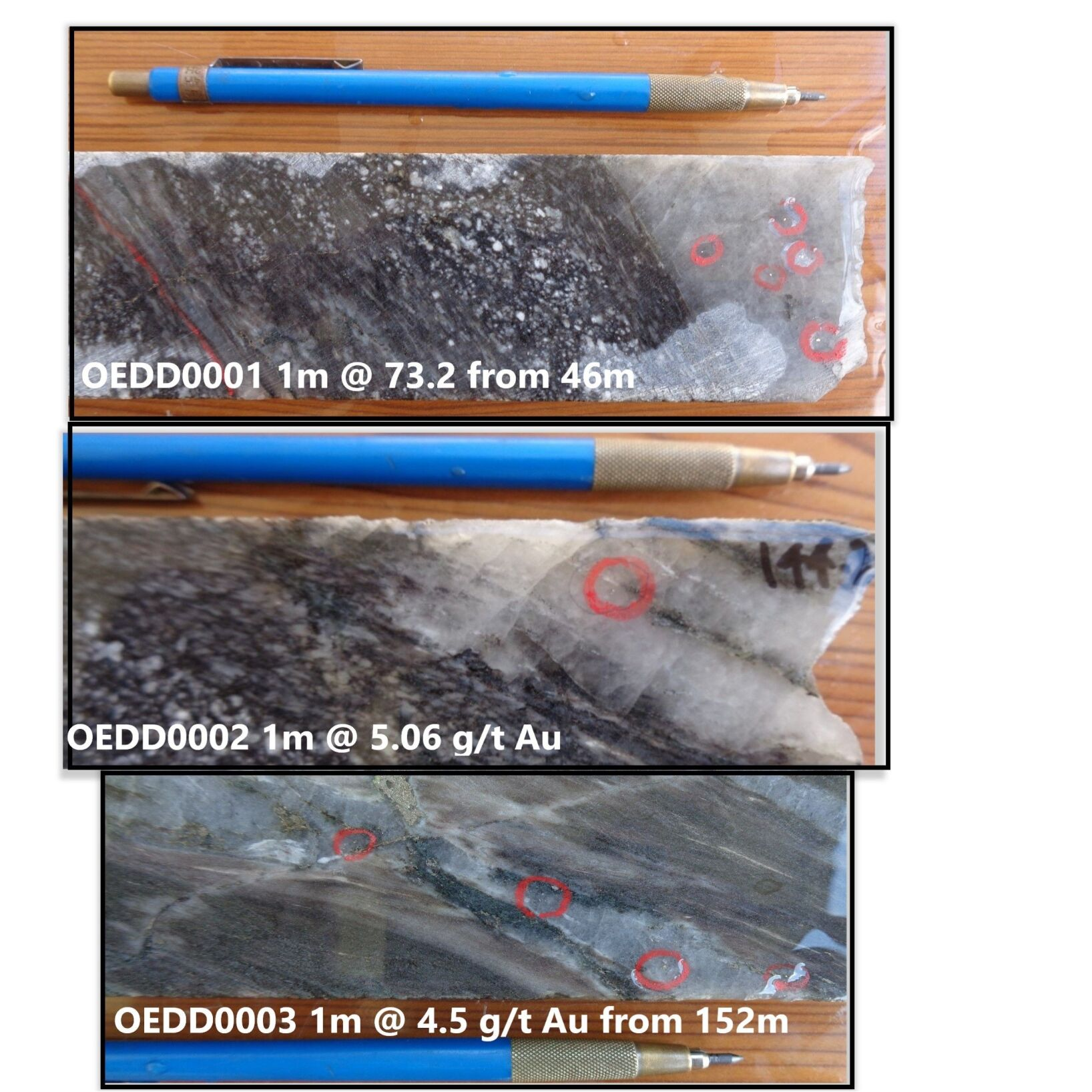
Some significant results from OEDD-45 include:
- OEDD-45 contains 3 high-grade intervals within a 65 m downhole width of mineralization which included:
- 12 m @ 4.9 g/t gold from 89m downhole,
- 13m at 1.3 g/t gold from 114m downhole and,
- 21m @ 1.3 g/t gold from 133m downhole.
OEDD-44 returned up to 4.35 m @ 2.1 g/t gold and was targeted at a parallel southern lode and intercepted fingers of the same brecciated polymetallic mineralisation observed in OEDD-45 and OERC-132 – plunging controls on mineralisation are envisaged with deeper higher-grade mineralisation similar to OER-C132 and OEDD-45.
OEDD-44 also returned noteworthy intercepts, reaching up to 4.35 meters at 2.1 g/t gold, targeting a parallel southern lode and intercepting features similar to the brecciated polymetallic mineralisation observed in OEDD-45 and OERC-132.
It is believed that plunging controls on mineralisation may be influencing deeper higher-grade mineralisation, similar to OERC-132 and OEDD-45.
The recent drill campaigns clearly indicate the potential for multiple lodes of plunging Mineralisation. These controls are expected to lead to the discovery of deeper high-grade mineralisation in multiple lodes. True widths of mineralisation in the discovery lode range from 25 to 50 meter (Figures 10 and 11).
Additionally, in late March, Awalé announced one of the highest grade gold discovery in Africa, in decades (see March 25, 2024 news release).
This new intercept opened Awale’s original interpretation of broader mineralization where the breccia zones may connect at depth (Figure 13A) which would rapidly increase the volume of the high-grade gold mineralization.
4 holes for 699 m were drilled at Charger during this phase, three testing a new 3D geologic framework for mineralization at the target. Three holes (OEDD-78, OEDD-79 and OEDD-82) did not intercept significant mineralization. However, hole OEDD-83 was specifically targeted to drill through potential mineralization associated with the newly recognized NE structural control. This intercept is 60 m north of the 2 previously intercepted breccia pipes, and is under the discovery hole at Charger, OERC-89.


![Figure 12: Charger Prospect - Drill core showing visible gold [D] and breccia hosted gold and polymetallic mineralisation [A and B] associated with silica sulphide and retrograde chlorite-actinolite-carbonate alteration. Peripheral iron oxide alteration present in the system [C]. Gold Grade of the sampled intervals associated with the VG is also shown.](https://i0.wp.com/awaleresources.ca/wp-content/uploads/2023/09/image12-53.png?ssl=1)
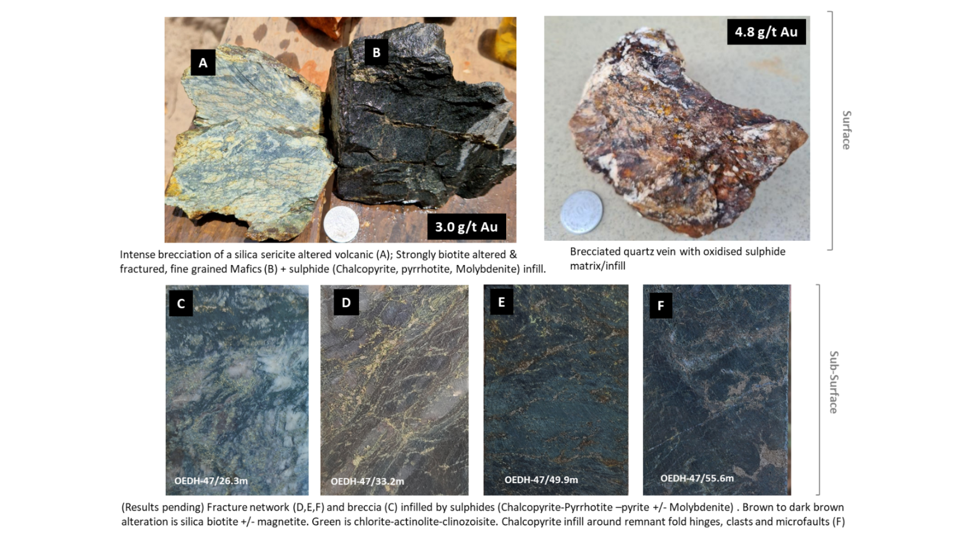
![Figure 15: Sceptre East drill core showing: Vuggy quartz vein infilled with chalcopyrite [A – OEDD-42 64.1m], Molybdenite – Chalcopyrite – Pyrite mineralisation. Molybdenite can commonly develop along foliation and fractures [B - OEDD43 140m] and Chalcopyrite – Pyrite – Molybdenite mineralization associated with silica-sericite alteration [C-OEDD 43 157m].](https://i0.wp.com/awaleresources.ca/wp-content/uploads/2023/09/image14-57.png?ssl=1)


