
Images


May 30, 2022 - Kufra District, Libya
 Tweet
Tweet
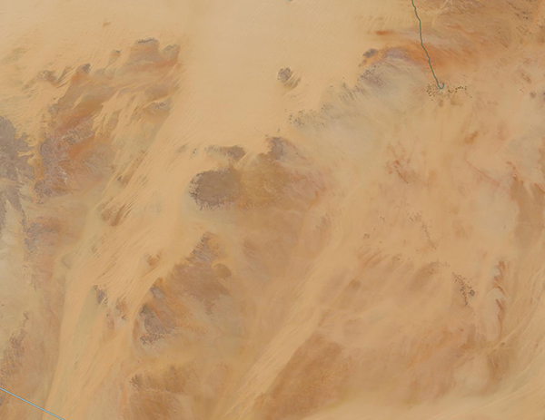
The remote and arid Kufra District of Libya sits at the heart of the Sahara Desert. Filled with sand seas and rugged plateaus, about 91 percent of the land in this region is extremely arid desert. Surprisingly, the region also holds a few oases and, thanks to the largest known fossil water aquifer on Earth (the Nubian Sandstone Aquifer), agriculture and palm trees thrive near Al Jawf, the capital of and the largest city in Kufra District.
More than 20,000 years ago, the landscape of this part of the Saharan Desert was wet, with continuous heavy rainfall that filled the aquifer. The condition of the region has changed considerably since that time, and rainfall in the region is typically less than 0.1 inch of rain a year, making the aquifer that supports farming and lush greenery a non-renewable resource.
On May 26, 2022, the Moderate Resolution Imaging Spectroradiometer (MODIS) on board NASA’s Terra satellite acquired a true-color image of the Kufra District of Libya. Camel-colored sand covers most of the region, interspersed with plateaus marked with tan tones, brown, and a few light washes of green. The green city of Al Jawf can be seen in the northwest (upper right corner) of the image. The linear green line that ends with a hook is a man-made highway leading to Al Jawf. Near the semi-circular end of the roadway, green circles can be seen dotting the desert. These are areas where water is pumped from the Nubian Sandstone Aquifer and used to irrigate crops. Each circle is approximately 1 kilometer (0.62 mile) in diameter.
Image Facts
Satellite:
Terra
Date Acquired: 5/28/2022
Resolutions:
1km (126.1 KB), 500m (311.2 KB), 250m ( B)
Bands Used: 1,4,3
Image Credit:
MODIS Land Rapid Response Team, NASA GSFC
