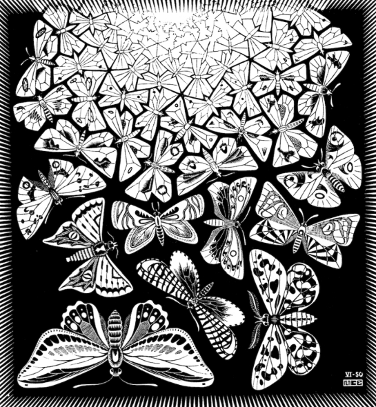
MC Escher’s work has always amazed me with the way he transforms reality: peeling it away in layers to reveal new structures and perceptions. Lately I’ve begun to wonder if I couldn’t use one of his prints – The Butterflies – to blend his work with how Geographers use Geographic Information Systems to portray the Earth’s surface. After all, Escher was always interested in landscapes too.
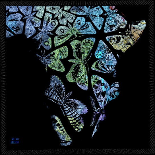
So I scanned The Butterflies from my 1972 copy of The Graphic Work of MC Escher and then removed all of the white areas from the print leaving those areas transparent.
This meant that when I overlaid it on to my map of Africa’s rivers then the coloured areas showed through to become the wing colours of the butterflies. You can clearly see the distinctive shape of Africa’s horn in the top right and the central large green butterfly is right over the Congo River.
For my next attempt I flipped the Butterflies image vertically and overlaid it on the topographic map of South Africa. This makes them fly up from the south coast over the mountains of Lesotho and on into Zimbabwe and Botswana.
This was a fun thing to try and it’s given me some lovely new African designs and ideas to work with.


Dear Roddy: I am blown away by the concept, the technology, the ingenuity, the artistry and the sheer beauty of what you have achieved with the topographical butterfly maps of Africa and South Africa. The results are absolutely splendid. Huge congratulations. Truly amazing. Love Sandy
Thank you so much Sandy!!