Visitor Guide to Fort la Latte and Cap Fréhel
If there is one place in northern Brittany that possesses all of the magic of this region – the sea, impressive cliffs, and stunning medieval architecture – it is Fort la Latte. Situated on a stretch of land that jets out far over the water, it is truly a magnificent sight to behold.
One of the many things I love about Brittany is its proximity to the sea. I grew up in the Midwestern part of the United States, and while we have some incredibly beautiful lakes, I find myself drawn to the expansive waters and mighty cliffs in la Bretagne. Whenever I’m there, I make a point to spend some time at the water’s edge. I love the sound of the waves and the birds, and I love the idea that travelers and merchants have sailed these waters for many centuries and gazed upon the same beautiful rock formations.
Fort la Latte lies on a stretch of land in the commune of Plévenon, in the Côtes-d’Armor department of northern Brittany. It lies about 35 kilometers west (22 miles) from Saint Malo and about an hour and a half from the Rennes train station. The views along this magnificent coastline are well worth an afternoon’s drive, and a stop at Fort la Latte and Cap Fréhel a must for history buffs and nature lovers.
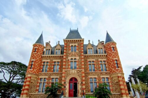
Construction began on the castle circa 1340 and the impressive Keep dates back to between 1365 and 1370. It had its fair share of action, as it was overtaken by the English in 1490. It was turned into a fortress under the reign of Louis XIV and later defended Saint-Malo against attacks by the English and Dutch. You can read more about the history of Fort la Latte here https://www.bklein.de/brittany/fort_la_latte.php and here https://www.spottinghistory.com/view/3052/fort-la-latte/.
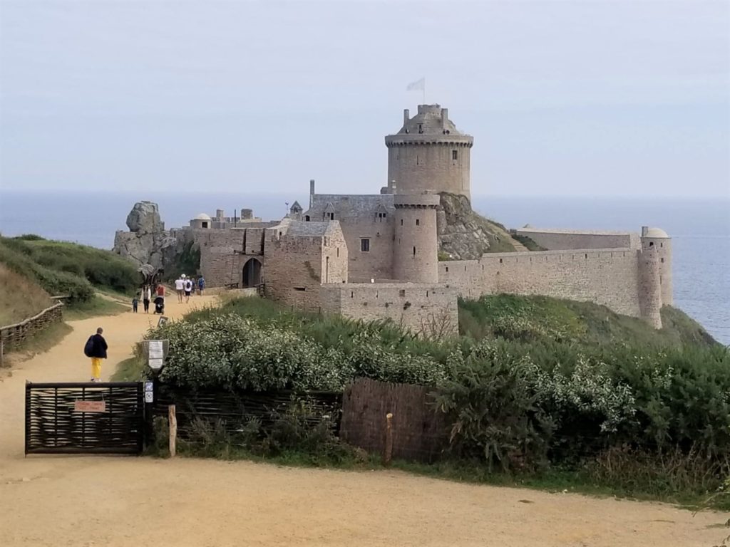
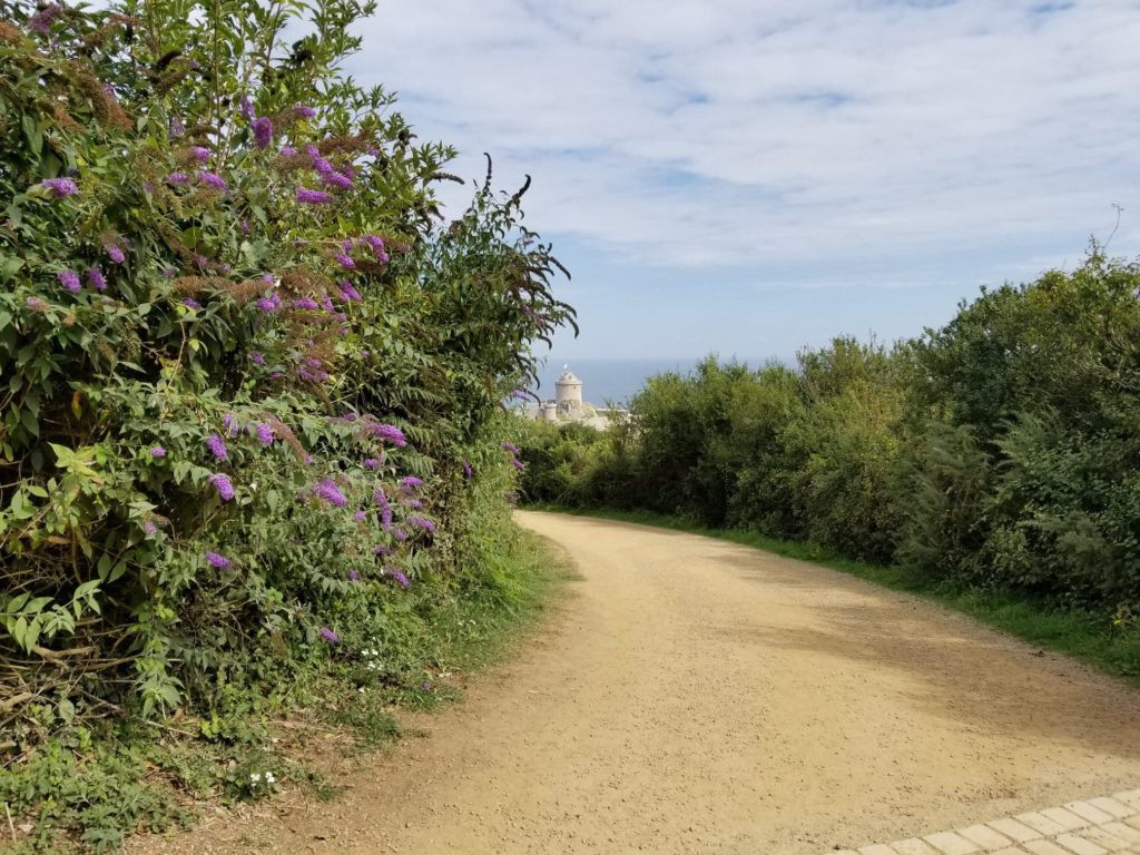
A car park lies far behind the entrance to the fort, and a long and winding path awaits. One gets glimpses of the castle between tree branches….
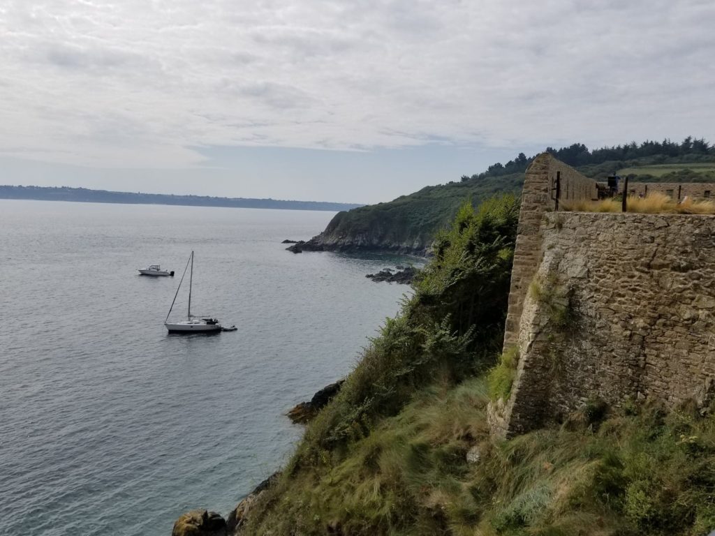
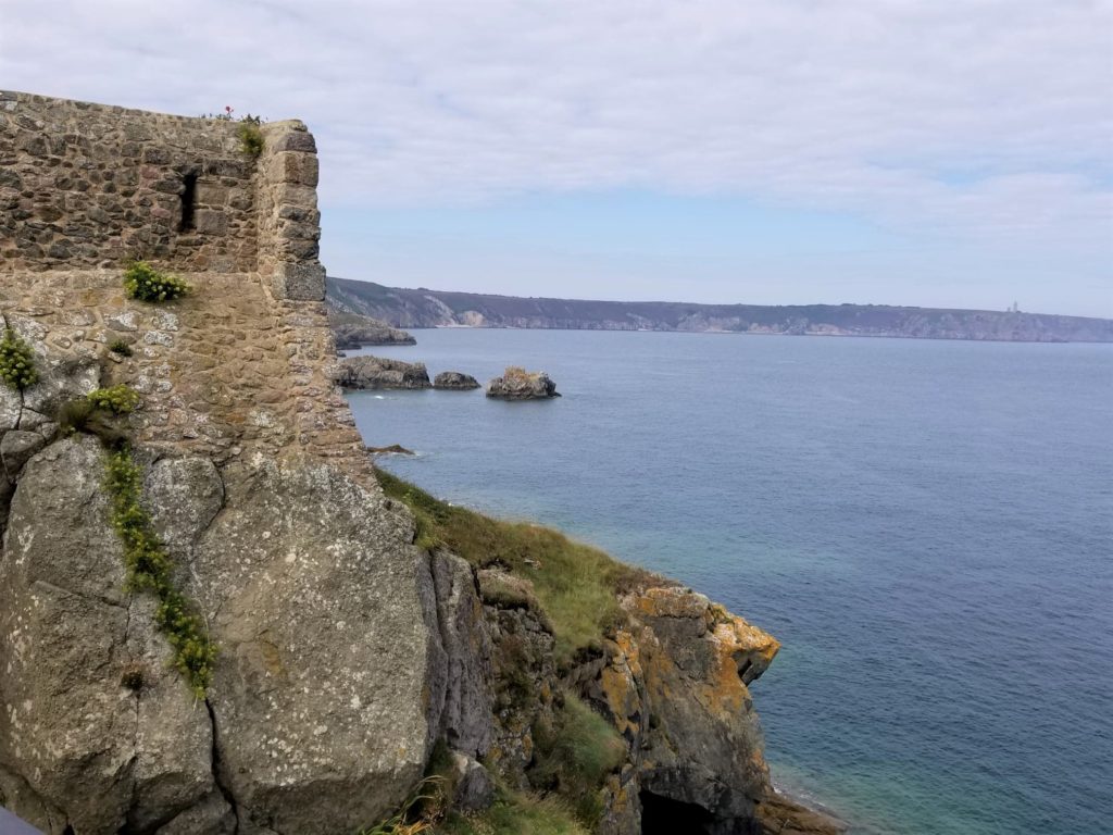
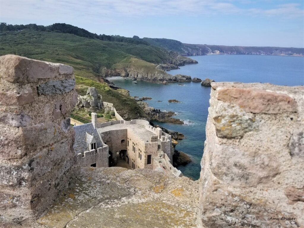
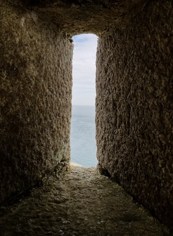
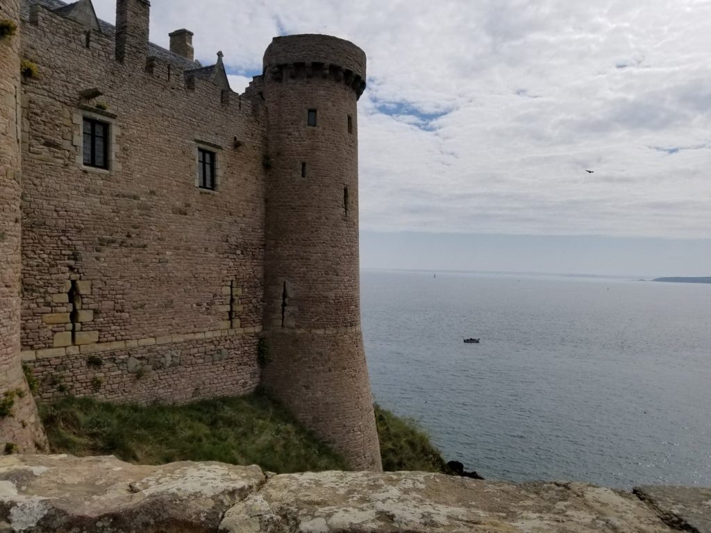
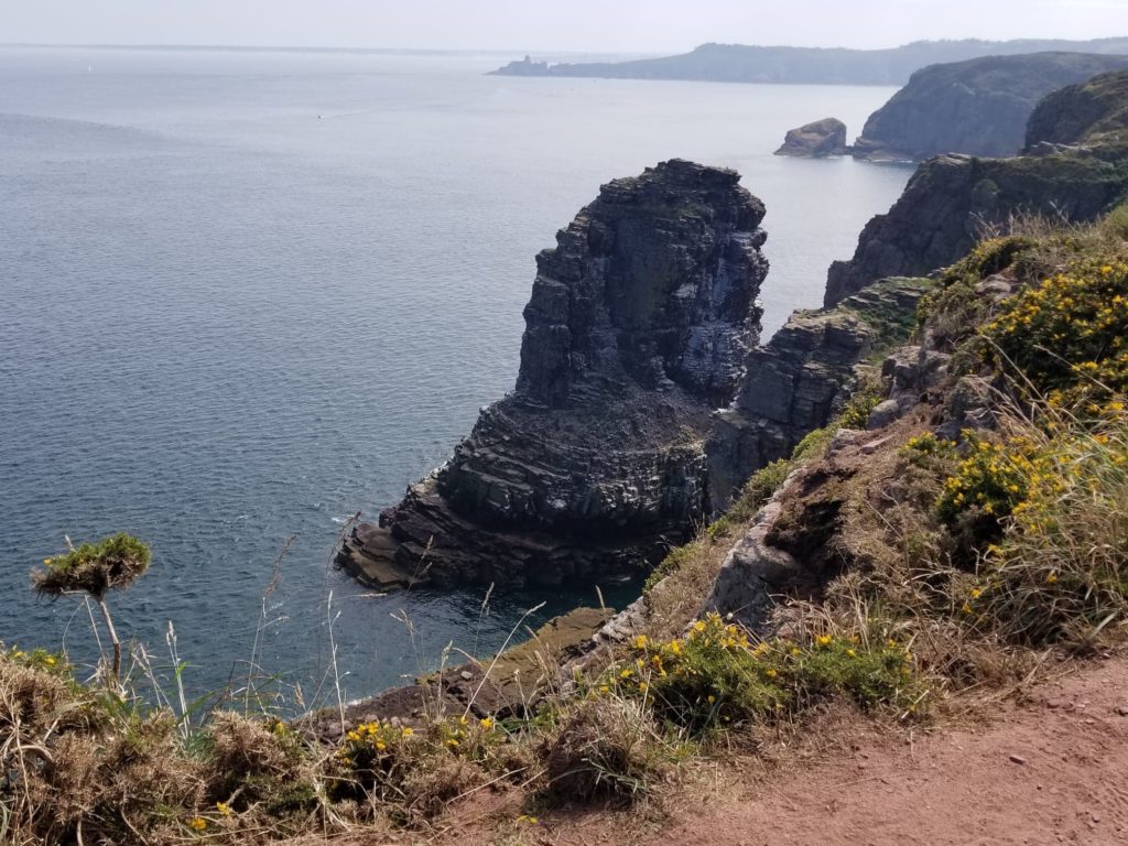
Once closer, you get a superb view of the English Channel and the magnificent cliffs that protected the castle from maritime invaders.
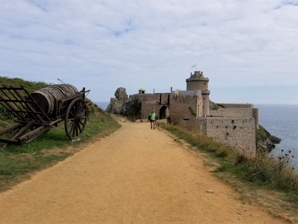
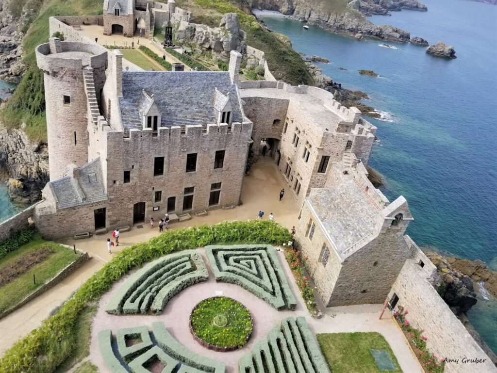
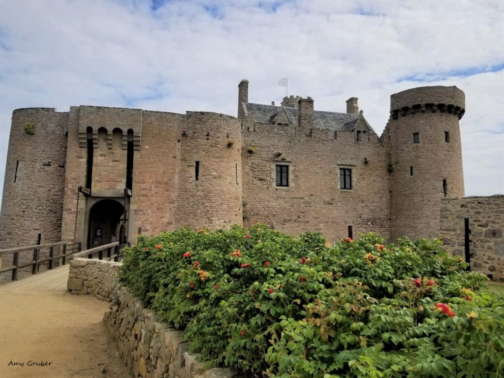
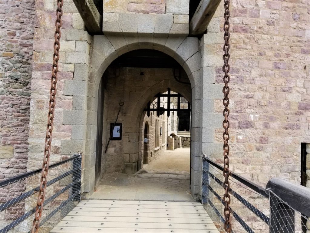
Walking across the drawbridge, one enters another world. Images of knights and battles and music and archery come to mind.
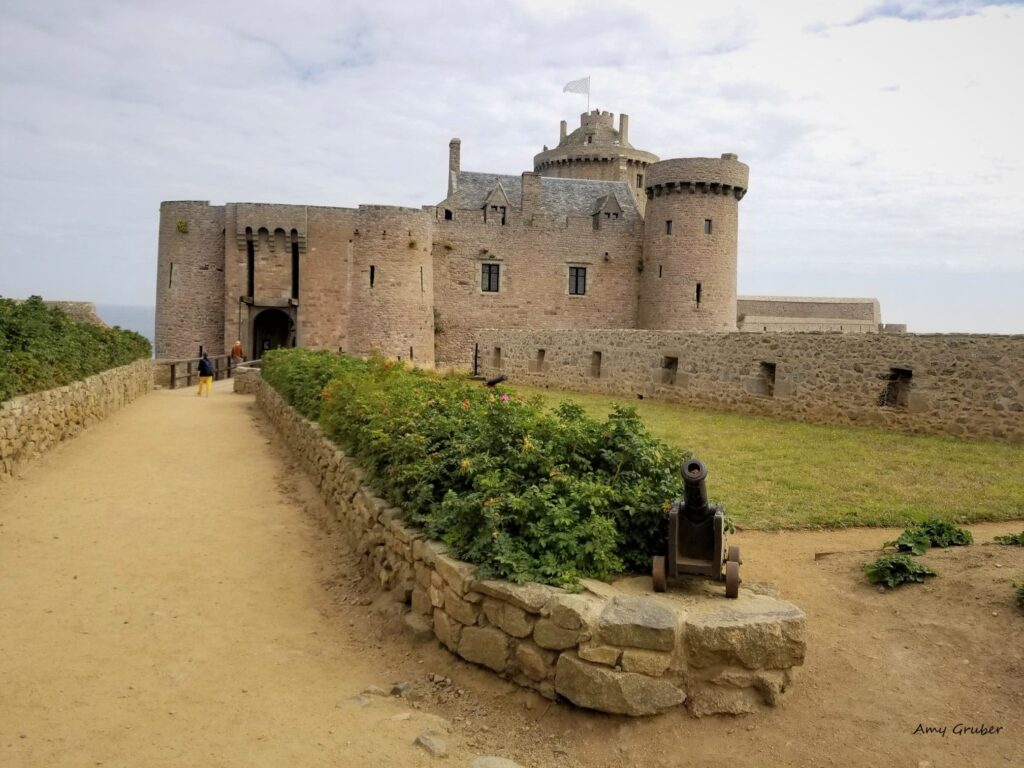
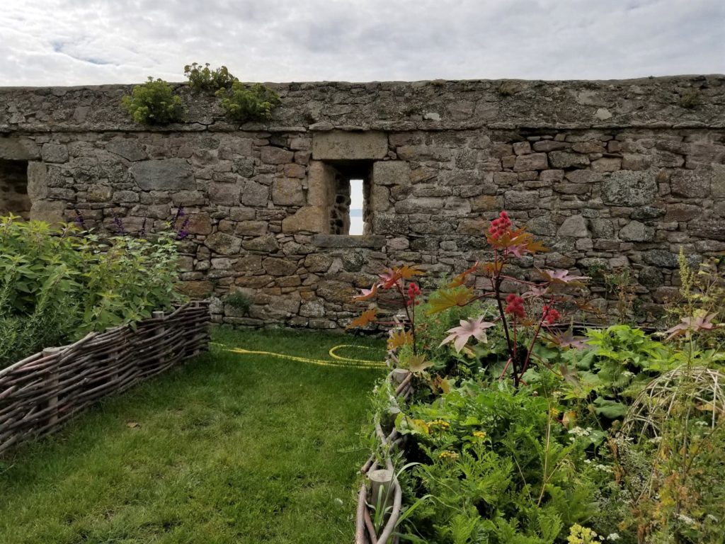
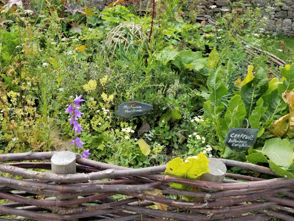
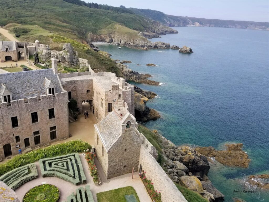
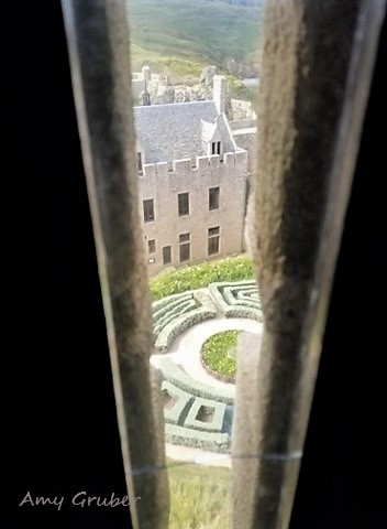
The courtyard offers incredible views of the water and contains a beautiful garden, full of fresh flowers and herbs, lying in stark contrast to the old canons.
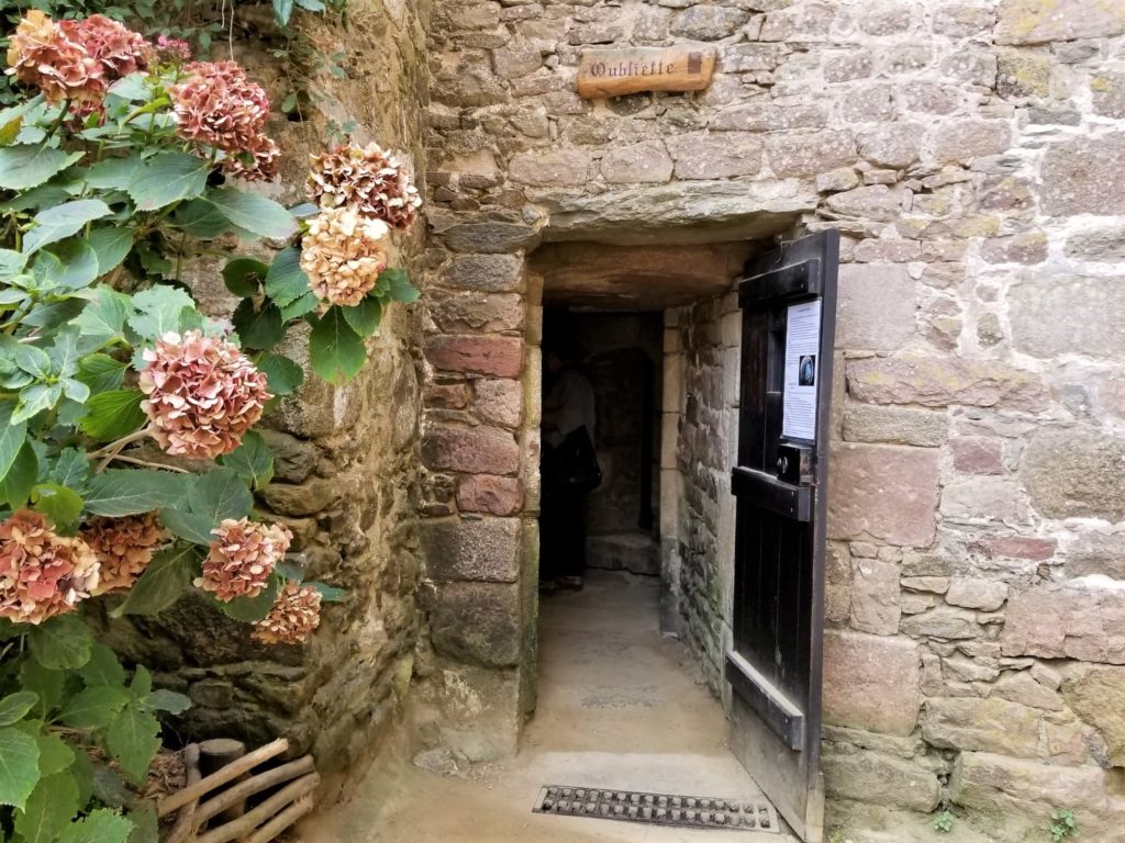
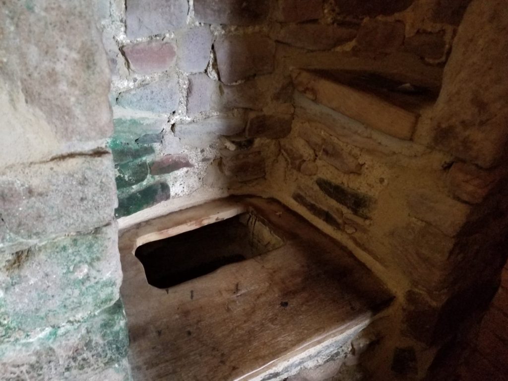
The photo below shows the outside of the dungeon. At first, I thought the room itself was the dungeon, but then that I realized there was a hole in the floor, with a metal grate atop, and it was the hole in the floor that was the dungeon (evidently I need to read up on my medieval history). No light, except what would filter in from the paper thin sliced “windows” in the stone walls above. I am sorry now that I didn’t snap a photo, but I couldn’t bear to look at the tiny space for too long. I can’t imagine what someone would have endured there, in that darkness, cold, and solitude, such a stark contrast to the beauty that lie above.
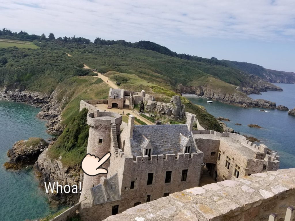
Walking along the walls of the fort, I was able to see out over the bluffs and into the channel. I then spotted what may be described as “steps” leading up the highest lookout point. Since my parents read these blog posts, I have omitted the photo of said “steps” and will leave them to your imagination. There was a rope of sorts to help me climb, which may have been a sign to most sane individuals not to proceed, but I just knew the view would be incredible.

And, it was!
While I can’t advise anyone to climb the “steps” to the top of the chateau, I will say it was worth the butterflies in my stomach. I was a little unsteady on my feet, but looking out over the sea, and at the manicured gardens below, it gave me great peace.
As I was snapping photos and taking a quick video, I noticed this staircase on the side of the castle….
Where was the side of the staircase, nearest to the water? Why would it simply disappear? Can you imagine walking down that case, seemingly into the oblivion, with winds howling and the crashing waves below? I think that it would give pause to even the bravest of souls. It was at about that time that I decided to climb, very carefully, down the “stairs”, worn flat and uneven, by several hundreds of years of wind and water.
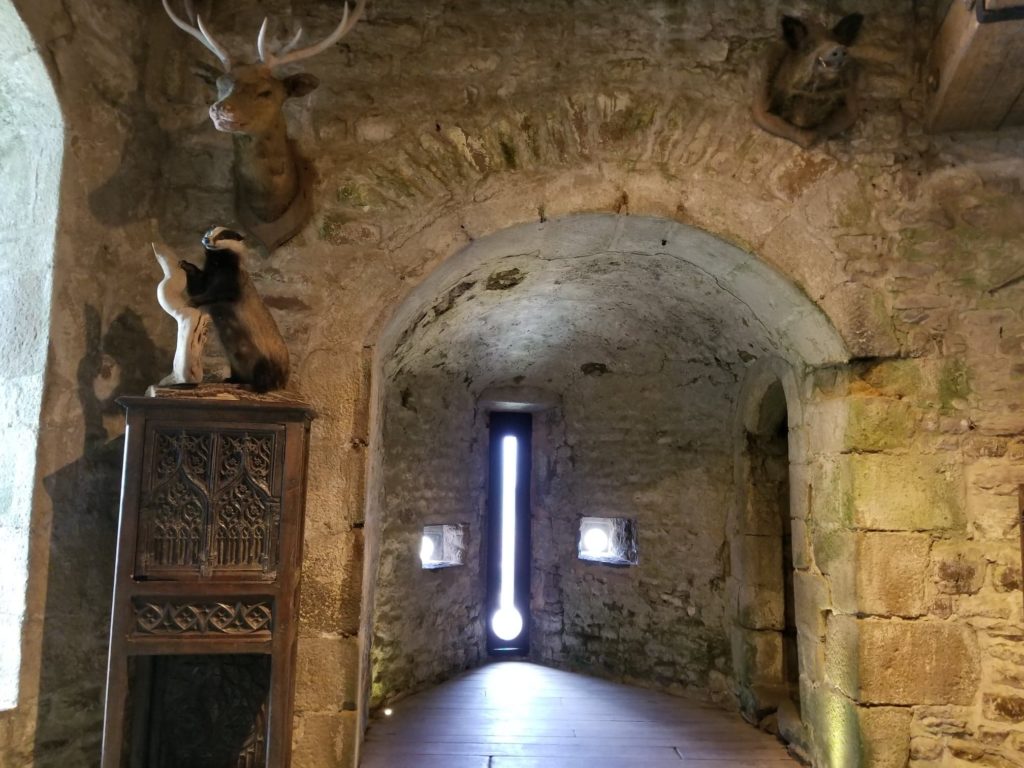
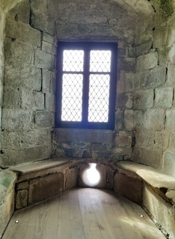
The inside of the chateau is equally interesting and brought to life the images that I had of life inside the castle. It’s hard to imagine what winters must have been like there, with the shorter daylight hours and intense winds. Did people ever find peace here, or were they always thinking about a potential attack? I hope it was the former, and they had some times when they looked out over the water and, even just for a moment, were happy to be there.
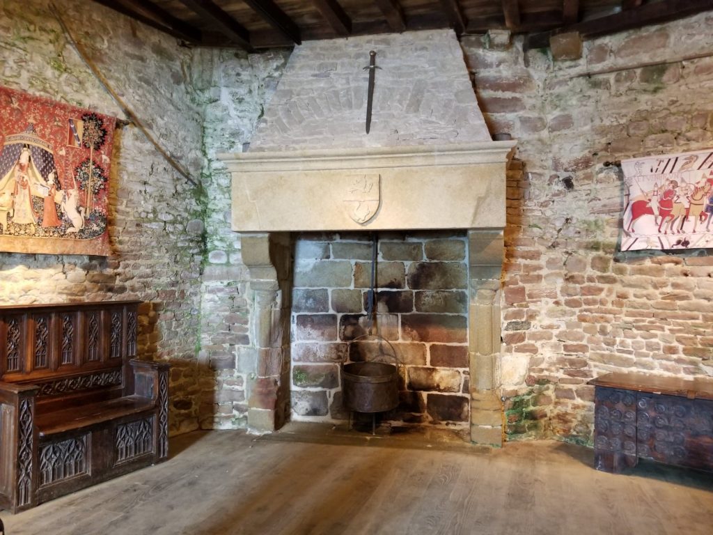
I found the inside of the castle, though stark, was hauntingly beautiful.
This would be a realtor’s dream, as it does have one heck of a view…
I will say that the bathroom could use a bit of an update….
For those who love reenactments and living history, there is a medieval festival held here every August. The festival usually brings in about 12,000 visitors. This year, the festival will be held August 11-14th . You can access the flier here: https://www.medieval-fortlalatte.com/aout.
The beauty of Fort la Latte has not escaped filmmakers. Due to its well-preserved walls and incredible views, several movies have been shot here. If you’re a fan of Tony Curtis and Kirk Douglas, you may remember seeing a film called The Vikings, filmed at Fort la Latte in 1958.
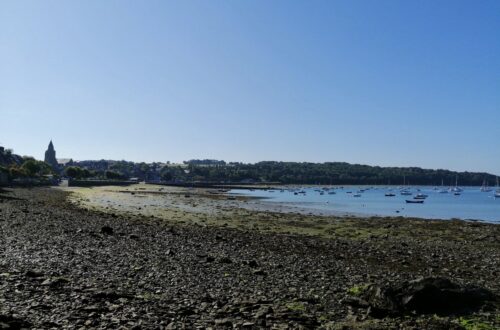
About 4 km or 2.5 miles from Fort la Latte lies Cap Frehel. You can walk between the two sites on the GR34 trail. Or, if you are pressed for time (as we were) you make the short drive.
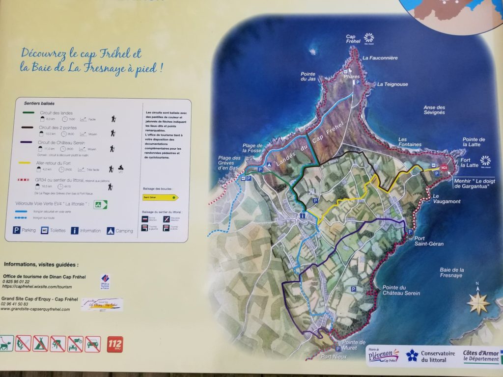
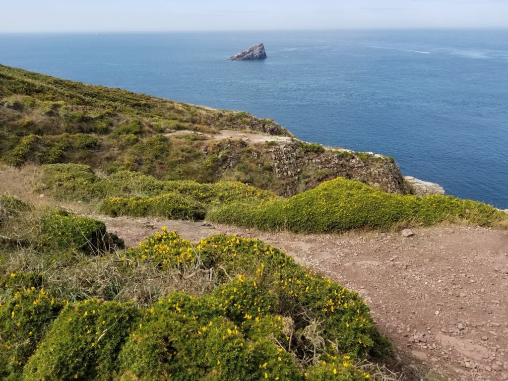
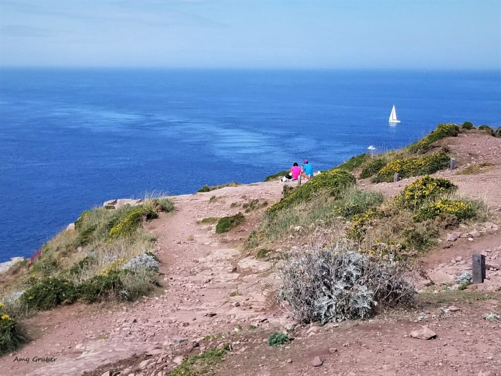
The footpath that links Fort la Latte to Cap Frehel takes about an hour each way to walk. This area, a protected moorland, stretches 1.5 square miles. In addition to the rose-colored rock formations, you may come across any number of native and migratory seabirds.
This area is lovely for sitting back and having a bite to eat. Next time we visit, we’ll make sure to pack a lunch.
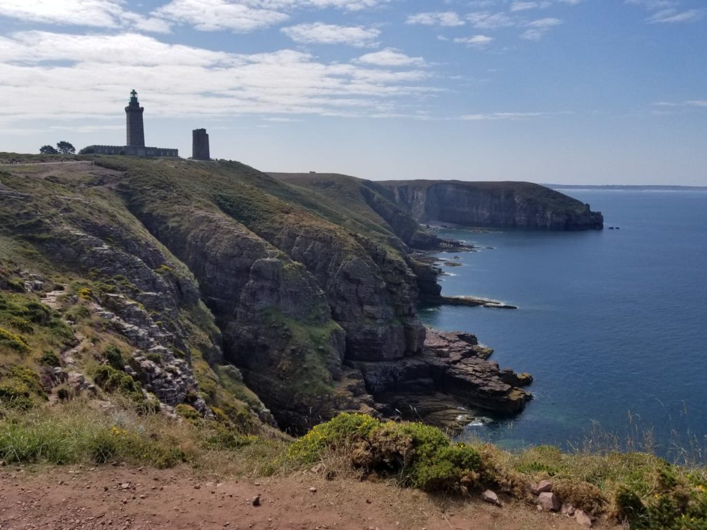
There are two lighthouses on the peninsula, one dating back to the 17th century and the other, quite new, built in 1950.
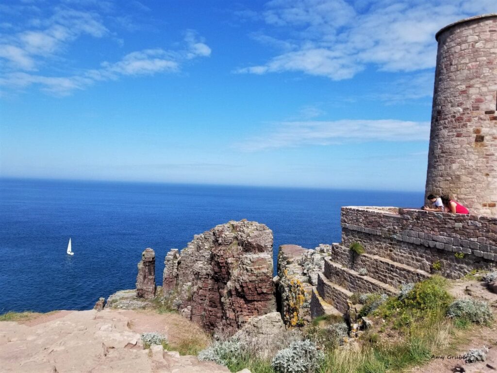
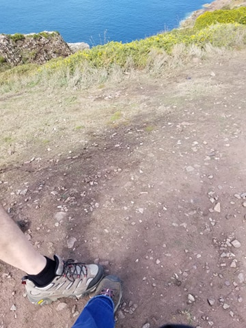
I would definitely recommend bringing a windbreaker that is water-resistant, sunscreen, and sunglasses. I would also recommend wearing shoes with good traction as the footpaths are, at times, uneven. Note that there is no barrier between the footpath and the sea, so tread carefully and enjoy the magnificent views.
Read more about Cap Frehel here https://www.brittanytourism.com/destinations/the-10-destinations/cap-frehel-saint-malo-mont-saint-michel-bay/cap-frehel-and-fort-la-latte/
Getting there:
Driving directions from Rennes to Fort la Latte. 1 hour and 30 minutes, approximately 103.8 km https://www.google.com/maps/dir/Rennes,+France/Fort+la+Latte,+22240+Pl%C3%A9venon,+France/@48.3924461,-2.2984721,10z/data=!3m1!4b1!4m14!4m13!1m5!1m1!1s0x480ede2fa7d69085:0x40ca5cd36e4ab30!2m2!1d-1.6777926!2d48.117266!1m5!1m1!1s0x480e77bd7b2e1f11:0xc1294844066ba895!2m2!1d-2.2848103!2d48.6683283!3e0
Additional Information:
Official website (French) https://www.lefortlalatte.com/
Fort la Latte and Frehel (English) https://www.bklein.de/brittany/fort_la_latte.php
Fort la Latte Hours of Operation:
School breaks in February and weekends in March 1 p.m. to 5:00 p.m.
April through June and September 10:30 a.m. to 6:00 p.m.
July and August 10:30 a.m. to 7:00 p.m.
October 1 p.m. to 5 p.m.
Weekends and school breaks in November and December 1 p.m. to 5 p.m.
Ticket prices range from 4, 40 euros to 6, 60 euros (as of February 2020)
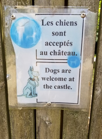
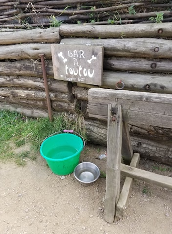
For pet owners..
I hope you enjoyed today’s blog. Please comment below with any thoughts, questions, or suggestions. I genuinely appreciate your feedback.
Until next time,
Amy
2 Comments
Barb Gruber
Just when I thought it couldn’t get any better, it does! This is my favorite post so far. Wow!!
Amy G.
I’m so glad to hear that! Thanks for your feedback.