Lighthouses of Southwestern Estonia

The Republic of Estonia (Eesti in Estonian) is a small country with a surprisingly long coastline. Surrounded on 2-1/2 sides by water, it faces the Gulf of Riga (Liivi Laht) on the southwest, the Baltic Sea (Läänemere) on the west, and the Gulf of Finland (Soome Lahe) on the north. The country includes two large islands in the Baltic, Saaremaa and Hiiumaa, and countless small islands. To guard these coasts, Estonia has more than 100 lighthouses and a well-developed lighthouse administration.

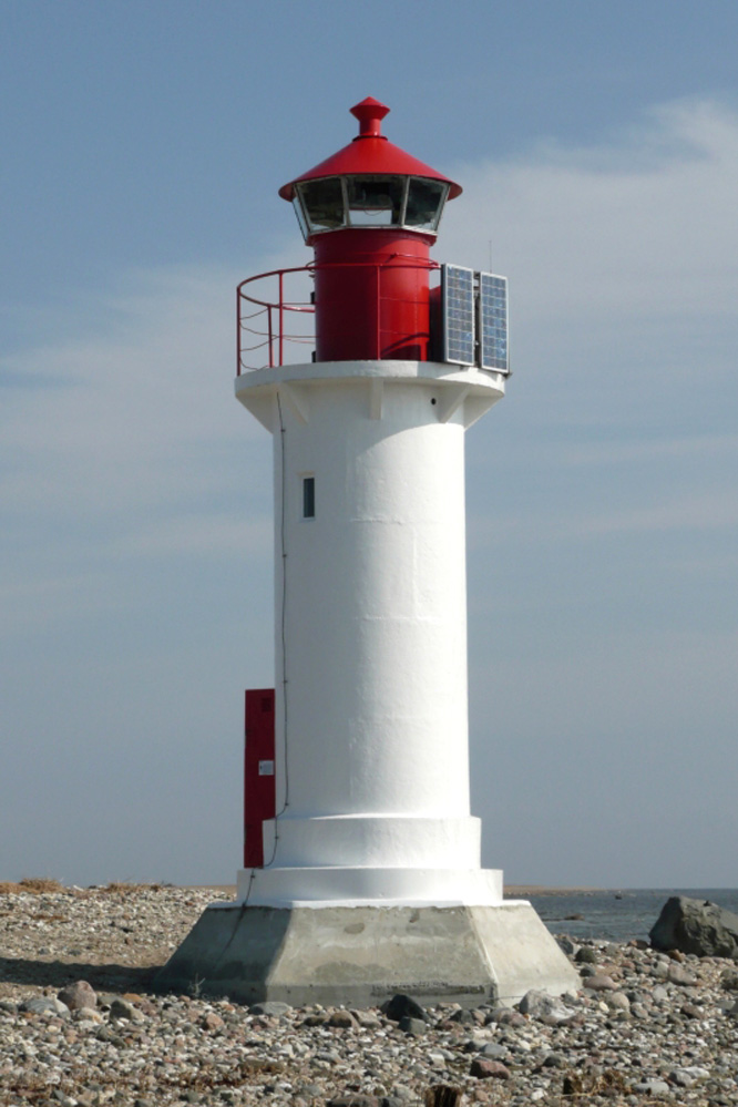
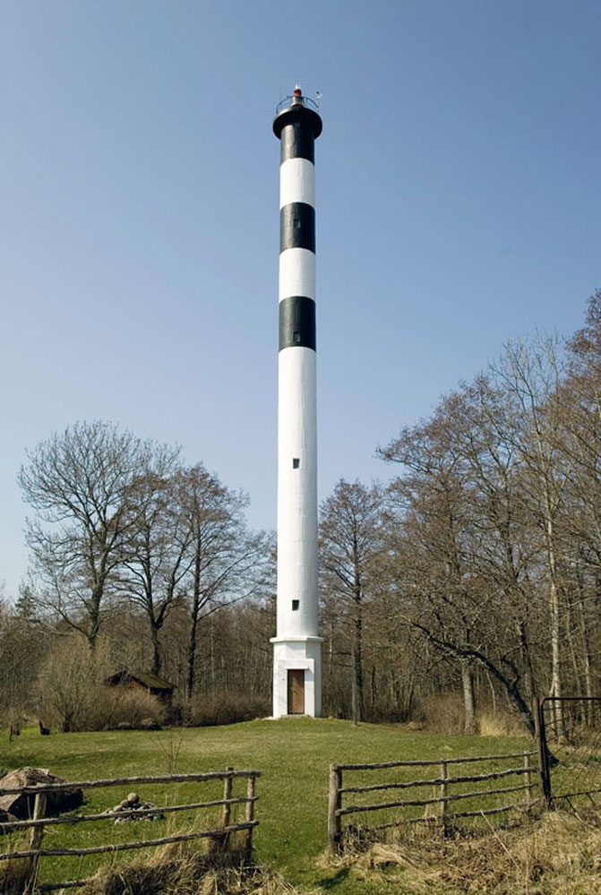
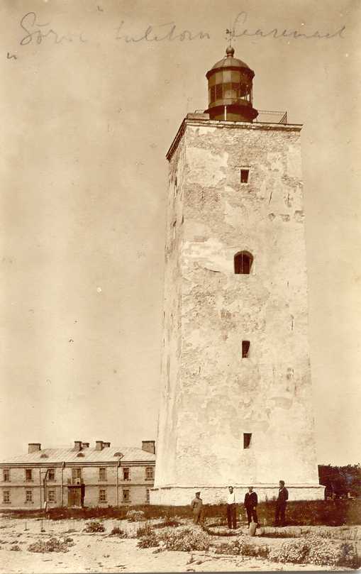
Estonia's independence is recent. The country was part of the Swedish Empire from 1625 to 1710 and then part of the Russian Empire from 1710 until the end of World War I in 1918. After two decades of independence it was incorporated into the Soviet Union from 1940 to 1990. Thus the older lighthouses are from the Russian Imperial period and some of the newer ones are of Soviet construction. An example from the imperial period appears at right: the Vilsandi lighthouse built in 1809.

Estonia is divided administratively into fifteen counties (maakonnad, singular maakon), and the counties are subdivided for local government into urban municipalities and rural municipalities called parishes (vallad). This page includes lighthouses of the southwestern coast including Pärnu and Saare counties.

Names in curly brackets {} are non-Estonian former names (Swedish or German).

In Estonian a lighthouse is a tuletorn (fire tower), a tulepaak (fire beacon), or a majakas (borrowed from the Finnish word majaka for a lighthouse). A daybeacon is called a päevamärk, saar is an island, poolsaar is a peninsula, parv is shoal, kari is a reef, neem is a cape or headland, väin is a strait, jõgi is a river, and sadam is a port or harbor.

Lighthouses in Estonia were operated previously by the Estonian Maritime Administration (Veeteede Amet, or VTA). In 2021 the functions of VTA were folded into the Estonian Transport Administration (Transpordiamet).

ARLHS numbers are from the ARLHS World List of Lights. VTA numbers are from the List of Lights - Estonia published by VTA. Admiralty numbers are from volume C of the Admiralty List of Lights & Fog Signals. U.S. NGA List numbers are from Publication 116.

General Sources
Navigatsioonimärkide andmekogu (Database of Navigation Signs)
Copied from the former VTA web site, photos and data for all the VTA beacons.
Transpordiamet - Tuletornid
Lighthouse information from the Transport Administration, including the Database of Navigation Signs and information on lighthouses open to visitors.
Eesti Tuletorni Selts
Web site of the Estonian Lighthouse Society (in Estonian)..
Online List of Lights - Estonia
Photos by various photographers posted by Alexander Trabas. Most of the photos for Estonia are by VTA.
Leuchttürme in Estland
Photos by Andreas Köhler taken in the summer of 2016.
Lighthouses in Estonia
Photos by various photographers available from Wikimedia.
World of Lighthouses - Estonia
Photos by various photographers available from Lightphotos.net.
Leuchttürme an der estländischen Ostseeküste
Photos of Estonian lighthouses posted by Bernd Claußen.
Lighthouses Estonia
Photos posted on Flickr.com by Joke Reijnen.
Six Remarkable Estonian Lighthouses
Information posted by Cybernetica AS, an Estonian manufacturer of aids to navigation.
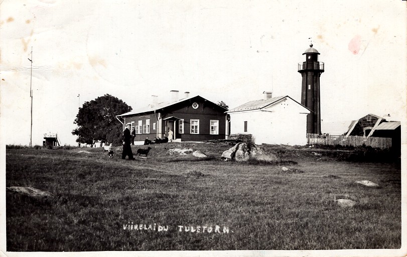
Vintage postcards and photos depicting lighthouses of Estonia
Historic postcard images posted by Michel Forand.
Leuchttürme...auf historischen Postkarten
This page, posted by Klaus Huelse, has 18 historic postcard views of Estonian lighthouses.
List of Lights - Estonia
The official light list for Estonia, with text in both Estonian and English.
GPSNauticalCharts
Navigational chart for Estonia.
Navionics Charts
Navigational chart for Estonia.

Vilsandi Light
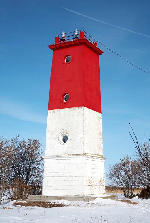
Vilsandi Light, Kihelkonna, August 2008
Wikimedia Creative Commons photo by Sven Vaarandi


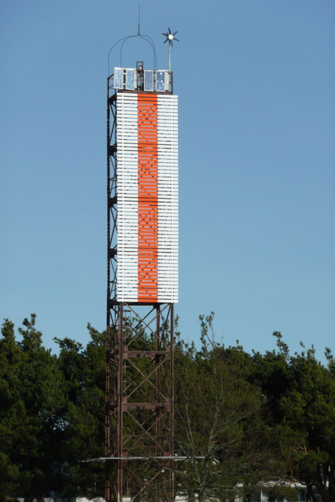
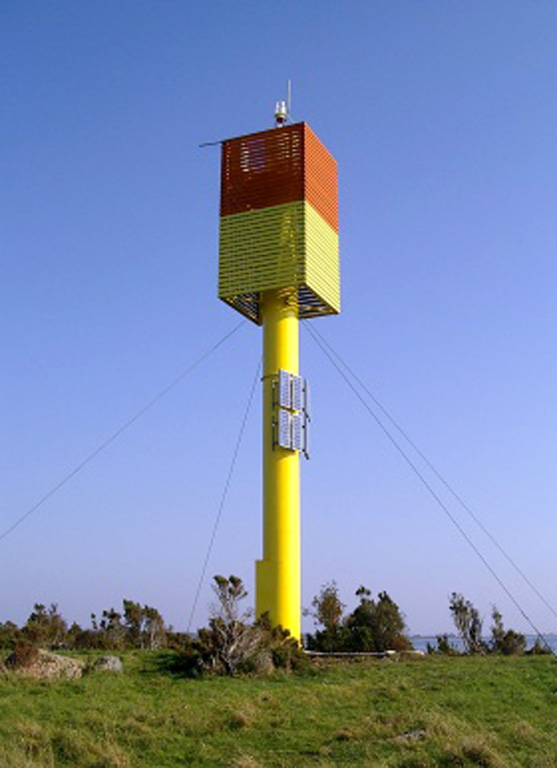
Virtsu Light, Virtsu
Estonian Maritime Administration photo

Pärnu County Lighthouses

Häädemeeste Parish Lighthouse
* Häädemeeste (Mõisaküla)
1956. Active; focal plane 30 m (98 ft); white flash every 5 s. 28 m (92 ft) square skeletal tower, painted red. The west side of the tower is covered by a slatted daymark painted white. Trabas has a photo by Klaus Kern, Claußen has a photo, and Google has an indistinct satellite view. Located in the village of Häädemeeste, on the east side of the Gulf of Riga about 35 km (22 mi) south of Pärnu. Site open, tower closed. VTA 894; Admiralty C3594.5; NGA 12452.

Pärnu City Lighthouses
Pärnu, formerly known by its German name Pernau, is a seaport and resort town at the mouth of the Pärnu River at the northeastern corner of the Gulf of Riga. VTA's pages indicate that there was a light at Pernau as early as 1835; Findlay's 1879 list describes "two lanterns" at the river entrance, a station established in 1856.

Seedri Range Front (Pärnu Outer Range Front) (2)
1976 (station established 1922). Active; focal plane 16 m (52 ft); white light, 0.5 s on, 0.5 s off, visible only along the range line. 14 m (46 ft) square cylindrical skeletal tower. The front of the tower carries a slatted daymark painted white with a red vertical stripe. Trabas has a VTA photo showing both range lights, Sven Vaarandi has a closeup photo, and Google has an indistinct satellite view. This is the second range guiding vessels approaching the Pärnu River entrance from the Gulf of Riga. Located on the east bank of the river about 200 m (650 ft) from the mouth. Site probably open, tower closed. VTA 881; Admiralty C3608; NGA 12468.
* Seedri Range Rear (Pärnu Outer Range Rear) (2)
1976 (station established 1922). Active; focal plane 25 m (82 ft); white light, 1.5 s on, 1.5 s off, visible only along the range line. 24 m (79 ft) square cylindrical skeletal tower. The front of the tower carries a slatted daymark painted white with a red vertical stripe. Trabas has a VTA photo, Sven Vaarandi has a closeup photo, Rene Mitt has a street view, and Google has a satellite view. Located on the east bank of the river on the grounds of the Tervis Medical Spa (Sanatoorium Tervis). Site open, tower closed. VTA 882; Admiralty C3608.1; NGA 12472.
Silla Range Front (Pärnu Inner Range Front) (2)
1999 (station established 1930). Active; focal plane 16 m (52 ft); red light, 1.5 s on, 1.5 s off, visible only along the range line. 13 m (43 ft) square cylindrical skeletal tower. The front of the tower carries a slatted daymark painted red with a white vertical stripe; the color of the stripe was changed fairly recently from black to white. Jānis Līsmanis has a photo, Trabas has a VTA photo and Google has a distant satellite view. This is the entrance range for the Pärnu River. Located on the quay at Pärnu. Site status unknown. VTA 891; Admiralty C3612; NGA 12476.
* Silla Range Rear (Pärnu Inner Range Rear) (2)
1999 (station established 1930). Active; focal plane 29 m (95 ft); red light, 3 s on, 3 s off, visible only along the range line. 26 m (85 ft) square cylindrical skeletal tower. The front of the tower carries a slatted daymark painted red with a white vertical stripe; the color of the stripe was changed fairly recently from black to white. Sven Vaarandi's 2007 photo at right shows the black stripe, Trabas also has a VTA photo showing the white stripe, and Google has a street view and an indistinct satellite view. Located on Jannseni Boulevard behind the harbor facilities of Pärnu. Site open, tower closed. VTA 892; Admiralty C3612.1; NGA 12480.
* Pärnu Approach Range Front (2)
2002 (station established 1960). Active; focal plane 24 m (79 ft); red light, 0.5 s on, 0.5 s off, visible only along the range line. 22 m (72 ft) robust round post, painted red. The tower carries a large slatted daymark painted white with a black vertical stripe. Trabas has a VTA photo, Claußen has photos of both lights, a winter 2023 closeup is available, and Google has a satellite view and a distant street view. This is range guiding vessels as they approach Pärnu. Located on the shore of the Bay of Pärnu about 500 m (0.3 mi) west of the Pärnu River entrance. Accessible by road. Site open, tower closed. VTA 871; Admiralty C3606; NGA 12456.
Silla Range Rear Light
Silla Range Rear Light, Pärnu, July 2007
ex-Panoramio Creative Commons photo by Sven Vaarandi
* Pärnu Approach Range Rear (2)
2002 (station established 1960). Active; focal plane 37 m (121 ft); red light, 3 s on, 3 s off, visible only along the range line. 34 m (112 ft) square cylindrical skeletal tower, painted red. The upper half of the tower carries a slatted daymark painted white with a black vertical stripe. Trabas has a VTA photo, Claußen has photos of both lights, and Google has a distant street view and a satellite view. Located off Merekalda Avenue in Pärnu. Site open, tower closed. VTA 872; Admiralty C3606.1; NGA 12460.
* Liu (Kirikunina, Kirku Nina)
1956. Active; focal plane 30 m (98 ft); white light occulting twice every 5 s. 28 m (92 ft) square skeletal tower, painted red. The south and east sides of the tower are covered by a slatted daymark painted white. Estonian Wikipedia has a page with Sven Vaarandi's photo, Trabas has a VTA photo, and Google has a street view from the rear of the tower and a distant satellite view. Located on a cape at Liu, the west side of the entrance to the Bay of Pärnu, about 16 km (10 mi) southwest of the city. Accessible by road. Site open, tower closed. VTA 865; Admiralty C3605; NGA 12492.
Sorgu {Sorkholm} (2)
1904 (station established with a daybeacon in 1864). Active; focal plane 19 m (62 ft); two flashes every 9 s, white or red depending on direction. 16 m (53 ft) round cylindrical brick tower with lantern and gallery, standing on an octagonal base. The lighthouse is unpainted red brick; lantern painted red. 2-story brick keeper's house. The lighthouse has been in poor condition; severe spalling of the bricks can be seen in the VTA photo posted by Trabas, and the lighthouse looks even worse in the 2017 photo by Tervo Orgma seen at right. A 2020 drone view and Rando Pauskar's 2022 closeup show that some of the spalled areas have been repaired. Google has a distant satellite view. This light and the Manilaid Light (next entry) guide vessels approaching Pärnu Bay from the west. Sorgu is a small island in the mouth of Pärnu Bay, about 8 km (5 mi) southeast of Manilaid and about 30 km (19 mi) southwest of Pärnu. The island is a bird sanctuary, closed to visitors until after the nesting season ends in July. Accessible only by boat. Site open, tower closed. ARLHS EST-050; VTA 860; Admiralty C3602; NGA 12508.

Sorgu Light, Tõstamaa, July 2017
Google Maps photo by Tervo Orgma
* Manilaid (Maniliau) {Manija}
1933. Active; focal plane 9 m (30 ft); white, red, or green light depending on direction, 2 s on, 2 s off. 8 m (26 ft) round cylindrical concrete tower with lantern and gallery. Tower painted white, lantern red. Estonian Wikipedia has a page with several closeup photos, Diana Stsolokova has a photo, Trabas has a VTA photo, Kristjan Raude has a 2021 photo, and Google has a very distant satellite view. Manilaid is a small island just off Munaliau at the western entrance to the Pärnu Laht (Pärnu Bay). The light displays no less than 10 sectors to guide ships around the island in their approach to Pärnu, Estonia's main port on the Gulf of Riga. Located at the southern tip of the island, which is accessible by passenger ferry from Munaliau. Site open, tower closed. ARLHS EST-070; VTA 855; Admiralty C3603; NGA 12464.

Kihnu Parish Lighthouse
* Kihnu {Küno}
1865. Active; focal plane 29 m (95 ft); two long (1.5 s) flashes every 12 s, white or red depending on direction. 28 m (92 ft) round tapered cast iron tower with lantern and gallery; Fresnel lens in use. Lighthouse painted white; lantern dome is red. Trabas has VTA's photo at right, a 2017 closeup photo is available, Wikimedia has several photos, Yuri Stepanovich Rybnikov has a 2022 photo, Andrei Klevtsov has a street view from the gallery, Taivo Kunder has a street view from the tip of the island, and Google has a distant satellite view. This lighthouse was prefabricated in England; it is a copy of the Vormsi Light (see below). Forand has a 1931 postcard view. Kihnu is an island in the northern Gulf of Riga, about 12 km (7.5 mi) south of the mainland and 40 km (25 mi) southwest of Pärnu. Most visitors arrive by air but there is also ferry service from Pärnu in the summer. The population of the island is about 700. Located on the south end of the island. Site open, tower closed. . ARLHS EST-028; VTA 840; Admiralty C3596; NGA 12500.

Lääneranna Parish (West Coast) Lighthouses
* Sõmeri (Matsiranna) (2)
1954 (station established with a daybeacon in 1941). Active; focal plane 23 m (75 ft); white flash every 5 s. 20 m (66 ft) octagonal white concrete tower with gallery but no lantern, mounted on a square white concrete base. Kristian Pikner has a 2015 photo and a 2017 photo of the lighthouse in action, Trabas has VTA's photo, Irene Bondarenko has a street view, and Google has a satellite view. Located on a promontory of the Sõmeri Poolsaar (peninsula) about 10 km (6 mi) south of Matsi on the north shore of the Gulf of Riga. Accessible by unsealed roads; local guidance may be needed. Site open, tower closed. . ARLHS EST-051; VTA 835; Admiralty C3595; NGA 12496.
Kihnu Light
Kihnu Light, Kihnu
Estonian Maritime Administration photo
Pöörilaid (Pöörilaiu, Pööriotsa)
1939. Active; focal plane 14 m (46 ft); four white flashes every 18 s, white, red, or green depending on direction. 13 m (43 ft) round cylindrical concrete tower with lantern and gallery. Marcin Kmicik's photo is at right, John Caddell has a photo, Trabas has VTA's photo, Kristian Pikner has a 2016 photo, and Google has a satellite view. This lighthouse marks the southern approach to the Suur Väin, the strait separating Muhu from the mainland. Located at the west end of an island west of Mereäärse. Accessible only by boat. Site status unknown. ARLHS EST-047; VTA 830; Admiralty C3631; NGA 12512.
* Virtsu {Werder} (3)
1951 (station established 1866). Active; focal plane 19 m (62 ft); white flash every 5 s. 18 m (59 ft) square concrete tower with gallery but no lantern, mounted on a square concrete block base. Upper half of the lighthouse painted red, lower half white. Trabas has the photo (seen at the top of this page) from VTA's page, Claußen's page has several photos, Wikimedia has Sven Vaarandi's photo and Jaan Rebane's view from the sea, and Bing has a distant satellite view of the station. The original lighthouse, a cast iron tower of the same class as the Kihnu Light, was destroyed in World War I, and its replacement (1924), a round concrete tower, was destroyed in World War II. Huelse has a historic postcard view of the 1866 lighthouse. Virtsu, on the east (mainland) side of the Suur Väin (strait), is the departure point for ferries to the island of Muhu and the larger island of Saaremaa beyond. Located on the western point of the Virtsu peninsula. Site open, tower closed. . ARLHS EST-062; VTA 780; Admiralty C3632; NGA 12520.
* [Saastna]
Date unknown. Daybeacon, never lit as far as we know. Approx. 25 m (82 ft) square skeletal tower, painted red. The front of the tower carries the remains of a slatted daymark, painted white. Lightphotos.net has Sven Vaarandi's photo and Bing has a satellite view. This appears to be an abandoned Soviet lighthouse. Maintained poorly as a daybeacon for a time, it has been dropped from the VTA list. Located on a promontory about 1.6 km (1 mi) west of Saastna. Site open, tower closed. ex-VTA 748.

Pöörilaid Light, Lääneranna, August 2015
Google Maps photo by Marcin Kmicik
 

Saare County Lighthouses

The large island of Saaremaa lies off the southwestern coast of mainland Estonia and borders the northwest side of the Gulf of Riga, separated from the mainland of Estonia by the Suur Strait and from the Courland peninsula of Latvia by the Irbe Strait. The island is readily accessible via ferry from Virtsu on the mainland to Kuivastu on Muhu Island and a bridge from Muhu to Saaremaa. Saaremaa was known historically as Osel in English and as Ösel in both German and Swedish. The permanent population of the island is about 30,000. In 2017 the 12 former parishes of Saaremaa were merged into a single Saaremaa Parish; Ruhnu and Muhu Parishes were not changed.

Ruhnu Parish Lighthouses
Ruhnu is an island in the central Gulf of Riga, 37 km (23 mi) due east of Cape Kolka, Latvia, and about 80 km (50 mi) southeast of Saaremaa. Until World War II it was the home of descendents of the original Swedish settlers, who called the island Runö. Now a popular tourist attraction in the summer, Ruhnu has a permanent population of about 100. Most visitors arrive by air but there is also passenger ferry service from Saaremaa.

*
Ruhnu {Runö} (3?)
1877 (station established 1646). Active; focal plane 65 m (213 ft); white flash every 4 s. 40 m (131 ft) cast iron quadripod tower with lantern, watch room, gallery, and central cylinder, painted brown; lantern roof is red. A photo is at right, Otto de Voogd has two photos, another excellent closeup is available, Trabas has a VTA photo, Huelse has a historic postcard view, and Google has a distant satellite view of the station. The lighthouse was prefabricated in Le Havre, France, and it is said to have been designed by Gustave Eiffel, although this has not been confirmed. Only a few lighthouses of this quadrupod design were built and this is a very rare survivor. It was heavily damaged in World War I but was repaired. The lighthouse replaced a 32 m (105 ft) wood tower built in 1860. The earlier history of this station is somewhat obscure. Lights were displayed on Ruhnu as early as 1646 and according to some sources a wood pyramidal tower was built on the present location in 1757. There was also a 24 m (79 ft) octagonal wood tower at the northern tip of the island, built in 1820; its fate is not known. The lighthouse was "reconstructed" in 1937. Kirill Aronshtam's photo shows the lighthouse surrounded by scaffolding during restoration in 2021. It was recognized as a national cultural monument in 2003. Located on the hill known as Håubjärre in the eastern part of the island. Site open, tower closed. . ARLHS EST-011; VTA 990; Admiralty C3482; NGA 12220.

Ruhnu Light, Ruhnu, 2005
Wikimedia Creative Commons photo by Naine

Saaremaa Parish: East Coast (Gulf of Riga) Lighthouse
* Kübassaare (2)
1924 (rebuilt 1939; station established 1915). Active; focal plane 20 m (66 ft); white light, 2.5 s on, 6.5 s off. 18 m (59 ft) round cylindrical concrete tower with lantern and gallery. Lower half of lighthouse painted white; upper half, lantern, and gallery painted black. 1-story keeper's house and other structures. Sven Vaarandi's photo is at right, Katrin Rästa has a 2018 photo, Trabas has VTA's photo, and Google has a distant street view and a distant satellite view of the station. This lighthouse is about 25 km (15 mi) southwest of the Viirlaid Light. The original lighthouse was wooden; it was destroyed by a fire started by lightning in 1923. The present lighthouse was originally 11 m (36 ft) high; it was extended to 18 m (59 ft) in 1939. The lighthouse was repainted in 2017, as seen in Mikko Kadak's photo. Located at the easternmost tip of Saaremaa, at the end of the Kübassaare Poolsaar (peninsula). Site open, tower closed. . ARLHS EST-029; VTA 987; Admiralty C3630; NGA 12636.
** Laidunina
1907. Inactive since about 1924. 24 m (79 ft) round brick tower with gallery, mounted on a 1-story hexagonal stone base. Lantern removed. Vello Kaasen has a 2016 photo, Mart Kivi has a photo, Jani Niskala has a 2020 photo, and Google has a satellite view of the station. This lighthouse was deactivated after it was found to be ineffective in warning ships away from nearby shoals. The lens and lighting equipment were transferred to the Kübassaare Light (previous entry). A preservation group, Laidunina Tuletorni Ühing, has leased the lighthouse and is seeking funds for its restoration. The lighthouse was recognized as a national cultural monument in 2005. Located on a point of land about 16 km (10 mi) west southwest of Kübassaare. Site open, tower reported open in the summer. Site manager: unknown. . ARLHS EST-030.
Kübassaare Light
Kübassaare Light, Pöide, August 2005
ex-Panoramio Creative Commons photo by Sven Vaarandi
* Kõiguste Sadam
Date unknown. Active; focal plane 14 m (46 ft); white flash every 4 s. 15 m (49 ft) square cylindrical skeletal tower, painted black and carrying a white slatted daymark. Köhler has a 2016 photo, Vladimir Gorbunov has a 2019 photo, and Google has a satellite view. This was formerly the front light of a range; the Admiralty dropped its listing when the range was discontinued but the light remains on the VTA list. Located near a shallow, now rarely-used harbor about 2.5 km (1.5 mi) south of Kõiguste. Site open, tower closed. VTA 981; ex-Admiralty C3629.
Kõiguste-Allirahu
1954. Active; focal plane 18 m (59 ft); white flash every 7 s. 16 m (52 ft) square cylindrical skeletal tower, painted red. The upper 4/5 of the tower is covered on all four sides by a slatted daymark painted in black and white horizontal bands. Trabas has VTA's photo, kayaker Marcin Kmicik has a view from the sea, and Google has an indistinct satellite view. Located on a sandbar near the end of a dangerous shoal, about 3 km (1.8 mi) off the coast southeast of Siiksaare. Accessible only by boat. Site status unknown. VTA 980; Admiralty C3628; NGA 12648.
* Sääretüki
1954. Active; focal plane 19 m (62 ft); three white flashes every 15 s. 18 m (59 ft) Virtsu-type square concrete tower with gallery but no lantern, mounted on a square concrete block base. Entire lighthouse painted white. Jordi Escuar's photo is at right, Kalmer Kand has a 2023 photo, Trabas has VTA's photo, Allan Kastepõld has a 2017 closeup photo, Mart Meriküll has a 2021 photo, and Google has a satellite view. Located at the end of a peninsula on the south side of Saaremaa, about 32 km (20 mi) east of Kuressaare. Accessible by road. Site open, tower closed. . ARLHS EST-054; VTA 977; Admiralty C3627; NGA 12658.
Allirahu (4)
2007 (daybeacon established 1887, light station 1912). Active; focal plane 14 m (46 ft); two white flashes every 12 s. 10 m (33 ft) square cylindrical skeletal tower, surrounded on all sides by a slatted daymark. Entire lighthouse painted red. Trabas has VTA's photo and Google has a satellite view. Located on a sand island about 8 km (5 mi) southeast of the Vätta peninsula. Accessible only by boat. Site open, tower closed. VTA 970; Admiralty C3626; NGA 12656.
* Roomassaare {Arensburg} Range Front (3)
1984 (station established 1896). Active; focal plane 14 m (46 ft); white, red or green light, depending on direction, occulting once every 4 s. 12 m (39 ft) square cylindrical skeletal tower, painted red. The tower carries a rectangular slatted daymark painted black with a white vertical stripe. Trabas has VTA's photo, Köhler has a 2016 photo, and Google has an indistinct satellite view and a distant street view. Michel Forand has a historic photo of the second (1904) light. This is the approach range for Roomassaare, an important ferry terminal south of Kuressaare. Located on the quay. Site open, tower closed. VTA 961; Admiralty C3622; NGA 12664.
Sääretukk Light
Sääretüki Light, Pihtla, August 2005
Flickr Creative Commons photo by Jordi Escuar
Roomassaare {Arensburg} Range Rear (3)
2003 (station established 1896). Active; focal plane 33 m (108 ft); white light occulting once every 4 s. 30 m (98 ft) square pyramidal skeletal tower. The tower carries a rectangular slatted daymark painted black with a white vertical stripe. Trabas has Klaus Kern's photo, Köhler has a 2016 photo, and Google has a closeup street view, a distant street view and a satellite view. Located at the water's edge, 720 m (0.45 mi) northwest of the front light. Site status unknown. VTA 962; Admiralty C3622.1; NGA 12664.1.
 
* Abruka {Abrö} Range Rear (2)
1931 (station established 1897). Active; focal plane 38 m (125 ft); white light, 2 s on, 2 s off. 36 m (119 ft) slender round cylindrical concrete tower with gallery but no lantern. Tower painted white with three black horizontal bands on the upper half. Jaanis Prii has a closeup photo, Trabas has VTA's photo (also seen at right), and Google has a satellite view. Forand has a historic photo of the present lighthouse. The 1897 lighthouse was a tall, octagonal wood structure of unusual design. Abruka is an island off the south coast of Saaremaa, about 6 km (4 mi) south of Roomassaare. The island has a small permanent population and is accessible in the summer by passenger ferry from Roomassaare. Located on the east side of the island. Site open, tower closed. . ARLHS EST-065; VTA 972; Admiralty C3616.1; NGA 12660.
* [Abruka {Abrö} Range Front (2?)]
Date unknown (station established 1897). Active; focal plane 22 m (72 ft); quick-flashing white light visible only on the range line. 21 m (69 ft) steel post carrying a large rectangular slatted daymark; the upper half of the daymark is painted red and the lower half white. Trabas has VTA's photo and Google has a satellite view. Forand has a historic postcard view of the original lighthouse, a tall octagonal wood tower. Located 658 m (0.41 mi) east northeast of the rear light, on the east coast of Abruka. Site open, tower closed. ARLHS EST-001; VTA 971; Admiralty C3616; NGA 12659.
Kirjurahu
2007 (daybeacon established 1872). Active; focal plane 11 m (36 ft); five quick white flashes every 12 s. 11 m (36 ft) square pyramidal skeletal tower, partially enclosed on all sides by a vertically-slatted daymark painted or stained a dark red. Trabas has a VTA photo and Bing has an indistinct satellite view. This is a longtime daybeacon to which a light was added in 2007; the solar panels seem incongruous on the old wood beacon. Located on a sandy reef about 4 km (2.5 mi) southeast of Abruka. Accessible only by boat. Site open, tower closed. VTA 949; Admiralty C3618; NGA 12665.
Vahase
1973. Active; focal plane 23 m (75 ft); four white flashes every 12 s. 15 m (49 ft) post; the upper portion is surrounded by a box-like daymark. Lighthouse painted yellow with a red band at the top. Trabas has VTA's photo and Google has a distant satellite view. Located at the southern tip of Vahase, a smaller island off the southwest coast of Abruka. ARLHS EST-016; VTA 947; Admiralty C3707.
 

Abruka Range Rear Light, Roomassaare
Estonian Maritime Administration photo
 

Saaremaa Parish: Sõrve Peninsula Lighthouses
The narrow Sõrve Peninsula projects southward 32 km (20 mi) from the southwestern side of Saaremaa, closing off half the width of the Irbe Strait, the entrance to the Gulf of Riga. The former Salme Parish occupied the northern half of the peninsula, and Torgu Parish occupied the southern half.

*
Anseküla (Range Rear) (2)
1953 (station established 1921). Active; focal plane 41 m (135 ft); white flash every 1.5 s. 28 m (92 ft) Virtsu-type square concrete tower with gallery but no lantern, topped by a square skeletal tower and mounted on a square concrete block base. Lower 2/3 of lighthouse painted white, upper 1/3 black. This lighthouse carries a general purpose light that also serves as the rear light of the Lõu-Anseküla Range. A skeletal tower was added atop the lighthouse in 2006, but Köhler's 2016 photo shows that this tower was later removed. Trabas has the VTA photo seen at right and on VTA's page, a 2016 photo is available, Alexander Yartsev has a 2022 photo, and Google has a street view and a satellite view. The original light was on a church, but that bulding was destroyed in 1944 during World War II. Located beside highway 77 at Anseküla, on the east side of the narrow neck of the Sõrve peninsula. Site open, tower closed. . ARLHS EST-020; VTA 932; Admiralty C3710.1; NGA 12680.
* Lõu (Range Front) (2)
1934 (station established 1921). Active; focal plane 11 m (36 ft); four quick flashes every 15 s, white to the west northwest along the range line, red to the left and green to the right of the range line. 9 m (30 ft) round cylindrical concrete tower with lantern and gallery, painted white with green and yellow trim. Trabas has Klaus Kern's excellent closeup, Vladimir Harri Kaert has a 2018 photo, Claußen has photos, Köhler has a 2016 photo, and Google has a distant street view and a distant satellite view. Forand has a historic photo. At least since 1953 the lighthouse has also served as the front light of the Lõu-Anseküla Range. Located just off the beach on the west (Baltic Sea) side of the Sõrve peninsula, north of the village of Lõu and 3.1 km (2 mi) west northwest of the Anseküla Light. The entrance is unmarked. Site open, tower closed. . ARLHS EST-075; VTA 931; Admiralty C3710; NGA 12679.
* Kaavi
1954. Active; focal plane 20 m (66 ft); white flash every 2.5 s. 15 m (49 ft) Virtsu-type square concrete tower with gallery but no lantern, mounted on a square concrete block base. Lighthouse painted brown with a broad white horizontal band. The light has been raised a few feet on a short mast. Trabas has Klaus Kern's photo, Köhler has a 2016 photo, VTA's page has a photo, and Google has a street view and a fuzzy satellite view. Located on a promontory on the southeast side of the Sõrve peninsula about 4 km (2.5 mi) east of Mäebe. Site open, tower closed. . ARLHS EST-023; VTA 943; Admiralty C3705.3; NGA 12668.

Anseküla Light, Salme
Estonian Maritime Administration photo
* Mõntu Range Front
1971. Active; focal plane 16 m (52 ft); quick-flashing white light. 11 m (36 ft) square cylindrical skeletal tower. The side facing the range carries a slatted daymark painted white with a black vertical stripe. Trabas has Tom Chisholm's photo, Köhler has a 2016 photo, and Google has a satellite view and a street view of the range with this light in the distance. Located at the water's edge 209 m (686 ft) southeast of the rear light. Site open, tower closed. VTA 941; Admiralty C3704.5; NGA 12670.
* Mõntu Range Rear
1971. Active; focal plane 22 m (72 ft); white light, 2 s on, 2 s off. 15 m (49 ft) square cylindrical skeletal tower. The side facing the range carries a slatted daymark painted white with a black vertical stripe. Trabas has Tom Chisholm's photo, Köhler has a 2016 photo, and Google has a street view and a satellite view. Located just east of highway 77 on the north side on Mõntu. Site open, tower closed. VTA 942; Admiralty C3704.51; NGA 12671.
**** Sõrve {Sworve, Swalfer Ort} (5)
1960 (station established 1646). Active; focal plane 52 m (171 ft); white flash every 15 s. 53 m (174 ft) round concrete tower with lantern and double gallery. Lighthouse painted black with a broad white horizontal band at the base. 2-story crew quarters and other buildings. A 2021 photo is at right, Trabas has the photo from VTA's page, Otto de Voogd has a 2006 photo, Reijnen has an excellent photo, Claußen has a page for the lighthouse, Wikimedia has numerous photos, and Google has a street view and a satellite view. This handsome tower, one of Estonia's best known lighthouses, marks the north side of the entrance to the Gulf of Riga through the Irbe Strait (Irbeni Väin). The similar Mikeltornis lighthouse in Latvia (built in 1955) marks the south side. The third Sõrve lighthouse, built in 1863, was destroyed during World War II when German troops made their last stand in Estonia on this site; Klaus Huelse has a historic photo of that tower. It was replaced by a temporary wooden tower in 1949. Formerly a highly restricted Soviet military zone, the Sõrve peninsula is now open to the public. In 2017-18 the lighthouse was restored in a project supported in part by a grant of €111,629 from the European Regional Development Fund. The lighthouses opened for climbing in June 2018. Located on the southernmost point of Saaremaa, at the end of highway 77 about 2 km (1.2 mi) south of Sääre. Site open, visitor center and tower open daily late May through early September. Site manager: Sõrve Tuletorn. . ARLHS EST-013; VTA 935; Admiralty C3704; NGA 12672.
* Loode
1955. Active; focal plane 19 m (62 ft); two white flashes every 10 s. 15 m (49 ft) Virtsu-type square concrete tower with gallery but no lantern, mounted on a square concrete block base. Lower 3/5 of lighthouse painted white, upper 2/5 red. Laur Sibold has a 2017 photo, Trabas has Klaus Kern's photo, a 2018 closeup is available, and Google has a satellite view. Located on the southwestern tip of the Sõrve peninsula between Tammuna and Türju and about 11 km (6.5 mi) northwest of the Sõrve lighthouse. Site open, tower closed. . ARLHS EST-032; VTA 934; Admiralty C3704.2; NGA 12674.

Sõrve Light, Torgu, July 2021
Instagram photo by nature_of_estonia

Saaremaa Parish: West Coast (Baltic Sea) Lighthouses
* Karala
1953. Active; focal plane 42 m (138 ft); white flash every 5 s. 28 m (92 ft) square skeletal tower. The upper 2/3 of two sides of the tower are covered by a slatted daymark; the upper half of the daymark is painted red and lower half white. Köhler has a 2016 photo, Trabas has Köhler's photo, the culture ministry has a photo, and Google has a street view and a satellite view. The daymark was restored sometime in 2015-16. Located beside a highway west of the village of Karala on the west coast of Saaremaa. Site open, tower closed. VTA 930; Admiralty C3712; NGA 12682.
*** Vilsandi {Filsand}
1809. Active; focal plane 40 m (131 ft); two short white flashes followed by one long (2 s) white flash every 15 s. 37 m (121 ft) round stone tower with lantern and gallery. Tower painted white, lantern and gallery black. Sven Vaarandi's photo is at the top of this page, Trabas has VTA's closeup photo, VTA's page has another photo, Ragne Kuuse has a 2022 photo, Wikimedia has Ivo Kruusamägi's photo, Forand has a historic postcard view, Huelse also has a historic postcard view, and Google has a satellite view. This historic and well known lighthouse is located on the island of Vilsandi off the northwest coast of Saaremaa. Originally there were two towers but the lower tower was demolished in 1840. The joints in the surviving tower reflect several increases in height, the most recent being in 1870 when a 1st order lantern was installed. Artur Toom, the keeper here from 1906 to 1941, put up nestboxes for birds all over the island, and in response the Russian government of Estonia declared the area a bird sanctuary in 1910. The Soviets sent Toom to Siberia in 1941 but today his island is a national park and a popular destination for birders and other tourists. The lighthouse was opened to the public in June 2021 following the completion of a €70,000 restoration project. Located on the west end of the island, facing the Baltic. The island is accessible by passenger ferry from Papisaare. Site open; tower open daily. Site manager: Vilsandi Rahvuspark (National Park). . ARLHS EST-061; VTA 925; Admiralty C3714; NGA 12684.
* Kihelkonna Range Rear
1955. Inactive since 1998. Approx. 24 m (80 ft) square cylindrical church steeple with a tall square pyramidal spire. The light was formerly shown through a small opening in the steeple. Church painted white. Köhler has a 2016 photo, a 2007 photo is available, Forand has a historic postcard view, and Google has a street view and a satellite view. The church is the Lutheran St. Michael's Church, founded in the 13th century, but the tower was not built until 1899. Located in Kihelkonna, a fishing port at the end of a long fjord on the west side of Saaremaa. Site open, tower closed. Site manager: Kihelkonna Mihkli Kirik. ARLHS EST-067; ex-VTA 923; ex-Admiralty C3708.1.
* Kihelkonna Range Front
1955. Inactive since 1998. 18 m (60 ft) octagonal concrete tower with gallery, rising from a square concrete base. The lantern, if there was one, has been removed. Tower painted white with a black vertical stripe on the range line. The tower continues to be maintained as a daybeacon. Sven Vaarandi has a photo and Google has a satellite view. Located just off the beach about 3 km (1.8 mi) northwest of Kihelkonna, a fishing port at the end of a long fjord on the west side of Saaremaa. Site open, tower closed. ARLHS EST-068; ex-VTA 922; ex-Admiralty C3708.
* Kiipsaar (Kiipsaare, Undva) {Hundsort} (2)
1933 (station established 1879). Inactive since 1992 (listed as a daybeacon until 2009). 25 m (82 ft) round cylindrical concrete tower with lantern and gallery, painted with black and white horizontal bands. Nathan Wind's photo is at right, Aiva Dance has a 2022 photo, Estonian Wikipedia has a page with several photos including an August 2013 photo by Urmas Haljaste, Otto de Voogd has excellent photos from visits in 1997, 2004, and 2011, Jolita Zimbienė has a 2021 photo, and Google has a 2017 street view from the beach and a satellite view. Sibling of the 1931 Juminda Light east of Tallinn. This is presently the world's best known leaning lighthouse, but if you want to see it, don't delay. Critically endangered by beach erosion, the lighthouse stands at the water's edge. For several years it was leaning at an angle of as much as 15°, but an August 2007 photo shows a reduced angle, and by early 2008 it had come back close to vertical. However, these shifts are caused by undermining of the foundation by the waves, and it seems very likely the tower will collapse eventually. Located at the tip of the Undva Poolsaar (peninsula) on the northwestern coast of Saaremaa, about 4 km (2.5 mi) west of the town of Undva. Site open, tower closed. . ARLHS EST-077; ex-VTA 921; ex-Admiralty C3716.
* Merise
1952. Active; focal plane 20 m (66 ft); white flash every 1.5 s. Approx. 18 m (56 ft) square cylindrical skeletal tower painted red. All four sides of the tower are covered by a slatted daymark painted white. Allan Kastepõld has a 2017 photo, Trabas has the photo from VTA's page, and Google has an indistinct satellite view. Located on a promontory on the northwest coast of Saaremaa. Site open, tower closed. . VTA 913; Admiralty C3717; NGA 12696.
Kiipsaar Light
Kiipsaar Light, Kihelkonna, August 2008
Flickr Creative Commons photo
by Nathan Wind
* Panga
1962. Active; focal plane 48 m (157 ft); white flash every 5 s. 30 m (108 ft) square cylindrical skeletal tower, painted red. All four sides of the top half of the tower are covered by a slatted daymark painted white. Trabas has a VTA photo, VTA's page has a similar photo, Toomas Pihl has a 2016 photo, Köhler has a 2016 photo, and Google has a distant street view and a satellite view. Located on a prominent cape northwest of Panga. Site open, tower closed. ARLHS EST-088; VTA 911; Admiralty C3717.5; NGA 12694.

Saaremaa Parish: Northeast Coast (Väinemeri) Lighthouses
The broad sound called the Väinemeri ("Straits Sea") separates Saaremaa from Hiiumaa and Hiiumaa from the mainland.

* Rannaküla
1954. Active; focal plane 19 m (62 ft); two white flashes every 5 s. 16 m (52 ft) square cylindrical skeletal tower painted red. Three sides of the tower are covered by a slatted daymark, painted white. ARLHS has a photo by Sven Vaarandi, Trabas has a fuzzy VTA photo, VTA's page now has a better photo, and Google has an indistinct satellite view. Located on a promontory near Rannaküla on the northeast coast of Saaremaa. Site open, tower closed. ARLHS EST-072; VTA 901; Admiralty C3641; NGA 12693.

Muhu Parish Lighthouses
Muhu is an island off the northeastern tip of Saaremaa. Ferries cross the starit from Virtsu on the mainland to Kuivastu on Muhu and there is then a bridge from Muhu to Saaremaa. The island, formerly called Mohn in German and Moon in Swedish, has a population of about 1700.

Kõinasta (2)
Sometime between 2017 and 2022 (station established 1979; apparently unlit until 2005). Active; focal plane 19 m (62 ft); white flash every 2 s. 15 m (49 ft) robust white mast surrounded by a round orange daymark. Kalmer Kand has a 2022 street view and Google has a satellite view. The original lighthouse was a square cylindrical skeletal tower, painted black. Jaanis Prii has a 2017 photo of that tower, Wikipedia has Sven Vaarandi's 2005 photo, and Trabas has a VTA photo . Located on the northern point of Kõinastu, a small island off the northwestern corner of Muhu. Accessible only by boat. Site open, tower closed. VTA 898; Admiralty C3640.8; NGA 12550.
* Seanina
1953. Active; focal plane 20 m (66 ft); white flash every 5 s. 16 m (52 ft) square cylindrical skeletal tower, painted black. Three sides of the tower carry a slatted daymark, the upper third painted black and the lower 2/3 painted white. Jaan Rebane's photo is at right, Sven Vaarandi has a photo, Trabas has a fuzzy VTA photo, VTA's page has a better photo, Ueli Lieberherr has a 2022 view, and Google has a satellite view. Located on the northern tip of Muhu. Site open, tower closed. VTA 825; Admiralty C3639; NGA 12548.
Seanina Light
Seanina Light, Muhu, September 2006
Wikimedia Creative Commons photo
by Jaan Rebane
* Raugi Range Front (3?)
Date unknown (station established 1885). Active; focal plane 27 m (89 ft); white light occulting once every 5 s. 25 m (82 ft) square skeletal tower with gallery, painted red. The front of the tower carries a long slatted daymark, painted white with a black vertical stripe. Trabas has VTA's closeup photo and Google has a street view and a satellite view. The range guides vessels southbound in the channel between the mainland and the island of Hiiumaa. Forand has a historic photo of the second (1906) lighthouse. Located on the coast near Raugi, at the northeastern corner of Muhu. Site open, tower closed. ARLHS EST-079; VTA 815; Admiralty C3638; NGA 12540.
* Raugi Range Rear (3?)
Date unknown (station established 1885). Active; focal plane 49 m (161 ft); white light occulting once every 5 s. 40 m (131 ft) square skeletal tower with gallery, painted red. The front of the tower carries a long slatted daymark, painted white with a black vertical stripe. Trabas has Joke Reijnen's photo, Köhler has a 2016 photo, a 2006 closeup is available, ARLHS has Sven Vaarandi's 2004 photo, and Bing has a satellite view. Located 755 m (2500 ft) south southeast of the front light. Site open, tower closed. ARLHS EST-080; VTA 816; Admiralty C3638.1; NGA 12544.
Kesse (Kesselaid) Range Rear
Date unknown. Active; focal plane 23 m (75 ft); white light, 2 s on, 2 s off. 18 m (59 ft) square cylindrical skeletal tower painted yellow and carrying a slatted daymark painted white with a red vertical stripe. Trabas has VTA's photo and Bing has a fuzzy satellite view. The range guides vessels southbound entering the Suur Strait between Saaremaa and the mainland. The front light is on a post. Located on the southwest side of Kesselaid, an island northeast of Muhu. Site status unknown. ARLHS EST-005; VTA 802; Admiralty C3637.1; NGA 12532.
* Kuivastu Range Rear
1978. Active; focal plane 17 m (56 ft); white light, 1.5 s on, 1.5 s off. 12 m (39 ft) square cylindrical skeletal tower, painted red. The tower also carries a slatted daymark painted white with a red vertical stripe. Trabas has VTA's photo, Köhler has a 2016 photo, and Google has a street view and a satellite view. The range guides ferries arriving from Virtsu on the mainland. The front light is on a much shorter tower. Located 320 m (1050 ft) west of the front light, near the Kuivastu ferry terminal. Site open, tower closed. VTA 791; Admiralty C3634.1.
Viirelaid (Viirelaiu) {Paternoster} (3)
1970 (?) (station established 1857). Active; focal plane 17 m (56 ft); one long (1.5 s) flash every 8 s, white or red depending on direction. 13 m (43 ft) round cylindrical concrete tower with lantern and gallery. Entire lighthouse painted red. Trabas has the closeup photo (also seen at right) from VTA's page, Sigrid Kasari has a 2017 photo, a closeup is available, and Google has a satellite view of the station. The keeper's quarters have been restored as a holiday resort. Viirelaid is a small island just off the southeastern corner of Muhu, at the southwestern entrance to the Suur Väin. The first lighthouse at this station was a wood tower. Huelse has a historic postcard of the second (1881) tower, a cast iron tourelle. Located on the eastern point of the island. Accessible only by boat; there should be at least a distant view from the ferry to Muhu from Virtsu. Site and tower closed. Site manager: Viirelaid Private Island. ARLHS EST-060; VTA 785; Admiralty C3636; NGA 12516.

Viirelaid Light, Muhu Parish
Estonian Maritime Administration photo

Information available on lost lighthouses:

Notable faux lighthouses:

Adjoining pages: North: Northwestern Estonia | Southeast: Eastern Latvia | Southwest: Western Latvia

Return to the Lighthouse Directory index | Ratings key

Posted May 1, 2005. Checked and revised June 25, 2023. Lighthouses: 48. Site copyright 2023 Russ Rowlett and the University of North Carolina at Chapel Hill.