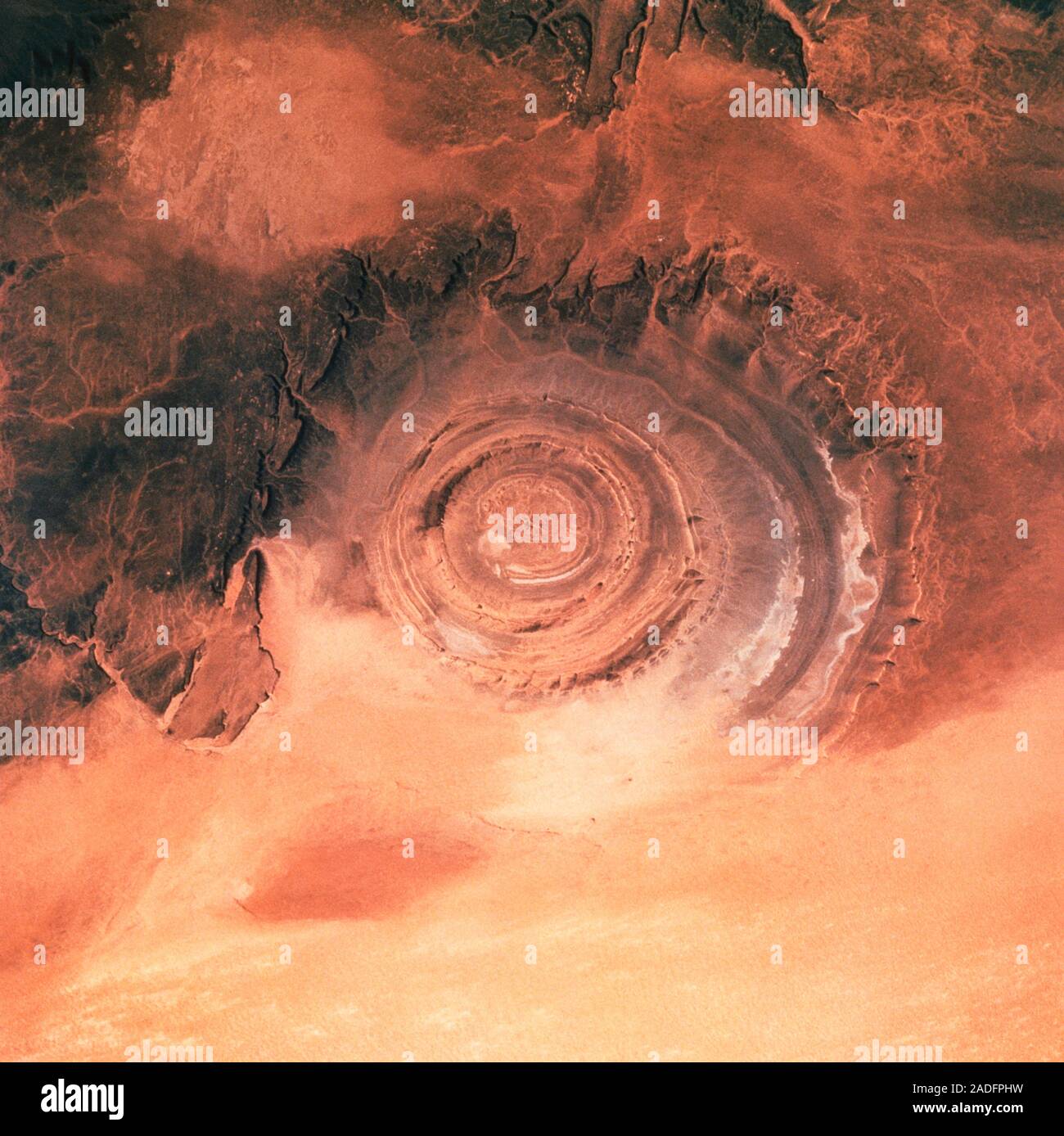
The Richat Structure. View of the Richat Structure in the Sahara Desert, as seen by the crew of Shuttle Mission STS-58 of 18 October to 1 November 199
RMID:Image ID:2ADFPHW
Image details
Contributor:
Science Photo Library / Alamy Stock PhotoImage ID:
2ADFPHWFile size:
50.6 MB (2.1 MB Compressed download)Releases:
Model - no | Property - noDo I need a release?Dimensions:
4208 x 4203 px | 35.6 x 35.6 cm | 14 x 14 inches | 300dpiDate taken:
20 June 1994Photographer:
NASA/SCIENCE PHOTO LIBRARYMore information:
The Richat Structure. View of the Richat Structure in the Sahara Desert, as seen by the crew of Shuttle Mission STS-58 of 18 October to 1 November 1993. The Richat Structure is 40km across and was originally thought to be a meteorite impact crater. More recent analysis has led to the conclusion that the Structure was an uplifted dome of rocks, subsequent erosion of the 'roof' of the dome having exposed this cross-sectional 'slice' through the various layers. The Richat Structure is in Mauritania, and was first photographed from space from a Gemini spacecraft in 1965.